
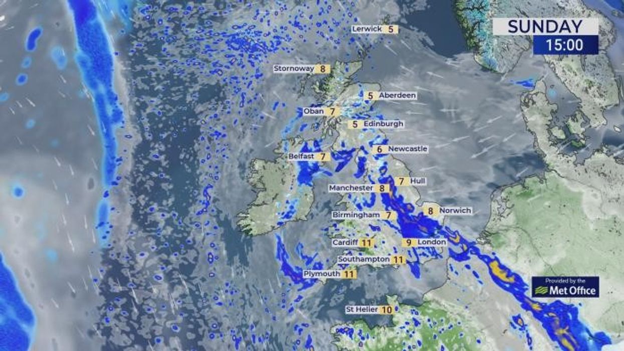


Britain could be covered in snow next week as weather maps show temperatures plummeting to -2C.
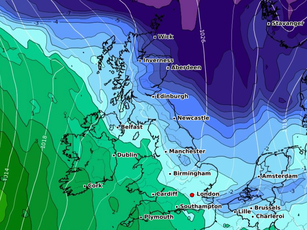
An Arctic blast is expected to hit the UK as forecasters warn that a rare weather phenomenon could bring bitter wintry conditions.
According to meteorologists, Sudden Stratospheric Warming (SSW) is underway and could draw in cold polar air and drive up the risk of heavy snow like 2018’s "Beast from the East".
Stormy conditions are set to give way for snow blizzards in around two weeks, the latest weather maps suggest.
Britain could be covered in snow next week as weather maps show temperatures plummeting to -2C
|WXCHARTS
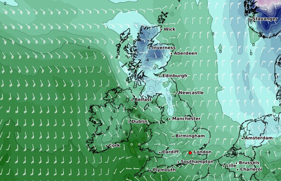
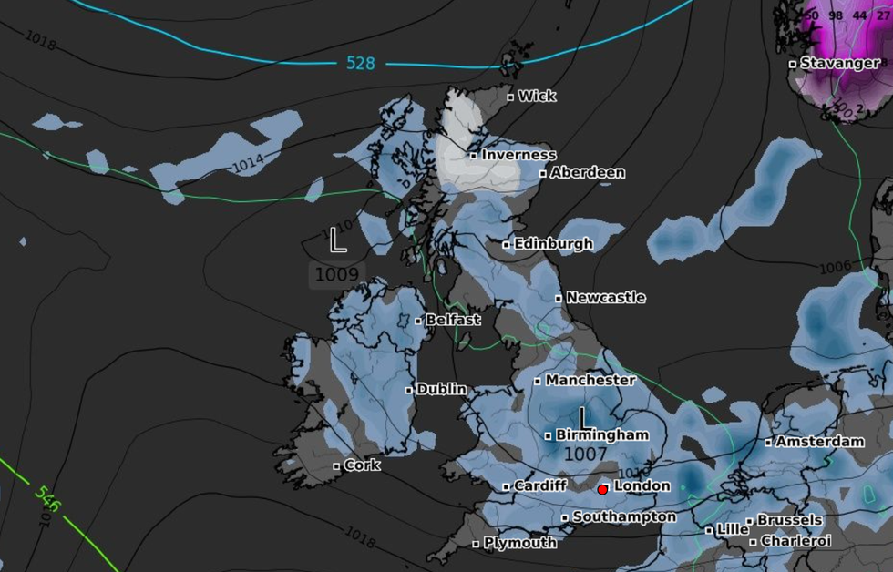
On March 19, maps shows snow falling in northern Scotland before moving further south the following day.
Worst hit areas include Inverness and Aberdeen while Edinburgh, Newcastle, Manchester, Cardiff, and Plymouth could see heavy snow fall.
Between March 13 and 22, the Met Office's long range forecast predicts "unsettled" conditions with a possibility of overnight frost.
A spokesperson said: "Around the middle of next week, conditions are expected to once again turn unsettled across western areas with outbreaks of rain and perhaps some strong winds, particularly in the northwest.
LATEST DEVELOPMENTS:
An Arctic blast is expected to hit the UK as forecasters warn that a rare weather phenomenon could bring bitter wintry conditions
|WXCHARTS
"Elsewhere, mostly dry at first with some sunshine.
"By the end of next week, conditions are likely to become more widely unsettled with rain and showers for all regions at times, although the wettest weather is likely in the south and west, with some drier and brighter spells still likely in the north and east.
"Showers could be heavy at times in the south, with a risk of thunderstorms here. Temperatures will be near or slightly above normal, although there is risk of some colder interludes, with overnight frost, across northern and eastern areas."
The weather agency has warned that the unusual weather event should occur "once every 250 years".
Snow is predicted to fall in northern Scotland before moving further south
|WXCHARTS
However, it appears to be happening for the third time since November.
"To date, we haven't seen a sustained easterly developing this winter and the approach has been more from the north during the cold and snowy periods," Exacta Weather forecaster James Madden told The Mirror.
"In essence, the cold just hasn't been able to dig in deep enough from these to bring in parts farther south for snow.
"However, this particular sudden stratospheric warming (SSW) is going for it this time around in terms of obliterating the polar vortex and almost every output and scenario reviewed for afterwards, places us in a strong blocking pattern over some sustained periods from late February and in March/early April."