


A snow-bearing tempest spanning almost half a million square kilometres named Winter Storm Kayden is about to rip through the United States.
Kayden threatens up to a foot of snow in parts of western and southern America ahead of the weekend.
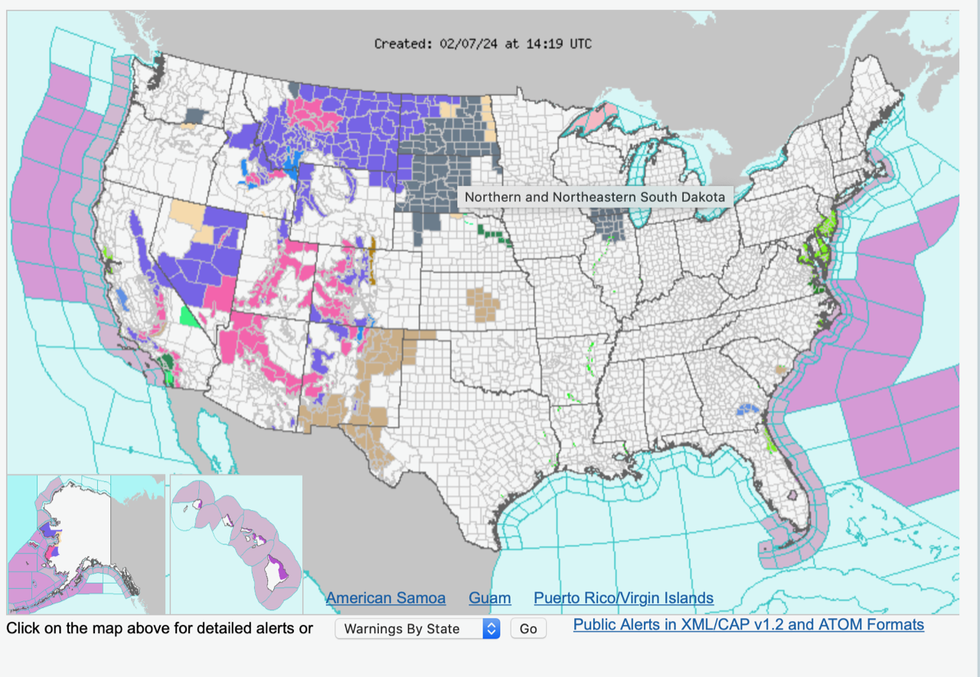
Storm warnings have been issued across the region as the National Weather Service (NOAA) urges people to brace for travel chaos and deadly floods.
Kayden will bulldoze California, Nevada, Utah, Arizona, Wyoming, Colorado and New Mexico through mid-week.
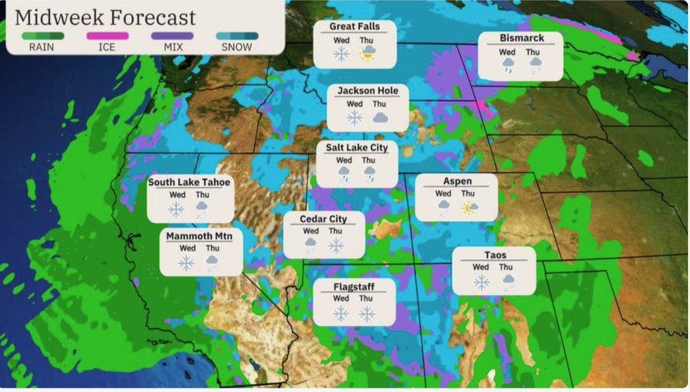
Up to a foot of snow is projected
|The Weather Channel
While the storm will have mostly blown itself out by Thursday night, warnings remain in place for ongoing ‘disturbed weather’ this weekend.
Weather Channel meteorologist Dominica Davis said: “Winter Storm Kayden is affecting the west right now, and it is going to bring some heavy snow as it makes its way through the Rockies and into the Northern Plains and eventually moves further east.
“We have this storm through Thursday and into Friday as well before that snow starts to wind down.
“In terms of snowfall, over some of the higher elevations we could pick up a foot or even more.”
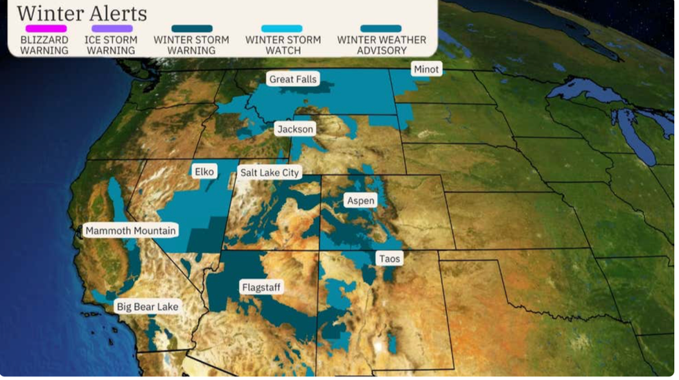
Storm Kayden, named by The Weather Channel, has triggered a raft of severe weather warnings spanning an area of more than 400,000 square kilometres.
Kayden is forecast to sweep heavy bands of snow eastwards mid-week into eastern Montana and western North Dakota.
Heavy snow will be swept up by strong winds triggering dangerous travel conditions, experts warn.
Storm Kayden will hit California, Nevada, Utah, Arizona, Wyoming, Colorado and New Mexico
|The Weather Channel
Up to a foot of snow could fall over the hills and mountains through the next 24 hours, they say.
The storm will start to calm ahead of the weekend although an unsettled picture remains into next week.
Weather Channel meteorologist Linda Lam said: “The Weather Channel has named Winter Storm Kayden due to winter storm warnings covering more than 400,000 square kilometres of the western United States
“Snow will increase across the interior West on Wednesday and last into Thursday, and strong winds combined with heavy snow will result in dangerous travel conditions.
“Snowfall from Kayden will come to an end Thursday night in the Northern Plains, but disturbed weather will continue across much of the West into the weekend.”
Meanwhile on the eastern side of the States, a plume of warm air will usher in an early taste of spring.
Tropical gusts from the Gulf of Mexico will push temperatures in some central, southern and eastern states into the 70Fs.
Storm Kayden has triggered a raft of severe weather warnings spanning an area of more than 400,000 square kilometres
|National Weather Service
A spokesperson for the NOAA said: “High temperatures will remain above average broadly across central and eastern portions of the country, with much above average conditions centred on the Upper Midwest and Great Lakes.
“Forecast highs in the 40s, 50s, and even some low 60s are upwards of 25-35 degrees above average.
“Some record-tying/breaking high temperatures are possible.”
But a battle between the hot and the cold will stir up the risk of thunderstorms and even tornadoes.
Jim Dale, social commentator and US correspondent for British Weather Services, said: “Warmth and humidity is coming out of the Gulf of Mexico, and ahead of the weekend, this is going to bring the risk of stormy conditions.
“We are looking at thunderstorms in the region, and possibly the risk of tornadoes.”