


Huge temperature swings driven by a ‘venomous’ heat plume threaten further storm misery through the end of March.
A surge of tropical air from the Gulf of Mexico could break spring temperature records, forecasters say.
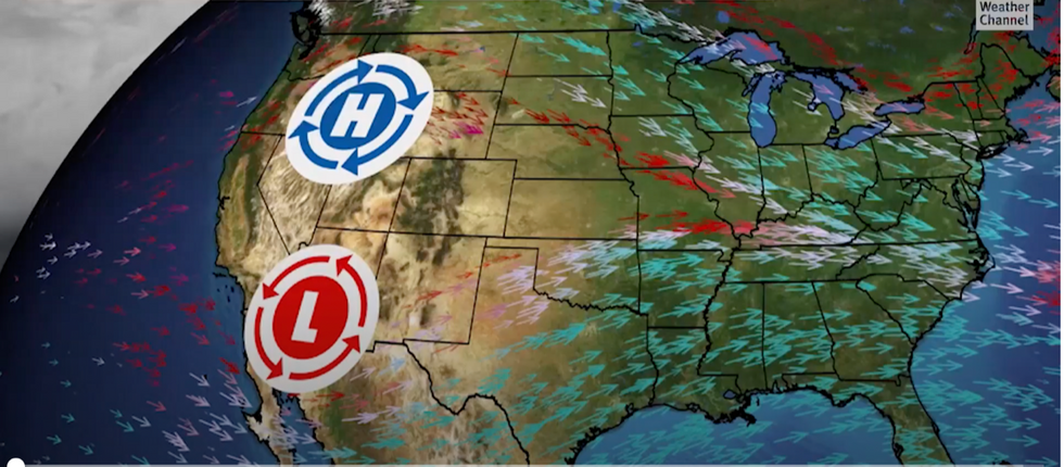
It will bump against freezing Polar air currently driving severe winter storms across northern and north-eastern America.
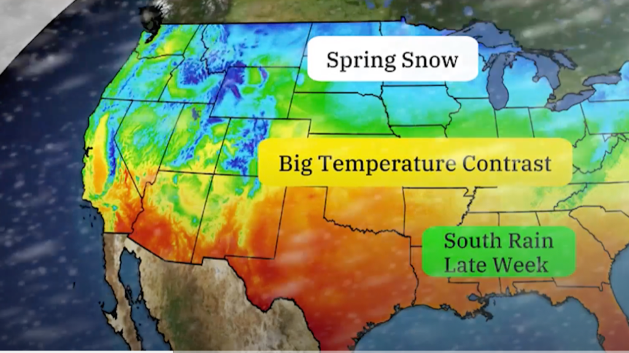
Further snow is forecast in the region ahead of the weekend as mild, moisture-laden air sweeps over the Great Lakes.
Lows dragged in on a cold front will trigger unstable conditions
|The Weather Channel
But the collision of air masses at vastly different temperatures has sparked warnings for a fresh round of storms.
Jim Dale, US weather correspondent and meteorologist for British Weather Services, said: “When you get two air masses colliding like this, you are going to get action, and that is going to come in the form of thunderstorms and further tornado activity.
“The main risk is going to be to the southeast, Florida, Georgia, Louisiana and perhaps the Carolinas.
“The driver for this is a plume of heat coming in from the Gulf of Mexico, and this has got some venom on it.”
A freezing Polar blast driven by low pressure from Canada has buried parts of northern and eastern states under inches of snow.
Cold air passing over the Great Lakes has triggered so-called ‘lake-effect’ snow –as moisture from the lakes rises into cold air aloft before drifting as snow into surrounding areas.
Further active weather systems will bring rain, snow and temperature swings across the country, according to the Weather Channel.
LATEST DEVELOPMENTS:
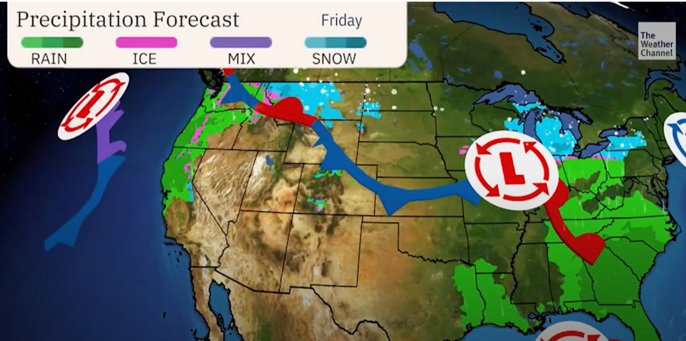
Cyclonic low-pressure systems heading eastwards along the boundary ‘front’ between airmasses will drive wet weather
|The Weather Channel
Warm air will sweep up from the southeast, where temperatures have fallen, pushing them back into the 70Fs.
Northern states will hold on to the cold weather through the weekend as thermometers rocket elsewhere.
Cyclonic low-pressure systems heading eastwards along the boundary ‘front’ between airmasses will drive wet weather, experts warn.
A spokesperson for The Weather Channel said: “Dry conditions will start the week but changes are ahead.
“During the second half of the week, the dry and warm pattern comes to a screeching halt.
“A couple of disturbances will slide eastwards late this week bringing an increase in wet weather, so umbrellas will be needed in the south, while snow gear will be needed in the northern tier.”
Parts of the south could be looking at record highs over the coming days, as tropical warmth shunts the winter chill.
A spokesman for the National Weather Service (NOAA), said: “As far as the temperature highlights for the short-term time period, a frost and freeze threat remains this morning from the Lower Mississippi Valley to the Southeast as lows dip into the 20Fs and 30Fs.
“This cold snap is forecast to be short-lived as temperatures warm to near average by Thursday across the South.
“Meanwhile, above-average temperatures are expected across the central Plains and Northwest, and afternoon highs could break daily temperature records throughout the northern Great Basin.”
Longer-range outlooks predict hot weather to hold out through spring, as the odds tip in favour of a record summer.
A Weather Channel meteorologist said: “Spring will skew warmer than usual in much of the United States, particularly in the northern tier, and that could be followed by one of the nation's hottest summers on record.”