


Dangerous ‘supercell’ thunderstorms driven from their typical target zone by volatile winds threaten to plague America for another 10 days.
A spate of unusually powerful storms has this week swept thousands of miles of the country unleashing deadly gales, rain and giant hail.
Tropical gusts from the south clashing with cold air to the north ahead of the weekend will ramp-up the assault.
Relentless storms will plough the country as meteorologists warning battling air masses will spawn giant ‘supercell’ thunderstorms.
Storms sweep across America
|X
The superstorms differ from typical thunderstorms in boasting a violent ‘mesocyclone’ winds core capable of triggering tornadoes.
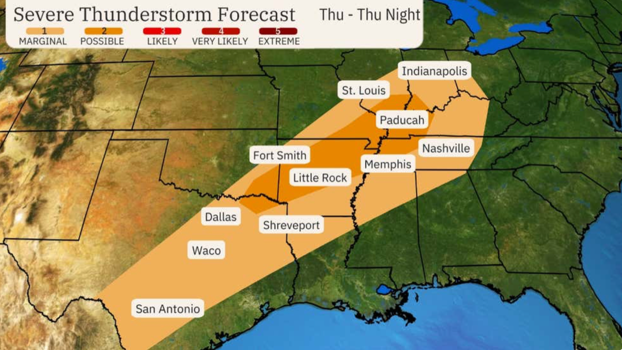
Weather Channel meteorologist Jonathan Erdman said: “Severe weather will impact the Midwest and parts of the South into midweek, with portions of the mid- and upper Mississippi valleys facing the greatest risk at the start of the week.
“Tornadoes, hail and damaging thunderstorm winds are all threats, and these severe thunderstorms could spawn tornadoes and large hail.
“A corridor from central and eastern Iowa into northwest Illinois and northern Missouri has a higher likelihood of supercell thunderstorms which could produce destructive hail, tornadoes and damaging winds.”
Supercell thunderstorms are unlike typical thunderstorms in their ability to unleash exceptional disruption, according to The Weather Channel.
Mr Erdman said: “A supercell is an elite type of thunderstorm accompanied by dangerous weather conditions including large hail, damaging winds and, sometimes, tornadoes.
LATEST DEVELOPMENTS:
The Midwest will be the most affected region
|National Oceanic and Atmospheric Administration
“An ordinary summer thunderstorm can produce lightning and a heavy downpour, but it rains itself out and fizzles out within an hour or less.
“In contrast, ssupercell thunderstorms can last several hours and track hundreds of miles.”
Storms will persist through the coming days, moving eastwards by the weekend to east Texas, Arkansas, Louisiana, Tennessee, Illinois and Indiana.
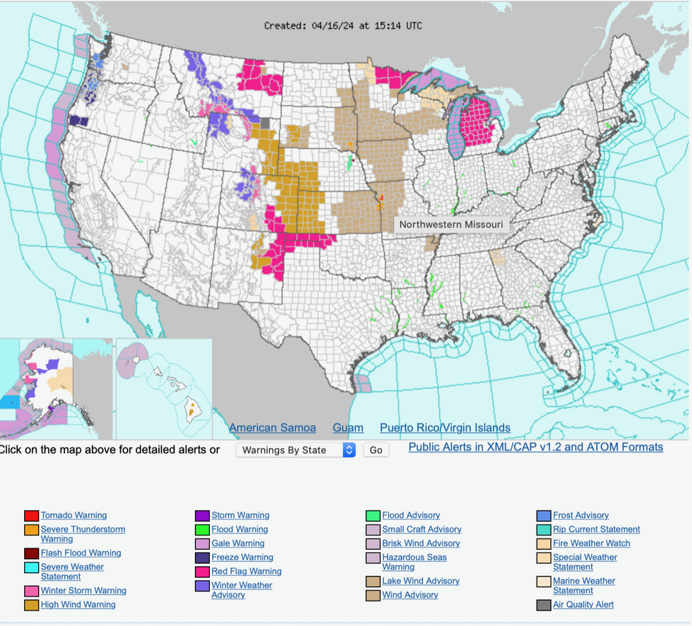
The US National Weather Service (NOAA) has high wind warnings in force in Wyoming, Nebraska, Colorado and New Mexico.
Further south, where dry winds will blow across parched land, red-flag warnings for wildfires have been issued.
Further severe weather alerts warn of wintry storms across Montana, Wyoming and Utah.
Thunder, rain and hail will persist for 10 days as a tussle ensues between hot and cold air masses, pushing storms out of the usual ‘tornado alley’ prone regions.
Jim Dale, meteorologist and co-author of ‘Surviving Extreme Weather’, said: “Storms are likely to occur where we don’t usually expect to see them, and this is the result of the unusually volatile atmospheric conditions brought by cool air to the north hitting warm, moist air coming in from the Gulf of Mexico.
“We could see storms to the northeast, and around the Great Lakes, and because of the unusual spread of these things, the threat this week is going to be wider.
“The heat in the atmosphere and in the oceans is one of the drivers of this, and the threat could persist for at least the next 10 days.”
Later this week, tornadoes could hit EF2 or above on the Enhanced Fujita Scale – reaching speeds of up to 135mph.