


A shape-shifting jet stream will plumet temperatures across swaths of the US amid warnings chilly weather could hold out until spring.
Colder-than-average temperatures threaten to grip southern and eastern States from President’s Day weekend until the end of the month.
Balmy heat elsewhere will simmer down as cold air from the north sweeps through Canada and into the US.
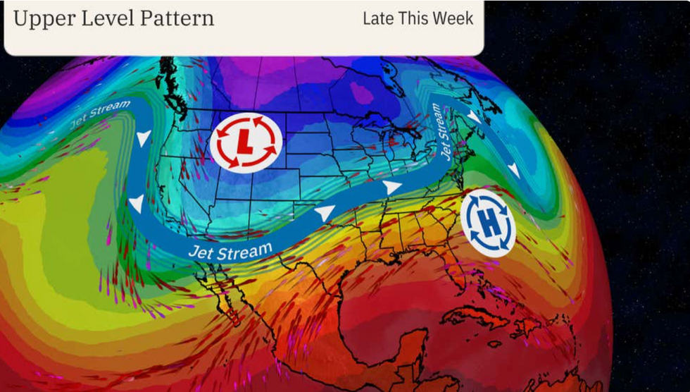
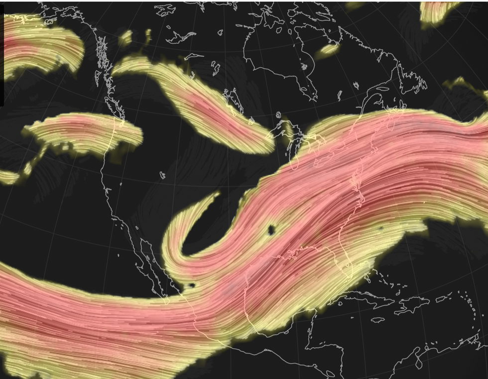
The jet stream will change shape from ‘bulging’, which allowed a bubble of hot air to smother parts of the country, to a straighter ‘zonal’, driving the change.
A jet stream will send temperatures plummeting
|The Weather Channel
It will turn off the tap to the persistent ‘atmospheric river’ deluge which last week sparked devastating floods across California.
Weather Channel meteorologist Linda Lam said: “If you've been looking for a change in the weather, you may be in luck.
“An upcoming pattern change will bring an end to the record warmth in the northern tier and the persistent wet weather in California.
“Cooler-than-average temperatures are likely for much of the East and South around Presidents' Day weekend and possibly into the following week.”
A wavy jet stream will straighten changing the pattern of low and high pressure across the States.
Near-record temperatures will give way to cooler winds although the northeast and the mid-west will remain milder than average.
LATEST DEVELOPMENTS:
- UK weather forecast: 'Disruption of Polar vortex' set to plunge Britain into -10C deep freeze lasting for MONTHS
- Polar ice blast to see Britain bombarded by fresh heavy snow - new warnings issued
- UK snow: 'Arctic blast' to bring FREEZING end to February as heavy snowfall expected to cover 'entire country'
The south and the east will be the ones most affected
|Netweather
Ms Lam said: “The jet stream pattern will change by the second half of next week. It will become more zonal, generally moving west to east. This will bring an end to the near record-warm temperatures.”
It comes as parts of the United States brace for yet another winter assault while wind and heavy rain move across to the east coast.
Texas, New Mexico and Oklahoma are on snow alert for a ‘significant winter storm’ to dump up to a foot of snow.
Low pressure sweeping through the region hitting moisture over the Texas Panhandle will bring heavy snowfall to the south.
The National Weather Service (NOAA) warned a winter ‘nor’easter’ storm will strengthen through the week.
A spokesperson said: “As the storm system arrives across the Mid-Atlantic region, the concern will again turn to a threat for significant winter weather as moisture surging northward ahead of the strengthening low centre begins to encounter sufficient levels of cold air.
“Locally as much as six to 12 inches of snow can be expected north of this low track. Strong winds and coastal flooding will also accompany this evolving nor'easter threat.”
A Nor’easter storm is typically driven along the east coast of the United states by winds from the northeast.
They commonly occur between Georgia and New Jersey, building in intensity as they hit New England.
New York and northern Pennsylvania will be first in the firing line at the start of the week before the storm heads to New England.
The NOAA spokesperson said: “The primary corridor of heavy snow is expected to set up across northern Pennsylvania and southern New York before tracking into southern New England on Tuesday as a very deep low centre edges offshore.
“Locally as much as six to 12 inches of snow can be expected north of this low track. Strong winds and coastal flooding will also accompany this evolving nor'easter threat.”