


A powerful storm ‘slicing' through a plume of heat pushing temperatures into the 90Fs threatens torrential downpours, tornadoes and 10 feet of snow.
Extreme heat is forecast through the week while a Pacific storm injects a thrust of volatility into the atmosphere.
An associated cold front will clash with hot, unstable air threatening a spate of tornadoes and California’s "heaviest snowstorm in a year".
Blizzard warnings have been issued in northern and central Sierra, with Lake Tahoe and the surrounding areas on snow watch into the weekend.
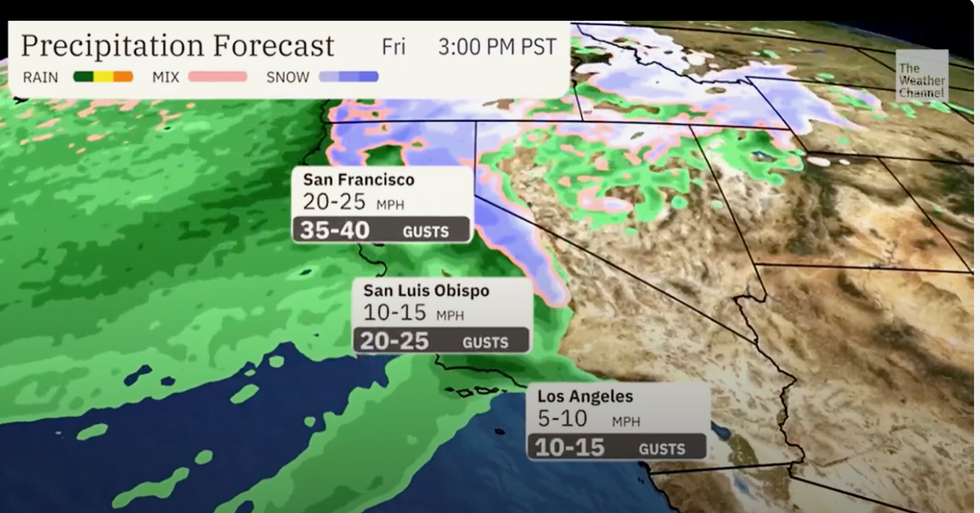
Rain and strong winds
|The Weather Channel
Weather Channel meteorologist Domenica Davis said: “A strong system moving into the west is going to bring unsettled weather to California, and by unsettled, I mean heavy rain, heavy snow and strong wind, and this is going to be through the weekend.
“The winds will be problematic, and through the weekend we will continue to see gusty winds and in the higher elevations, feet of snow.”
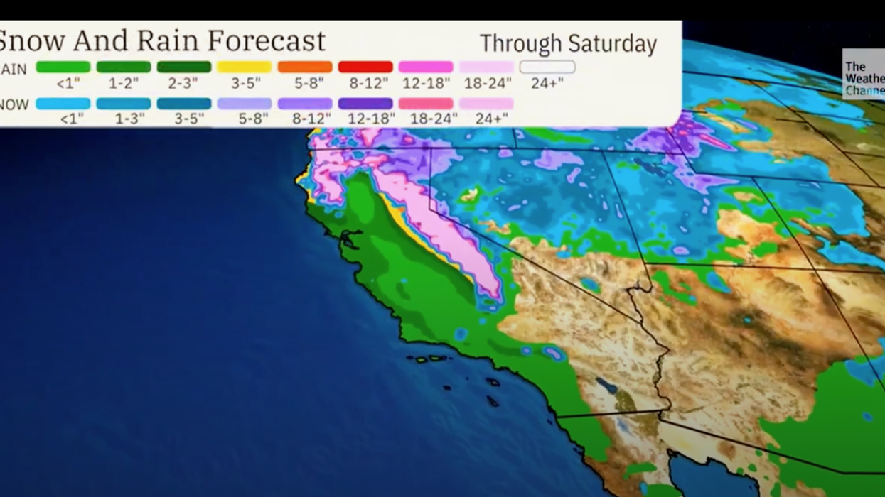
Northern California will see the heaviest rain by the end of the week before it spreads through the central state and into the south.
Meanwhile, deadly wildfires triggered by temperatures in the 90Fs have ripped through parts of Texas.
The fires, which have destroyed four hundred square miles of land, prompted authorities to evacuate the region and shut down a local nuclear power plant.
Southern states set a "slew of records" this week as thermometers rocketed well beyond what is normal for the end of winter.
Cold air associated with the weekend storm will bump against the hot air driving volatile weather, forecasters warn.
LATEST DEVELOPMENTS:
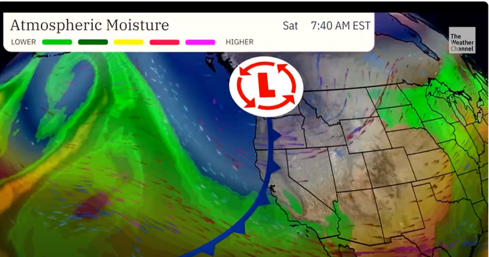
Low pressure storm sweeps in from the Pacific
|The Weather Channel
Weather Channel meteorologist Chris DeWeese said: “As the cold front moves East, severe weather is possible in the Ohio Valley.
“Unseasonably hot temperatures set a slew of records, including the preliminary hottest February recorded temperatures in Illinois, Michigan and Wisconsin.
“Then, as a strong cold front sliced into that unusually warm air, severe storms developed, with several tornadoes reported in Illinois and Michigan.”
California’s National Weather Service has warned ‘whiteout’ conditions through the coming days are likely to bring road closures.
It said travel in the Sierra region will be ‘extremely dangerous’ describing the blizzard as ‘life threatening’.
The worst of the storm is expected at the end of the week although snow and heavy rain will persist into the weekend.
Weather Channel meteorologist Jonathan Erdman said: “A Pacific storm will hammer California’s Sierra with feet of heavy snow and blizzard conditions in what could be the region’s heaviest snowstorm in a year.
“Up to ten feet of snow could fall, and strong winds will accompany the cold front in Northern California and the Great Basin into Thursday.
“High winds will continue into Friday, before easing a bit on Saturday and ending on Sunday.”
Cold air sweeping against hot air will trigger volatile weather conditions and the risk of tornadoes.
Jim Dale, US weather correspondent and meteorologist for British Weather Services, said: “When you get mixing air masses, there is going to be the risk of tornadoes, and this is what we expect to see as this hot weather continues with the colder conditions to the north and coming in from the west.
“There is going to be further heavy rain and snow in the west and the northwest of the country.”