
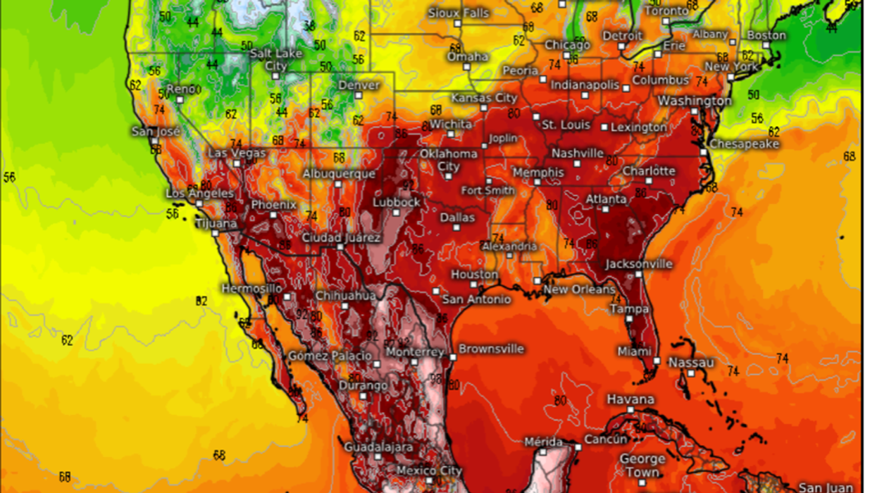


Summer is about to hit swaths of the United States with temperatures in parts this week to hit 100F.
Hot air sweeping in from the Gulf of Mexico will rocket thermometers as far north as Kansas, southern Colorado and Washington DC.
Cooler weather will dig in to the north west where the risk of snow will return over high ground, experts warn.
Jim Dale, US correspondent for British Weather Services, said: “The next week or two weeks will see the heat really starting to build widely across the United States, although it will be southern regions that will see the highest temperatures this week.
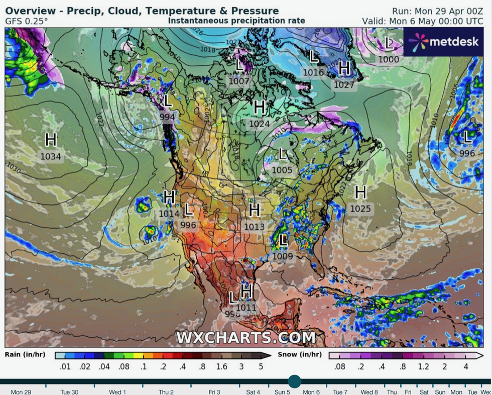
High pressure builds to the south helping boost temperatures
|WX Charts
“In the far south, where air comes up from the Gulf of Mexico, we could see 100F through the coming days.
“Further north it will be cooler, and there could be some mountain snow, but elsewhere, we are starting to see the unwrapping of summer.”
However, surging heat from the south will clash with cool air to the north creating a spawning ground for tornadoes and thunderstorms.
Meteorologists have sounded the alarm for further severe weather this week especially across central states and the Midwest where the two airmasses collide.
Mr Dale said: “We are still very much in tornado season, and so we can expect further fireworks where mixing of airmasses leads to instability.
“There will also be the threat of thunderstorms through the next week as cold air hits warmer, moist air.”
LATEST DEVELOPMENTS:
The US has been in the firing line for a barrage of storms through the last week with disruptive weather forecast through the start of May.
The Storm Prediction Centre issued an alert for slight risk of severe thunderstorms at the weekend, with heavy rain threatening floods.
Cold air ‘pouring over the Rockies’ hitting ocean moisture threatens up to 12 inches of snow in parts by the start of the week.
A spokesperson for the National Weather Service (NOAA) said: “Cold continental air will pour into the Rockies on the backside of the amplified upper trough and interact with Pacific and Gulf moisture to produce heavy snow over portions of the Colorado Rockies.
“Snowfall totals of eight to 12 inches are likely with isolated higher amounts possible over higher elevations.
“A strong southerly flow into the Mississippi Valley and Midwest will see high temperatures climb into the 70Fs and 80Fs, which is well above average for some places.”
Thunderstorms have been driven in part by a strong jet stream steering cyclonic pressure systems across the US.
The jet has swooped southwards scooping up storms fed by unstable air from the Gulf of Mexico.
Weather Channel meteorologist Chris DeWeese said: “A ‘western trough’, or southward dip in the jet stream is the reason from the current thunderstorm threat, and this often happens at this time of year.
“Disturbances ride the jet stream from the Rockies into the central US, and as they do, they pull warm and increasingly muggy air in from the Gulf of Mexico.
“This creates an unstable environment where thunderstorms can form, so it is important to make sure you are prepared and keep an eye on the forecast.”