


A freak ‘rain plume’ sweeping in from the Gulf of Mexico will unleash a deluge driven by severe thunderstorms and a spate of tornadoes.
A north-south split across the country will see temperatures plunge to -10C, with the chance of snow.
WATCH HERE: Nathan Rao warns Britain to get 'a proper taste of Scandinavia'
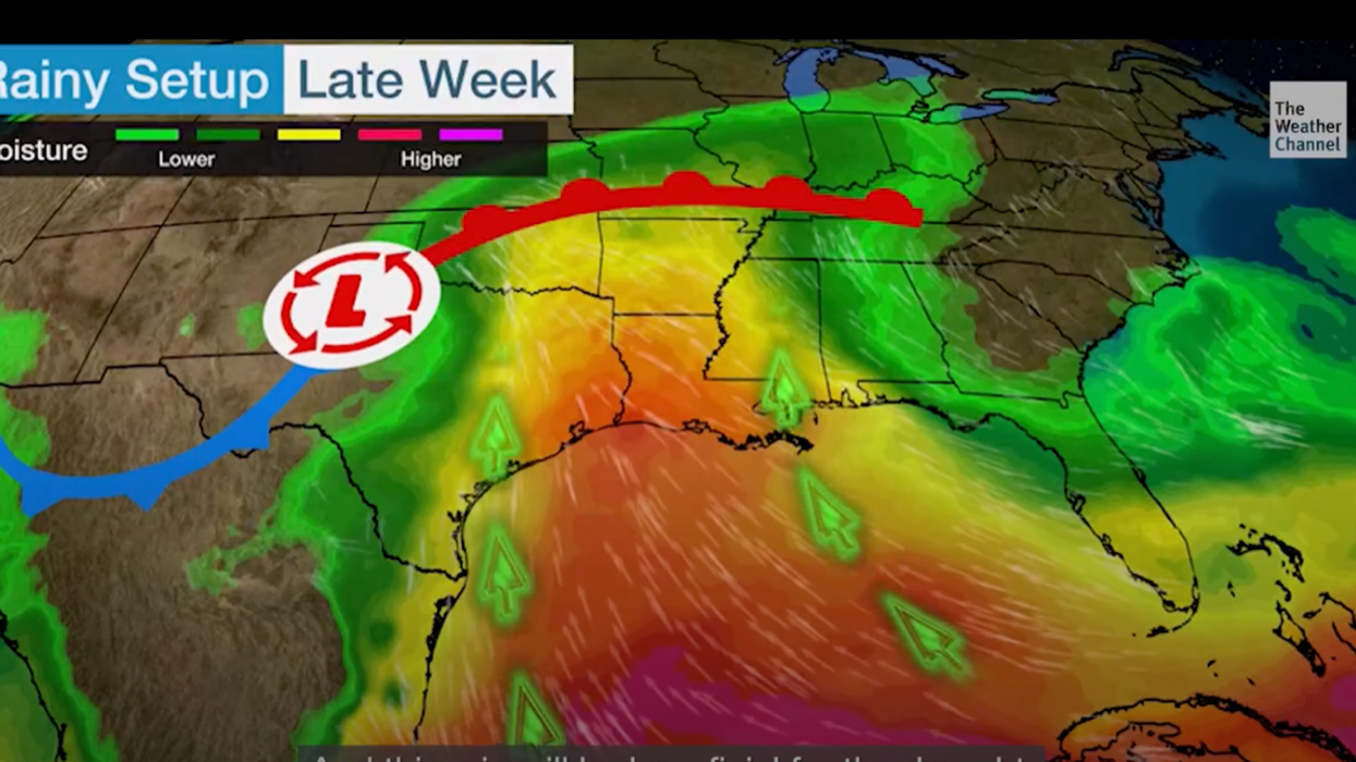
Jim Dale, US weather correspondent for British Weather Services, said: “The weather is now looking very changeable across the south of the country, and the story here for the next few days is going to be the rain.
“There will also be the risk of thunderstorms as unstable air laden with moisture brings rain plumes in from the Gulf of Mexico.
“This is the picture into the weekend, and there could be some significant rain amounts, particularly across Florida, Georgia, and the southeast regions.”
The threat of tornadoes has prompted the US Storm Prediction Centre to issue a storm ‘Enhanced Risk’ warning.
US LATEST: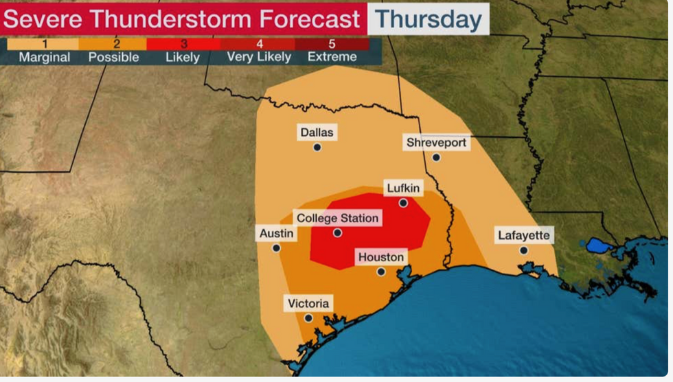
Heavy downpours threaten flash floods across the Southern Plains and the Lower Mississippi Valley
|The Weather Channel
Heavy downpours threaten flash floods across the Southern Plains and the Lower Mississippi Valley.
In contrast from the north, temperatures will hover in the 50Fs and 60Fs, although snow is still possible over high ground.
A spokesman for the National Weather Service, said: “The Storm Prediction Centre has issued an Enhanced Risk of severe weather for the threat of a few tornadoes. “Storm coverage should continue to expand north and eastward through the Southern Plains into the Lower- to-middle Mississippi Valley by later Thursday into the early hours of Friday.
“Some locally heavy downpours are expected, with a few isolated instances of flash flooding possible.
“Some cooler temperatures will flow into portions of the Central/Southern High Plains following a cold front passage Thursday, dropping into the 40Fs.”

Rain in New York
|Getty Images
Southern states are about to get a “long-lived soaking” which could hold out into next week, according to The Weather Channel.
However, the region will welcome rainfall after being in the grips of “exceptional drought” through the summer and the early autumn.
Weather Channel meteorologist Domenica Davis said: “Rain is entering the picture along the south and what we could see along with some strong to severe storms is some significant rain across the Gulf Coast and up through the mid-Mississippi Valley.
“This rain will be beneficial for the drought. In a lot of places, we are looking at extreme to exceptional drought.
“It is a lot of rain that is going to be coming in, and while it is beneficial, we could be looking at a bit of flash flooding at times.”
Rain over the coming days will come in two waves, the first bringing the risk of tornadoes.
A Weather Channel spokesman said: “The first wave of southern rain could also spawn severe thunderstorms in parts of southeast Texas and southwest Louisiana Thursday.
“The main threat with these storms is the potential for a few tornadoes beginning late morning and lasting into the afternoon.”