US weather: America to sizzle in freak February heatwave following freezing El-Nino

A wider ‘temperature nosedive’ is still possible
Don't Miss
Most Read
Latest
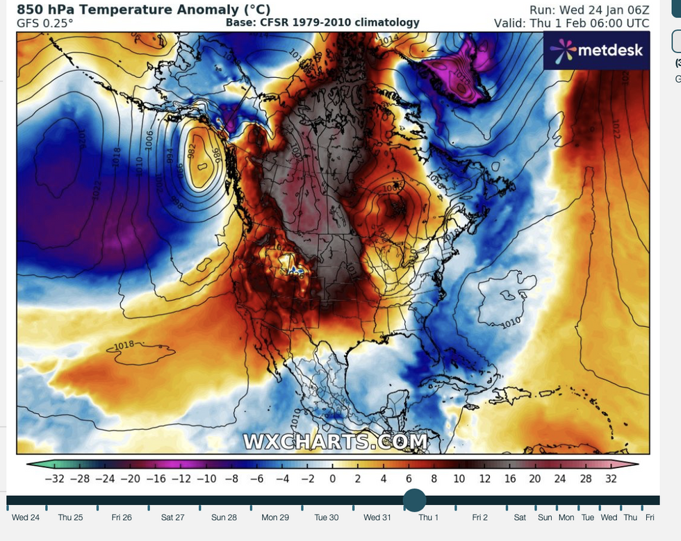
Snow-struck America is about to sizzle in a freak February mini-heatwave fired up in the death throes of a powerful El-Nino.
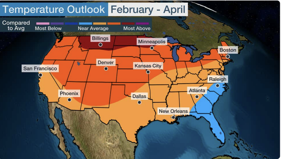
Above-average temperatures across swaths of the United States could hold out through spring, forecasters say.
Northern and western regions are most likely to enjoy the warmth, with southern regions more at risk of staying cold–typical for an El-Nino year.
The El-Nino event of 2023/24, confirmed last summer, rapidly strengthened through the end of last year prompting concerns of global weather impacts.

Warmer air to the north battles colder air to the south
|WX Charts
The phenomenon, which alters climatic patterns around the world, happens when ocean temperatures rise around South America.
Weather Channel meteorologist Danielle Banks said: “The big picture shows above-average temperatures most likely from the Northwest to the Rockies, the Northern and Central Plains, and the upper Midwest and New England.
“But parts of the south and the mid-Atlantic might see temperatures that are near average.
“Warmer-weather lovers across the southeast might not be too enthused to see that they are going to be cooler than average, but this is pretty typical in an El Nino.”
US LATEST:
Above average spring temperatures
|The Weather Channel
A wider ‘temperature nosedive’ is still possible given the unpredictability of February’s weather, she warned.
The unusually strong El Nino will start to weaken through the spring months possibly pendulum-swinging into a La Nina event.
La Nina, the opposite of El Nino, sees ocean surface temperatures in the east Pacific dip lower than normal.
Ms Banks said: “The strong El-Nino has peaked and looks to fade as we head into the coming spring months, like March, and that transition might even trend towards La Nina conditions by summer.
“That could mean more of a warmer March, and that leads us to April, where most of the lower 48 looks to see above-average temperatures again for March, but there are a few exceptions.”

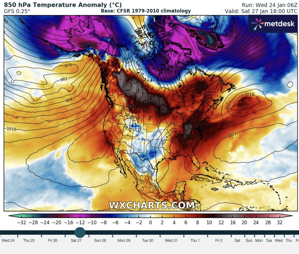
US weather: Hot air sitting over north America
|WX Charts
Weather Channel meteorologist Chris Dolce added: “Winter's handoff to early spring could feature increasingly warmer-than-average temperatures across the United States as El Niño gradually meets its demise.”
Higher-than-average ocean temperatures around the US coast will waft in warm gusts of air.
Spring’s early arrival would be the result of El Nino and a general trend of rising global temperatures, according to US weather correspondent Jim Dale.
Mr Dale, social commentator and senior meteorologist for British Weather Services, said: “When the ocean temperatures are high, the result is almost certainly going to be wafts of warm to very warm air across the United States, and this could bring periods of warmer weather that you might not expect.
“There is also an element of El Nino and climate change that is going to drive this warmer weather, if it happens.”
However, it will follow a barrage of storms drenching swathes of the country as cold and mild air masses lock horns in battle.
Mr Dale added: “Right across the United States now there is a battle going on between milder air to the south and the very cold air elsewhere.
“But gradually things will get back to normal, and with the influence of climate change, spring could arrive early.”


