


A ‘venomous’ cyclonic pressure system with the potential to unleash the 12th storm of the season – Lilian – could end April with a bang.
Britain is back on storm alert with the current calm weather at risk of getting an autumnal shake-up this weekend.
Although no warnings or names have been issued, an ‘unnaturally deep’ low-pressure system barrelling across the Atlantic has storm potential.
Southern regions including Cornwall and the West Country are in the firing line with Scotland and the north likely to dodge the assault.
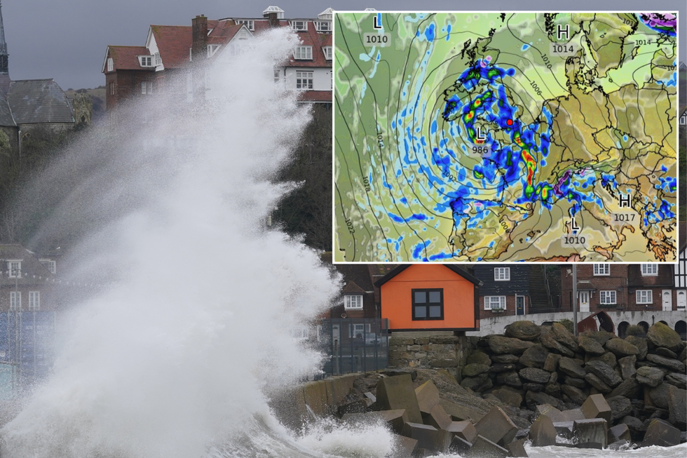
Storm Lilian could bash Britain
|PA/WXCharts
Jim Dale, meteorologist for British Weather Services and social commentator, said: “This system is looks unnaturally deep for the time of year and could be fairly venomous when it comes in off the Atlantic on Saturday and through Sunday.
“It is looking like a pretty ropey weekend, with heavy showers and gales which, at the moment, look like hitting southern regions while the north escapes the worst of it.
“This looks deep enough to warrant another storm name, though it may end up being named by the French meteorological service due to its southerly path, so this is something that we are keeping our eyes on.”
The storm will bring a burst of warm air in from the south at the weekend, briefly boosting temperatures, he said.
However, the gates to the east will open in its wake, pushing thermometers back below average for late spring, he added.
LATEST DEVELOPMENTS:
Britain in the path of potential weekend storm
|WXCharts
He said: “We are going to get the southerlies coming in with this low-pressure system, so it will feel warmer at the weekend, although it is going to be unsettled.
“But then, after the storm, we are going to get the easterlies back, so it will feel cooler again.”
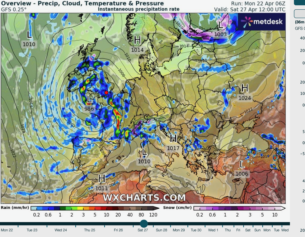
Current weather model runs show the centre of the low dipping to 950millibars, which, Mr Dale said, is "unusual" for the time of year.
A region of low pressure will gather strength off the southwest coast ahead of the weekend, meteorologists warn.
Some computer models show it shifting further towards the Continent, sparing the UK from a weekend deluge.
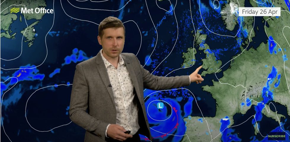
Met Office’s Alex Burkill warns of a potentially stormy weekend
|Met Office
However, other models show it veering back around and making a beeline for southern Britain.
Met Office meteorologist Alex Burkill said: “An area of low pressure is likely to deepen somewhere towards the southwest of the UK as we go through Friday.
“There is a reasonable chance that this low will clear away towards the south, but some models want it to come back up towards the UK as we go into the weekend, and if this happens, then that would bring some heavy rain spreading up from the south and also some strong winds, so a pretty unsettled weekend to come.
“But, there is some uncertainty because the models all want to do slightly different things.”
If named by the UK Met Office or Met Eireann, the storm would take the twelfth title of the 2023/24 storm season–Lilian.