


Temperatures are set to fall over the next few days as Britain is set to be hit with an Arctic blast.
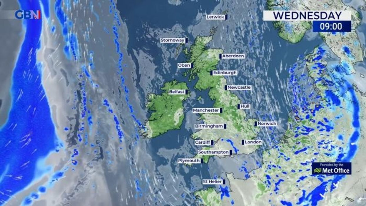
Showers are expected to come from the east into tonight and the early hours of Thursday morning.
An unsettled set of conditions are set to hit the UK, with a chance of some thunderstorms expected next weekend.
The Met Office is also forecasting strong winds and possible coastal gales across the Eastern coast with a chance of the 12th storm of the season, which would be named Lilian.
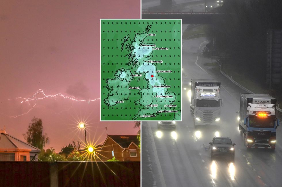
The Met Office has warned of some cold weather this weekend
|PA/WXCharts.com
Temperatures are also expected to fall to freezing lows, with the north of England seeing the mercury drop to -2C on Friday morning.
The cold will reach -1C in parts of Scotland, with 0C being the lowest temperature in Northern Ireland and 1C in Wales.
The Met Office forecast for next week says: "Gradually becoming more unsettled towards the weekend with showers or longer spells of rain at times. Often cloudy and feeling chilly in brisk winds.
"It will be an uncertain start to the weekend though likely unsettled as a frontal system continues to push north across the UK, coupled with strong winds and possible coastal gales, this likely followed by a showery day with potential thunderstorms on Sunday and again on Monday.
"Beyond this, low pressure patterns continue to dominate with wet weather perhaps more likely to develop in parts of the south and east, though all parts are may see some rain at times.
"Winds further into the period [will be] mostly light to moderate. Temperatures will likely trend near or slightly above average, though some cooler interludes remain possible."
LATEST DEVELOPMENTS
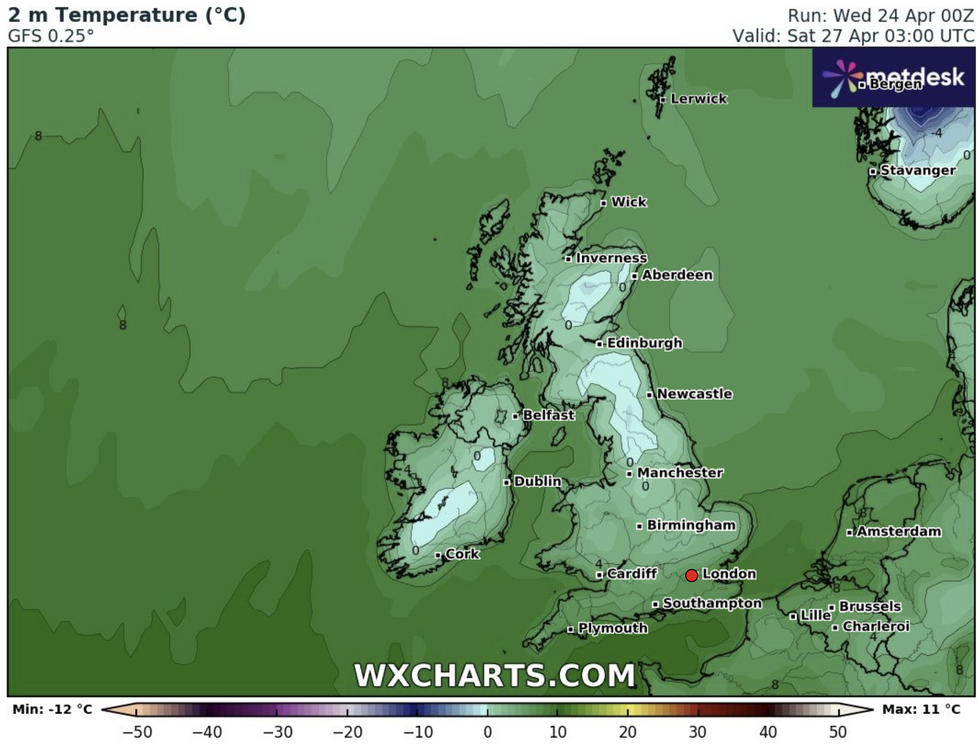
The forecast for this weekend
|WXCharts.com
The forecast continued: "Into early May, something of a north-south split looks possible, with relatively drier conditions further to the north and the greatest chance of rain further to the south."
Looking ahead to the long range forecast, early to mid May is expected to become more settled with temperatures expected to remain mostly average.
The Met Office forecast said: "The chances of unsettled weather are slightly less than usual in the north and about the same as usual further south.
"Therefore, some spells of wetter weather are likely for all, but perhaps especially southern areas with the driest conditions probably further north. Temperatures probably near average though with some cooler interludes possible."
A ‘venomous’ cyclonic pressure system with the potential to unleash the 12th storm of the season – Lilian – could end April with a bang.
Met Office meteorologist Alex Burkill said: "An area of low pressure is likely to deepen somewhere towards the southwest of the UK as we go through Friday.
"There is a reasonable chance that this low will clear away towards the south, but some models want it to come back up towards the UK as we go into the weekend, and if this happens, then that would bring some heavy rain spreading up from the south and also some strong winds, so a pretty unsettled weekend to come.
"But, there is some uncertainty because the models all want to do slightly different things."