


Britain’s Arctic chill will give way to a balmy festive season as freezing winds give way this week to freakish warmth.
December will kick off to an almost simmering start amid predictions double-digit temperatures could last until Christmas.
Hopes of festive flurries are fading with Britons to reach for t-shirts next week as thermometers bubble to 15C.
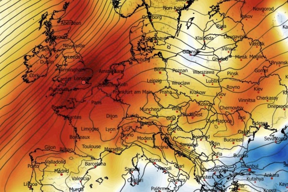
The steamy U-turn is thanks to westerly winds pulling up plumes of warmth from the south.
TRENDING
Stories
Videos
Your Say
Jim Dale, meteorologist for British Weather Services, said: “We are going to see temperatures fluctuate a bit this week, but then we are into a milder spell which looks like holding out into the start of December.
“We are losing the northerly and getting something in from the west, and this is going to drive the change.
“There is then nothing really to suggest we will get another spell of cold like we have just had before the end of this year.”
With the mild weather, though, will come some heavy rain and risk of storms as the weather becomes Atlantic rather than Arctic-driven.
Hopes of festive flurries are fading with Britons to reach for t-shirts next week as thermometers bubble to 15C
|NETWEATHER
Odds of Christmas rain are swiftly falling as the chance of snow melts with last week’s ice.
Dale said: “We are more likely to be looking at wetter and stormier conditions through the run up to Christmas as we start to pick up the Atlantic.
“The best chance at this point for Christmas snow would be in the very far north of the country, but at the moment it is still too far away to be sure.”
High pressure will bring a settled mid-week before the gates open once again to the Atlantic.
LATEST DEVELOPMENTS
Meanwhile, eastern regions in the firing line of a cyclonic system close to Scandinavia will take the unsettled hit.
Met Office meteorologist Annie Shuttleworth said: “There is a chance that the pressure pattern could become blocked with low pressure to the east taking a while to shift out of the way.
“After Tuesday, we are expecting a transition to low pressure, and low pressure will bring in milder, wetter and potentially windier weather at the end of the week.
“It will stay a milder but more changeable set up into the weekend.”
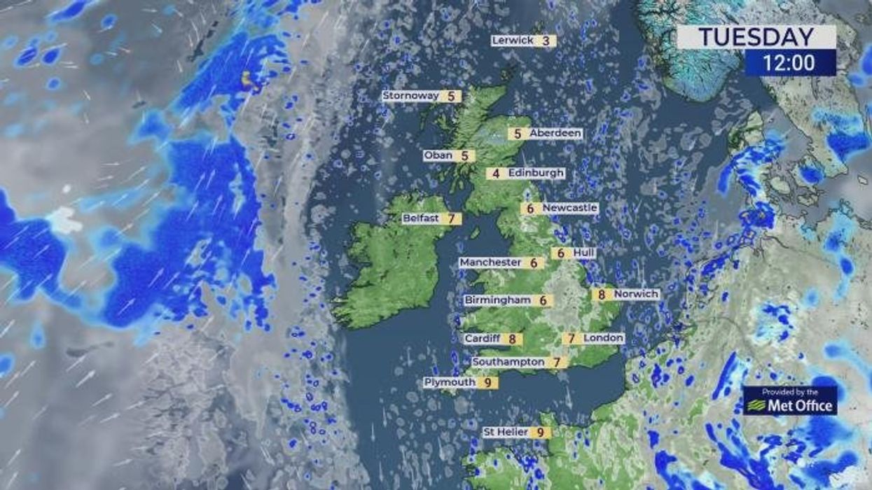
The Met Office’s Kathryn Chalk added: “As we go through Tuesday, we have a ridge of higher pressure extending over us, and it is a largely settled day.
“It is going to be turning milder mid-week, with the winds shifting to a south-westerly direction, but it will be breezy with outbreaks of rain.”
Some weather models show temperatures in southern counties hitting 15C by the first week of December.
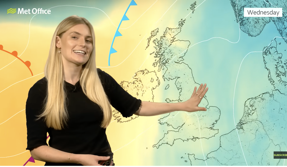
'As we go through Tuesday, we have a ridge of higher pressure extending over us, and it is a largely settled day,' Met Office’s Kathryn Chalk said
|MET OFFICE
Scotland and northern Britain will just about scrape double figures with Arctic air closer.
Dale said: “While Scotland and northern England will hang on to the cold for a bit, there is almost no chance of any more snow by the time we get to December.”