


Britain faces a two-week storm deluge with a washout start to the festive season melting almost all hopes of a White Christmas.
Torrential downpours and howling winds dominating forecasts up to the big day leave little room for sleighbells and snow.
A powerful low-pressure cyclone hammering western regions today will launch the assault with this week painting a grim picture.
Powerful jet stream winds showing no let up will smack Britain with a conveyor belt of Atlantic cyclones for another fortnight.
Jim Dale, meteorologist for British Weather Services, said: “Western regions will see the worst of the rain at the start of the week, although it is not looking pretty across the country through the week, this weekend and into next week.
“There is a conveyor belt of Atlantic lows bringing frontal systems across the country, and I see no change for at least the next 15 days, possibly longer.
“There is little respite between these systems, with further showers likely across the country.”
Wales and the southwest will bear the brunt of the assault during the start of the week, where torrential downpours could dump almost two inches.
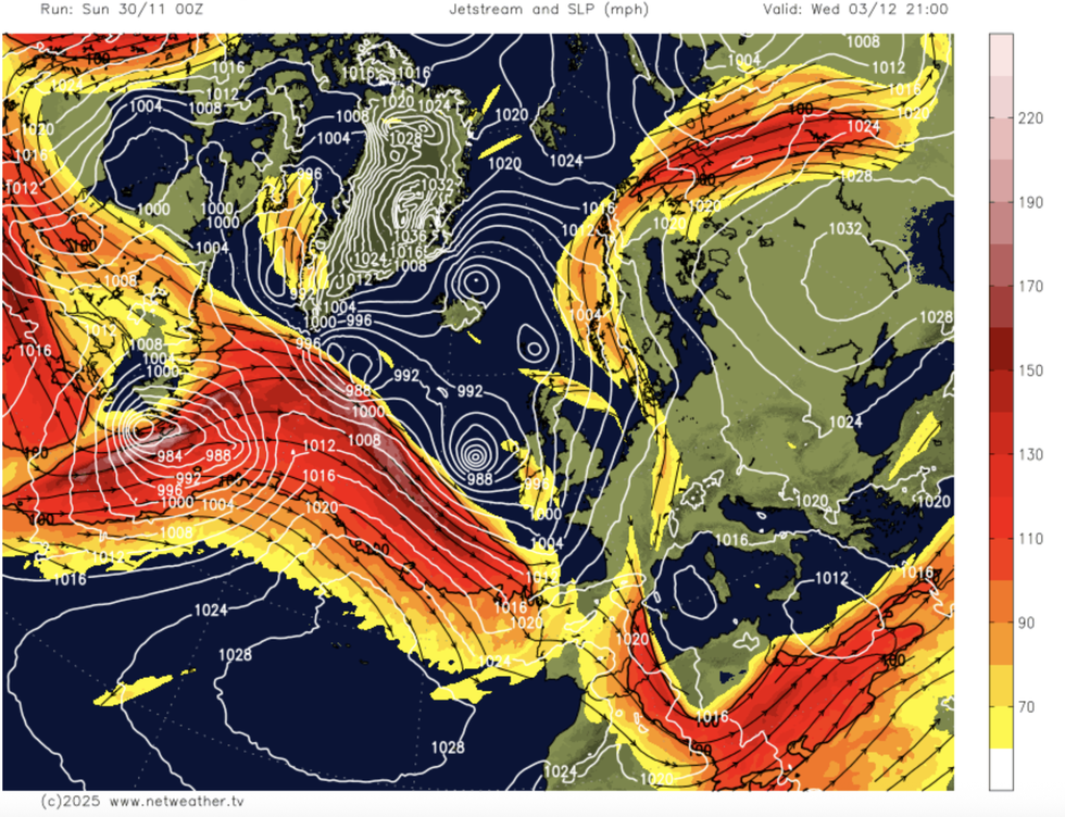
Jet stream pulls multiple storm systems in
|NETWEATHER
Eastern regions may dodge the assault for now, although heavy rain belts sweeping the country will eventually spare nowhere.
Dale said: “The valleys of Wales could see those totals really mount up through the coming days, and this is where we start talking about the threat of floods.
“With the rain, which will be more of an issue than wind, we will see milder temperatures.
“This is likely to be the picture through the period, with nothing in the immediate forecast showing snow.”
LATEST DEVELOPMENTS
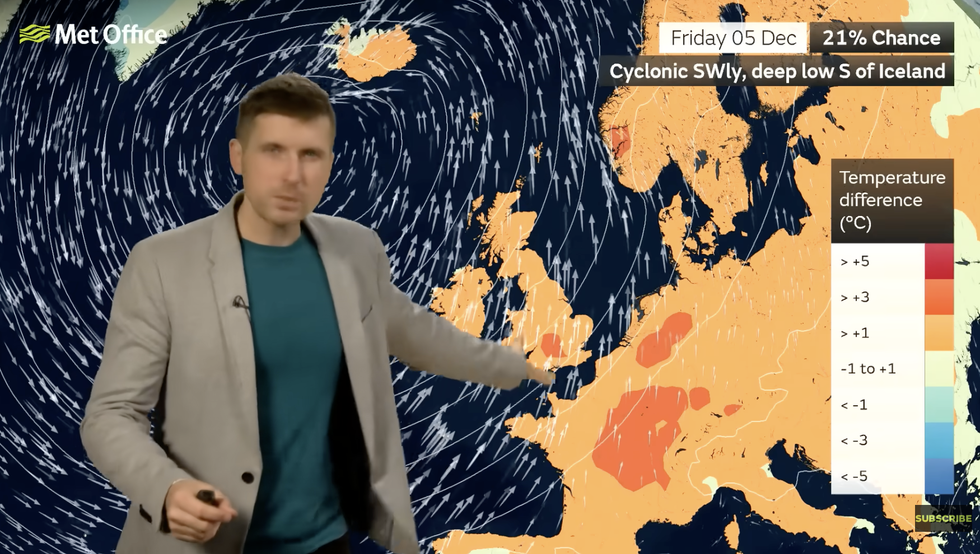
Alex Burkill describes the risk of stormy weather late week
|MET OFFICE
The Met Office has warnings in force today across western regions where heavy rain and strong coastal gales could hinder travel plans.
Relentless downpours will push rivers to breaking point amid fears of disruption and flooding.
Met Office meteorologist Liam Eslick said: “A band of rain will push eastwards, and we have warnings across northwest England, the west country and an amber warning across southwest Wales.
“This rain is going to be heavy and persistent, and we are expecting some flooding and plenty of disruption.
“Winds are going to be pretty strong and there could be some coastal gales.”
After today’s drenching, another cyclonic low is waiting in the wings to unleash another deluge.
Met Office meteorologist Alex Burkill said: “On Thursday another area of low pressure is coming through with more unsettled weather coming in from the west.
“It will be similar on Friday and into the weekend, so, it looks like things are going to stay pretty unsettled.”
The Atlantic-dominated weather pattern will raise temperatures from the weekend, although the cold will cling to the north, he warned.
He said: “Low pressure is going to be dominating, and it looks like we are going to see several areas of low pressure, so we expect some fairly wet and windy weather at times.
“With that, it will be milder than the weekend, but to the north it could be chillier or cold, and some of that colder air could make its way towards the south.”