


Britons should make the most of the ‘hottest day of the year’ before the mercury plummets in the next deluge.
Temperatures today will nudge 19C in parts of the country as tropical winds gush from the Atlantic.
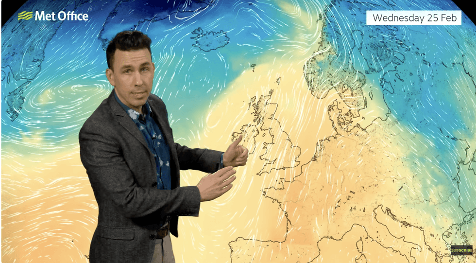
A sweeping warm front will thrust the mercury across southern regions with Scotland and the north also warmer than average.
Met Office meteorologist Aidan McGivern said: “It might still be meteorological winter, but there is a whiff of spring in the air because we have a warm front crossing the UK.
TRENDING
Stories
Videos
Your Say
“A broad warm sector will develop, and south-westerly winds will encompass much of the country with widely above-average temperatures.
“The highest temperatures will peak on Wednesday towards the east and the southeast.”
As warmth floods in from the Atlantic, so will further bands of rain soaking already drenched western and southwestern counties.
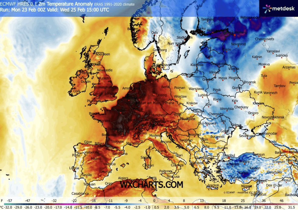
Eastern and southeastern regions will feel almost like early summer in the ‘exceptional’ warmth.
Britons will be able to enjoy spring-like conditions
|WX CHARTS
Mr McGivern said: “On Wednesday, towards the west, the rain sets in, and it pushes into northern Ireland, northern and northwest England, Wales and parts of the southwest.
“It is generally dry and bright for the east and southeast if not sunny, and that will allow temperatures to rise on the warmest day of the week, with 17C most likely.
“There is a 20-per cent chance of 18C to 19C in the east and southeast, which is not record-breaking but exceptionally mild.”
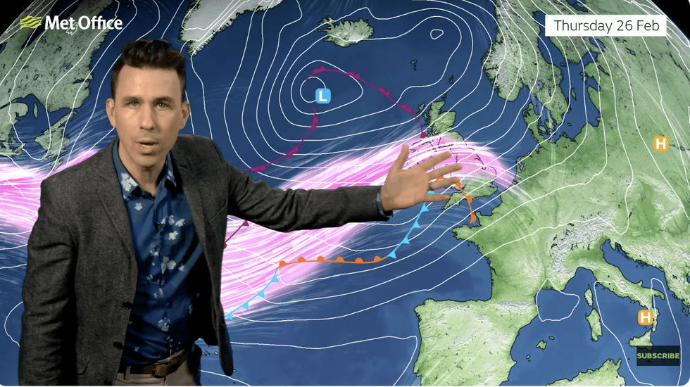
It is all change by the weekend, however, with the return of the rain and a chilly nudge from the North Pole.
LATEST DEVELOPMENTS
Wintry showers are possible over the hills and mountains of Scotland
|MET OFFICE
While the ‘blocking’ pattern has eased off keeping western counties in the relentless firing line for downpours, sweeping showers will keep the autumnal feel.
Wintry showers are possible over the hills and mountains of Scotland as moisture-laden weather systems collide with cold air.
Jim Dale, meteorologist for British Weather Services and co-author of ‘Surviving Extreme Weather’, said: “At the end of the week, there is likely to be another change with a cold plunge, starting in Scotland and pushing through the country.
“We are going to go back into a modified Polar airflow, and this will make it feel colder compared to the middle of the week.
It will be a short respite from cold conditions
|MET OFFICE
“Before then, though, Wednesday is shaping up to be the warmest day of the year so far, with temperatures hitting the high teens in some parts.”
The return of the cold will be driven in part by the jet stream, winding and sweeping across the Atlantic into Britain.
Supercharged jet-stream winds will hurl rain-loaded low-pressure weather fronts across the UK, as temperatures fall.
Mr McGivern said: “A weather front by the end of Thursday gets pushed along by an increasingly active jet stream.
“This will allow systems to move through at a greater pace and temperatures to ebb away by the weekend.”