


A tropical plume from the Bay of Biscay heralding a return to warm weather will arrive with a stormy sting in the tail.
Temperatures this weekend will once again head skywards as warm air sweeps around an "anticyclonic high".
But unlike last week’s hot spell, next week will see unstable air from the south bring a wider risk of thunderstorms.
Met Office meteorologist Honor Criswick said: “High pressure is building into the northwest, and as we get to Sunday, an area of low pressure towards the Bay of Biscay drags in a frontal system and that could push up across parts of the southwest.
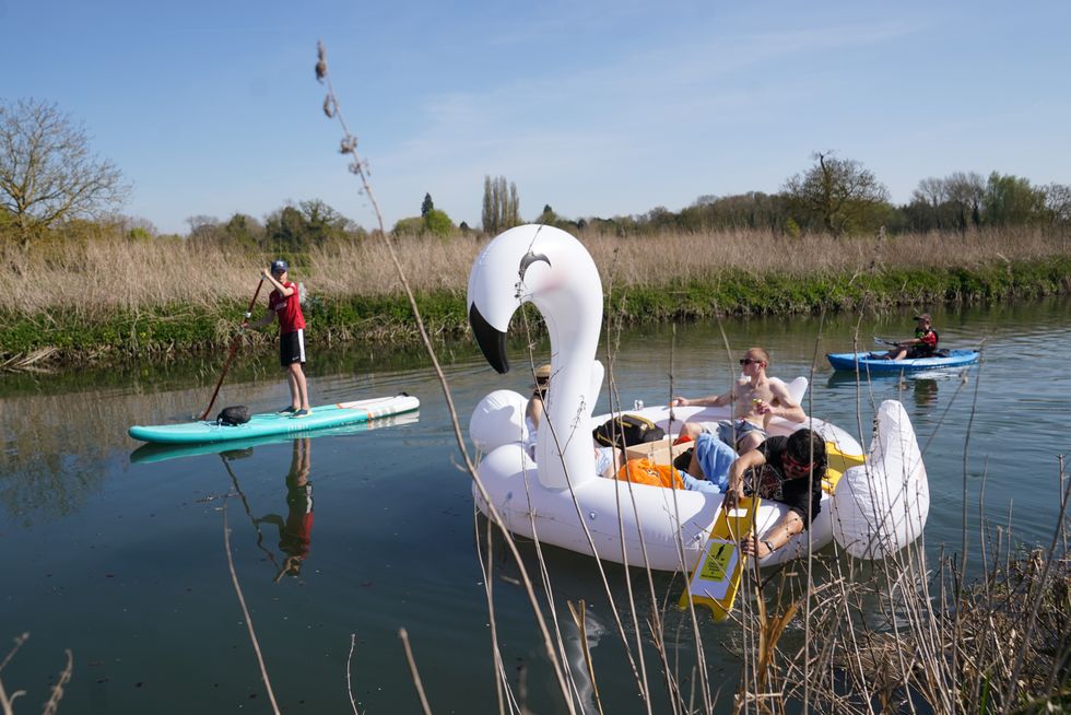
We saw very hot weather last week
|PA
“This would bring a warmer plume of air, and there is a chance we could see some showers into Sunday in the southwest and they could turn heavy and thundery.”
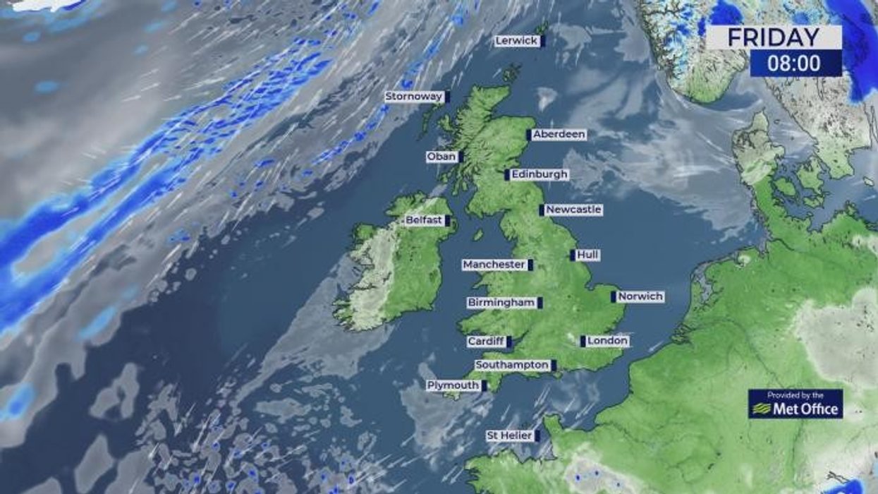
Currently, no Met Office warnings are in force for the weekend although that could change, she said.
"Frontal systems" bringing a greater risk of rain ahead of the weekend threaten to give the weather a rattle, she added.
She said: “As we head towards the end of the week, the high pressure is still with us, but the centre of the high is drifting its way towards Europe and this is allowing frontal systems to sweep their way in.
“On Sunday, there is a low risk that we could see a warning for thunderstorms.”
LATEST DEVELOPMENTS:
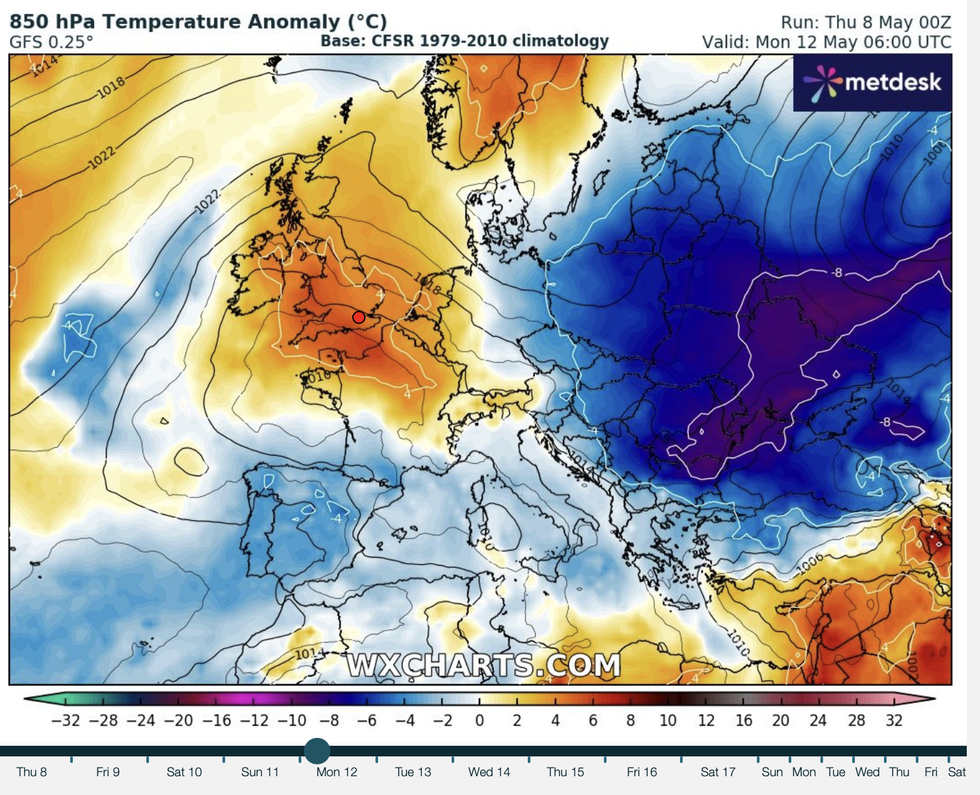
Warmth arrives from the south
|WXCHARTS
Britain’s weather over the past two months has been dominated by high pressure, also called an ‘anticyclonic’ pattern, and an ‘amplified’ jet stream.
Loops in the jet as it twists and turns over the Atlantic towards the UK have kept Britain locked into this pattern.
Criswick said: “We tend to see this when our jet stream is wavy, and this is called an amplified pattern, and this is when the jet stream dips down, dips backs up northwards and then back south.
“We tend to get areas of high pressure building under this jet, and they tend to stick around, and it is unusual that this one has not really gone anywhere since the end of February.”
Warm air sweeping in from the south will push the mercury higher than average for the time of year.
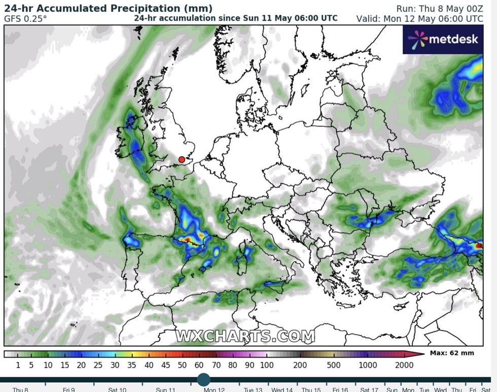
Rain and possible storms move in from the south
|WXCHARTS
Temperatures over the coming days could nudge the mid-20Cs, slightly cooler than the near-30C highs of last week.
Jim Dale, meteorologist for British Weather Services and social commentator, said: “The warmth is back for the weekend with temperatures into the 20CS.
“It is not going to be as hot as last week, but it will once again turn very pleasant and in the north, they will lose the cold starts and morning frosts.
“The next warm spell will be high pressure building right over the top of the UK, drawing air in from the south.”
Jason Nicholls, lead international forecaster for AccuWeather, said: “It will turn warmer later in the week and into the weekend, although there will be a risk of isolated showers.”