


Millions of drivers have been warned of dangerous conditions on the roads tomorrow as Storm Goretti batters the UK, prompting an urgent intervention from National Highways.
Motorists across the East and West Midlands have been issued with an amber severe weather warning between 6pm on Thursday, January 8, and 9am on Friday, January 9.
National Highways has called on drivers to ensure they check before setting off and plan in case of any interruptions on their journey.
Storm Goretti will hit the region with heavy snow overnight between Thursday and Friday, with millions of motorists potentially impacted.
TRENDING
Stories
Videos
Your Say
Snow will initially be seen on hills above 200 metres in the Midlands, with rain being seen on lower routes, which could also turn to snow.
The transport organisation stated: "Accumulations are uncertain, but 8-12cm looks probable on the higher routes with 10-15cm for routes around Birmingham, Leicester and Nottingham.
"[Between] 3-8cm looks more typical for lower-level routes in the south or east of the East Midlands and just small amounts in the far east and north of the East Midlands with 0-2cm."
It added that the snow is likely to be slushy in the South and East Midlands with a slow thaw on Friday morning.
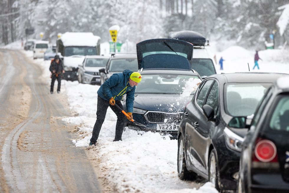
Millions of drivers have been issued a weather warning before travelling tomorrow
|PA
Nevertheless, drivers are being warned to prepare for their journeys ahead of time and potentially even delay any travel they are planning.
Routes around Birmingham, Leicester and Nottingham will see "particularly difficult driving conditions".
National Highways stated that drivers should consider the weather forecast before setting off, especially if they are travelling near the A628 Woodhead Pass, where there could be "considerable delays".
Alice Simpson, RAC breakdown spokesperson, said: "In the areas worst affected by Storm Goretti, drivers need to be considering if it's safe to get behind the wheel.
LATEST DEVELOPMENTS
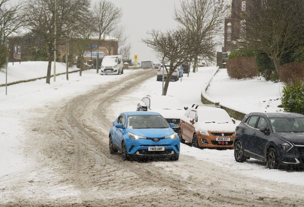
The RAC has called on drivers to consider their travel plans ahead of Storm Goretti
|PA
"As temperatures plummet, breakdowns rise, especially as older, less reliable batteries tend to fail more often in cold conditions.
"The key is allowing more time at every stage of the journey, whether that's clearing vehicles of snow and ice before setting off or reducing the speed at which you're travelling to suit the conditions."
The Met Office noted that Tomintoul, Banffshire, currently has the highest official Met Office snow reading with 46cm of lying snow.
The UK Health Security Agency (UKHSA) has also issued amber cold weather health alerts for all regions across England until Sunday, January 11.
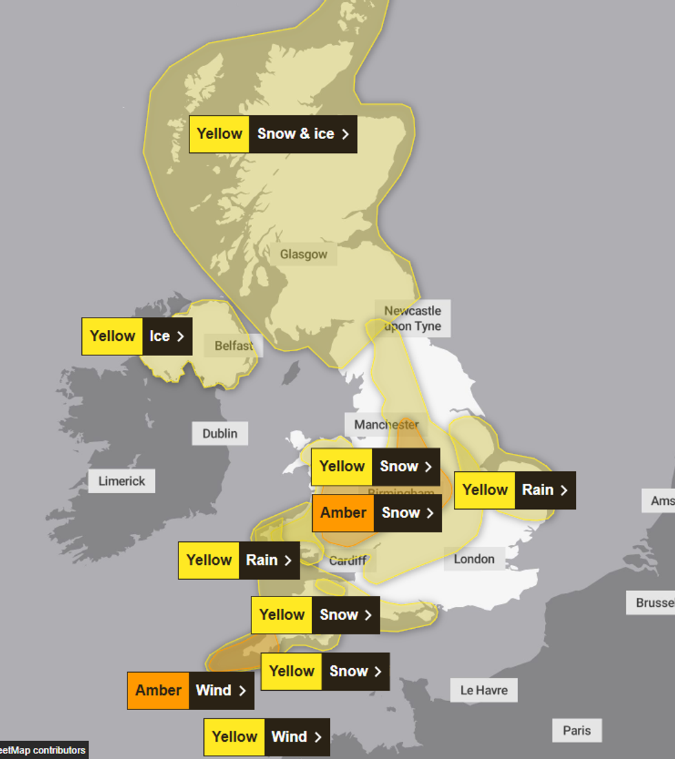
The Met Office has issued a number of yellow and amber weather warnings
|MET OFFICE
Neil Armstrong, chief forecaster at the Met Office, warned that Storm Goretti would be a "multi-hazard event" across Wales and the Midlands.
He continued, saying: "Goretti will bring snow on its northern edge, this most likely over Wales and the Midlands.
"Here accumulations of 5-10cm are likely widely, with 15-25cm in some places, especially hills, and perhaps up to 30cm very locally.
"An Amber warning has been issued where the greatest risk of disruption is likely on Thursday night into Friday morning, though updates may be required as confidence increases in the exact track of Storm Goretti."