


A savage snowstorm crippling the United States will turn the tables on Britain’s weather to drive a barrage of monsoon downpours.
The potent ‘nor'easter’, loaded with snow off the US east coast, will send shockwaves across the Atlantic, shuddering the jet stream to supercharge a slew of storms headed towards Britain.
Torrential rain shows no signs of easing into mid-December as the risk of flooding escalates, particularly across western counties.
Met Office meteorologist Annie Shuttleworth said: “In northeastern areas of the US, we will see a nor’easter develop, bringing a spell of potentially snowy weather, and this will then push into the Atlantic and influence our weather.
TRENDING
Stories
Videos
Your Say
“We have a strong jet stream, and that is what is driving the unsettled weather in the UK.
“With the really strong jet stream, which is driving low pressure systems to develop and deepen, we have high pressure building over eastern Europe and Russia, and that is stopping low pressure systems moving further, and so we are going to get some persistent rain with little change in our weather patterns.”
Nor’easter storms are driven in the US by northeasterly winds and can drive plummeting temperatures and heavy snow.
Cold Arctic air sweeping into milder air over America will join forces with the storm to send the jet stream into a frenzy.
The jet will hurl storm after storm at Britain through the weekend with one to the southwest threatening a more powerful punch at the start of next week.
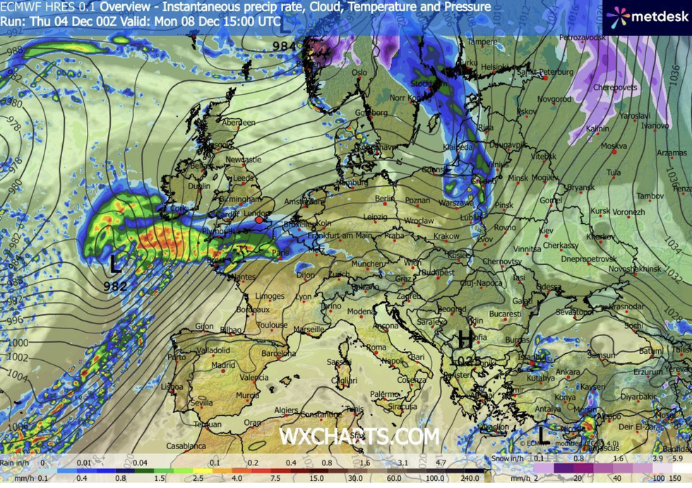
A storm is scheduled to smash Britain on Monday
|WX CHARTS
Met Office meteorologist Alex Deakin said: “The jet stream is pushing low pressure after low pressure after low pressure our way, and that is what is going to provide the rain.
“A spell of wet and windy weather will move through on Friday before the next low with a tangle of weather fronts comes through on Sunday, and then to the southwest another low is intensifying for Monday.
“This system has the potential to become a potent area of low pressure, and as the jet stream spins up this area of low pressure, it is drawing up warmer air, and it is likely to be packing a bit more rainfall.”
Next week’s deluge will be boosted by freakishly high temperatures, ploughing tropical moisture into incoming low-pressure cells.
LATEST DEVELOPMENTS:
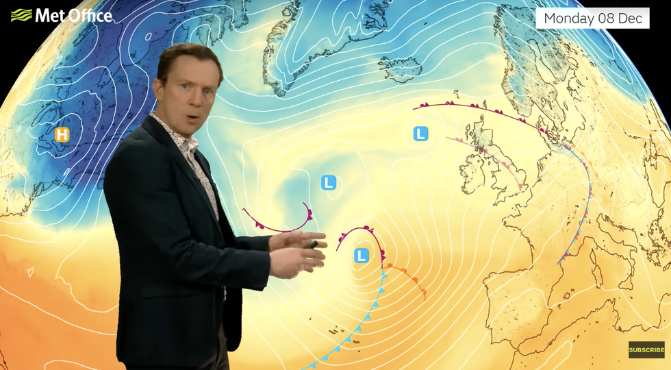
Low after low hits the UK, says Alex Deakin
|MET OFFICE
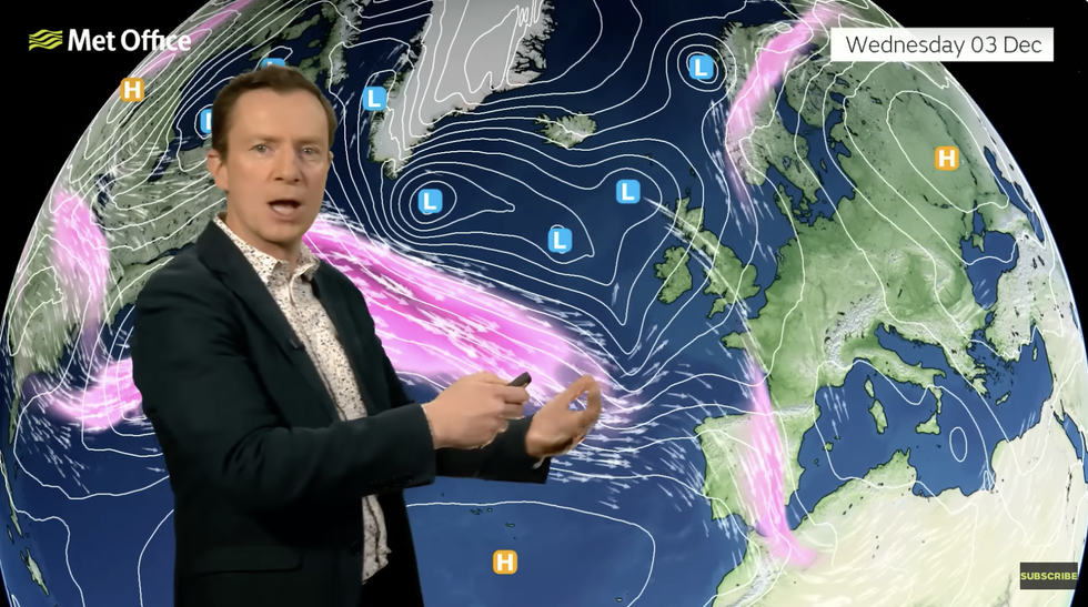
The jet stream will drive the change
|MET OFFICE
Southern regions could hit double figures as the chance of an icy snow-globe Christmas dwindles.
Deakin said: “This low brings with it warmer air and plenty of moisture, although it is going to be most potent in the Atlantic, there is some uncertainty about how quickly it develops.
“Most of the computer models show it spreading towards the west of the UK on Monday packing some gusty winds and more rainfall, and it is going to be the southwest that bears the brunt of the rain.”
Jim Dale, meteorologist for British Weather Services and co-author of ‘Surviving Extreme Weather’, added: “Heavy rain will be an issue through the next week at least with little if anything in the way of snow.”
Our Standards: The GB News Editorial Charter