


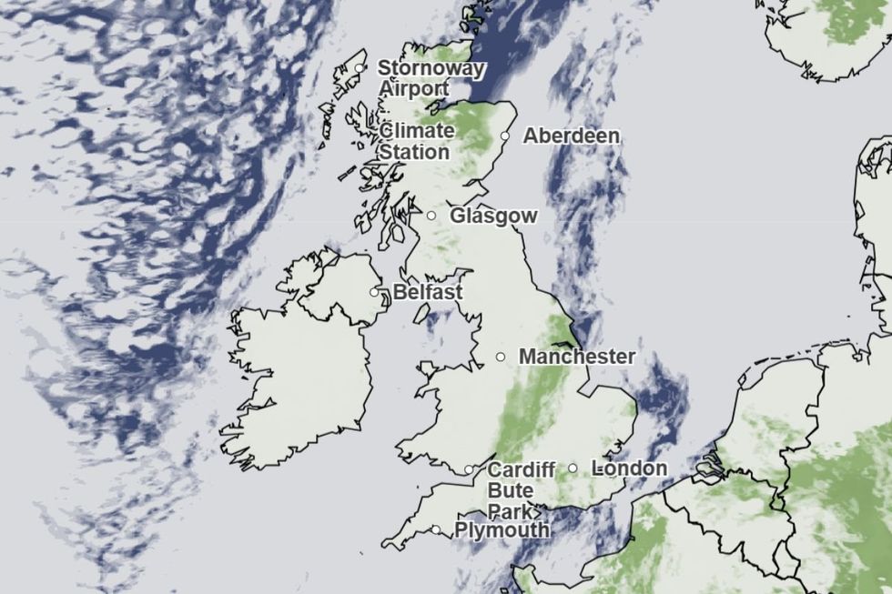
A return of autumn’s "anticyclonic gloom" will smother Britain under a murky shroud of low cloud and fog.
Meteorologists warn of a dreary start to the week as spring sunshine hides above a swirling dome of mist.
Nowhere will escape the eerie haze until later today in the southeast where the clouds will part to usher in the warmth.
Met Office meteorologist Kathryn Chalk said: “It is grey, it's dull, it's gloomy with a lot of low cloud, mist and fog.
“It is a much cloudier picture across southern Scotland and eastern Scotland as we go through Monday.
“Across the southeast there is signal for the cloud to break, and in the sunshine temperatures will rise to 16C or 17C.”
The dreary outlook is being driven by high pressure building over the UK as temperatures after winter lift.
Rising mists from water-logged ground will get trapped under a dome of ‘anticyclonic’ high pressure wedged over the country.
The dreary outlook is being driven by high pressure building over the UK as temperatures after winter lift
|MET OFFICE
A similar picture of ‘anticyclonic gloom’ last draped the UK in a leaden cloud which took weeks to shift.
As the mercury rises, though, the mist should evaporate more quickly allowing for spring sunshine.
However, another twist in spring’s weather tale mid-week will bring a return to wind and rain, experts warn.
Jim Dale, meteorologist for British Weather Services and co-author of ‘Surviving Extreme Weather’, said: “It is going to be a gloomy start to the week, with high pressure anticyclonic conditions driving fog and mist across much of the country.
LATEST DEVELOPMENTS
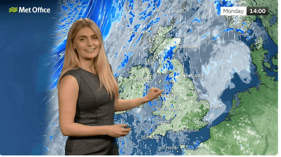
Kathryn Chalk describes the whole country being smothered in fog
|MET OFFICE
“But towards the middle of the week, there are signs of a return to the wind and rain with the return of low pressure, and this could cause some problems.
“It is going to be a changeable week, after a dull and gloomy start.”
Turbulent weather towards the middle of the week will be driven by the jet stream as it charges out of Canada at top throttle.
It will pick up areas of low pressure, the drivers of wind and rain, steering them across the Atlantic and into Britain.
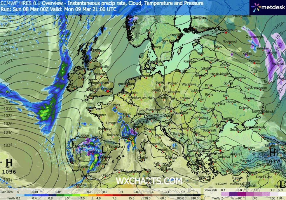
High pressure anticyclone moves over UK
|WXCHARTS
Met Office meteorologist Alex Deakin said: “The jet stream is coming out of Canada, and it is quite a powerful jet stream.
“As a trough of the jet stream moves across the Atlantic, it will be responsible for developing an area of low pressure.
“We have a south-westerly dominated flow, and towards the back end of the week, there is a hint of more unsettled weather with low pressure more likely.”
The foggy start to the week could arrive with an exotic added layer thanks to the dregs of a Saharan dust cloud.
The plume of sand from the African desert due to smother the country yesterday could wash down in a shower of ‘blood rain’.
Britons could catch a crimson sky this morning before the dust settles leaving the murky grey.
A Met Office spokesman said: “The inflow of Saharan dust, although not particularly dense, could contribute to reduced clarity in the sky and muted sunlight at times.
“Where breaks appear, the sun may have an orange or hazy cast to it.
“This effect is usually short‑lived but can be quite noticeable during sunrise or sunset.”