










Relentless heat ploughing the energy of an atom bomb into the atmosphere will explode with a deluge of thunderstorms.
As Britons sizzle in the hottest May temperatures ever recorded, experts warn the heatwave is about to erupt.
Electrical showers unleashing torrents of rain at the end of the week could spark flash floods.
The monsoon downpours will follow the hottest end to spring on record as May climaxes in searing 30C heat.
Jim Dale, meteorologist for British Weather Services, said: “There could be a lot of rain on Saturday and ahead of that, thunderstorms as heat and humidity build through the week.
“The amount of energy in the atmosphere from the high temperatures is already high, and this will provide fuel for thunderstorms.
“We are expecting some major downpours, and falling on dry ground after the past few weeks of little rain, there could be some issues with flash flooding.”
Meanwhile, Britons are warned heatwave conditions will hold out into the middle of the week before turning slightly cooler in parts.
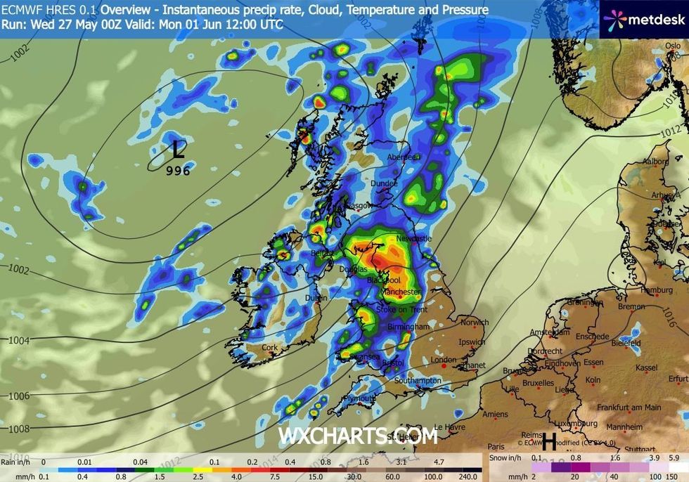
The monsoon downpours will follow the hottest end to spring on record as May climaxes in searing 30C heat
|WXCHARTS
Eastern coasts will catch a cooling North Sea breeze, while southern and western regions continue to bake.
Met Office meteorologist Greg Dewhurst said: “High pressure is dominating as we move into Wednesday, but there is a slight change in the position of the high pressure, and this will allow some cooler air to filter in from the North Sea.
“The east coast will be a little cooler with temperatures generally around 16C to 18C, but further south and west, where the warm air is holding on, it is approaching 30C or 31C, and this may be enough to trigger one or two thundery showers.
“High pressure is holding on into Thursday with more of a southerly again, which pushes the cooler air back away to the east and allows the warmer air to filter further north and east with temperatures getting into the high 20Cs, and perhaps the odd rumble of thunder.”
LATEST DEVELOPMENTS
Showers are likely to turn heavier into the weekend as high pressure shifts allowing in Atlantic weather systems, he warned.
He said: “To end the week, a weather system is more likely to push north-eastwards brining some thicker cloud and showery outbreaks of rain.
“As we move into the weekend, gradually it looks like Atlantic weather systems will start to move in, particularly across the north of the UK, turning it wetter and windier.”
Searing heat over the bank holiday saw records for May tumble as the mercury simmered to 34.8C, at London’s Kew Gardens.
Southern counties hit similar temperatures yesterday as high pressure drove blue skies and fierce sunshine.
Unprecedented heat and humidity ploughed millions of kilojoules of energy into the atmosphere, similar to an atomic explosion, turning CAPE (Convective Available Potential Energy) maps red.
CAPE is used as a measure of atmospheric volatility and a gauge for the risk of thunderstorms.
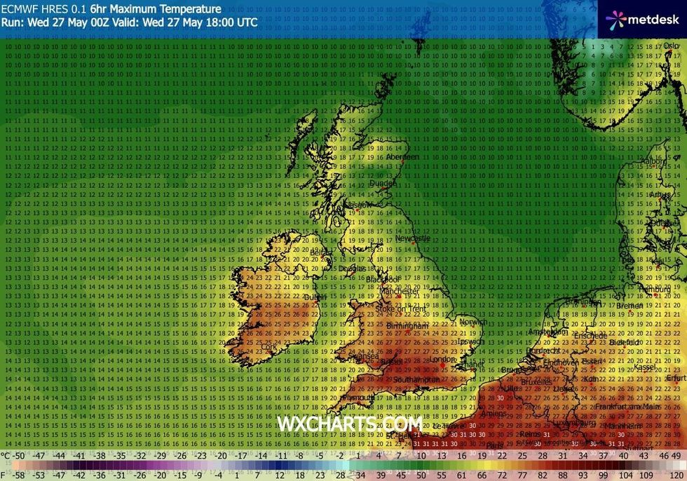
Temperatures had tipped above 30C this week
|WXCHARTS
Electrical downpours, however, are difficult to pinpoint, with experts warning of ‘sporadic’ storms.
Mr Dale said: “There could be scattered thunderstorms anywhere.”