


Surging temperatures during the first heatwave of summer threaten an eruption of violent thunderstorms.
Huge amounts of energy rapidly ploughed into the atmosphere as the mercury rockets will trigger an intense electrical deluge.
Southern and northern regions are most at risk on Saturday as Britain roasts in the first heat blast of the season.
Intense downpours will be boosted by soaring humidity, building tropical instability across Britain.
Jim Dale, meteorologist for British Weather Services, said: “Temperatures from the end of the week are going to rise rapidly, and this is going to lead to instability in the atmosphere.
“With the rising humidity, there is going to be a risk of thunderstorms and some heavy downpours as we go through the weekend.
“The warmth will be driven by a northerly airflow changing to coming in from Africa over the Continent."
High pressure over the Continent will nudge into the UK through the next 48 hours, bringing a brief calm before the storm.
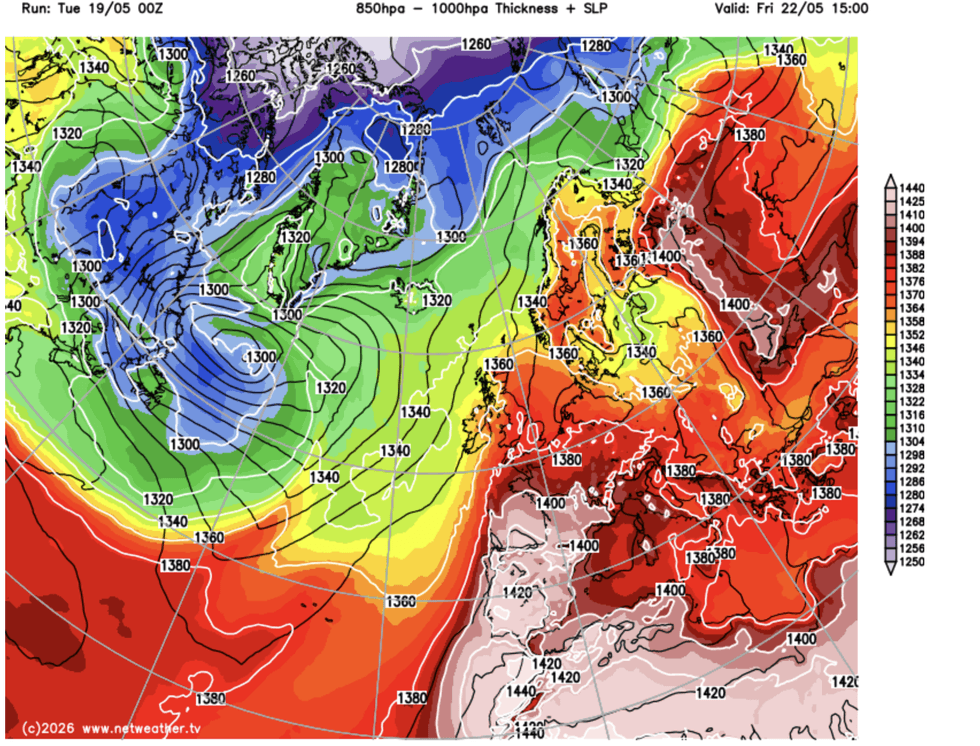
Surging temperatures are set to bring thunderstorms
|NETWEATHER
Temperatures will start to rise today before hitting the high 20Cs tomorrow, with the southeast in for the warmest weather.
Britain will turn warmer still into the weekend with some parts likely to see 30C on Saturday.
The Met Office officially declared a heatwave, with three or more days of temperatures above threshold levels.
Met Office meteorologist Clare Nasir said: “High pressure sitting across the near continent is building and pushing our way and that will allow temperatures to rise as we go into the weekend.
LATEST DEVELOPMENTS
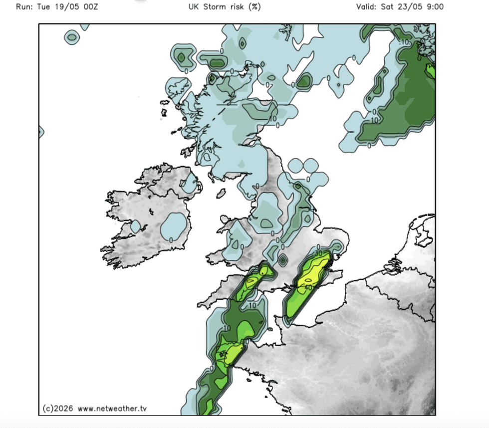
Southern and northern regions are most at risk from showers
|NETWEATHER
“A warm front comes in from the west and brings cloud and outbreaks of rain into the early hours of Thursday, and it could intensify a bit as it moves up towards western and southern parts of Scotland, so for some it is a wet start to the day on Thursday.
“In brighter breaks, we are likely to see temperatures coming in in the low 20Cs generally, and we could see a 24C towards the Home Counties.
“For most it is a fine day, and we have settled weather extending from the near continent and temperatures are up.”
Deputy Chief Forecaster Greg Wolverson said: “A very warm period of weather will develop through the weekend and into next week for much of the UK.
“Heatwave thresholds, defined as three consecutive days at or above a set temperature, are likely to be reached in parts of the UK from Sunday, most likely in southeastern England.”
Thunderstorms will carry the threat of torrential downpours, with the risk of rain holding through the start of the bank holiday.
Met Office meteorologist Annie Shuttleworth said: “Friday is set to be the warmest day of the year so far, but it is not all sunshine as there is a lot of rain to come.
“But it is likely to be the warmest day of the year so far, and temperatures are set to climb to the high 20C.
“During the Bank Holiday, we hold on to that shower risk through Saturday, but high pressure is set to build in more dominantly on Sunday into Monday, so we keep hold of the warmth.
“There are potentially some thundery downpours through Saturday.”
Our Standards: The GB News Editorial Charter