










A seismic drop in temperatures will plunge the mercury by 10C in parts of Britain today while elsewhere continues to bake in record heat.
Cold winds and sweeping clouds from the North Sea will push thermometers in the northeast from the high 20Cs to the mid-teens.
To the south, however, the mercury will continue to bubble, with more to come after London’s Kew Gardens yesterday set the new May record of 34.8C.
Met Office meteorologist Tom Morgan said: “There is a bit more in the way of cloud coming into northeastern England, and that will peg temperatures back much more than the last few days with temperatures only in the high teens for some.
“But in the south, temperatures could well push 35C in one or two spots once again, so it is going to be exceptionally hot for May.
“Some coastal regions, particularly northeast England will see a much cooler day with temperature 10C lower than bank holiday Monday.”
Cooler conditions will come as a relief to many, easing the stifling humidity and sticky sleeps.
Overnight temperatures in the south are expected to hover above 20C, bringing restless, tropical nights, unheard of in May,
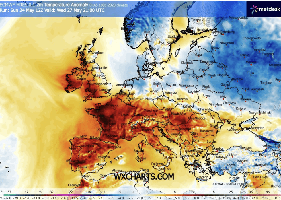
Temperatures could push 35C again
|WX CHARTS
Rocketing UV and pollen levels will add to the misery, Mr Morgan warned, as grasses and weeds spew clouds of irritants.
He said: “There is very strong sunshine with high levels of UV< and pollen levels are on the climb, we are entering the grass and the weed pollen season, so if you are a hay-fever sufferer and you haven’t had too many symptoms so far, then the next few days may be a bit troublesome.
“There are some exceptional temperatures over the next couple of days, but in the northwest of Scotland it is a different picture.
“Tuesday will start on a sunny and very warm note across England and Wales, but we could see the heat spark some very isolated thunderstorms.
LATEST DEVELOPMENTS
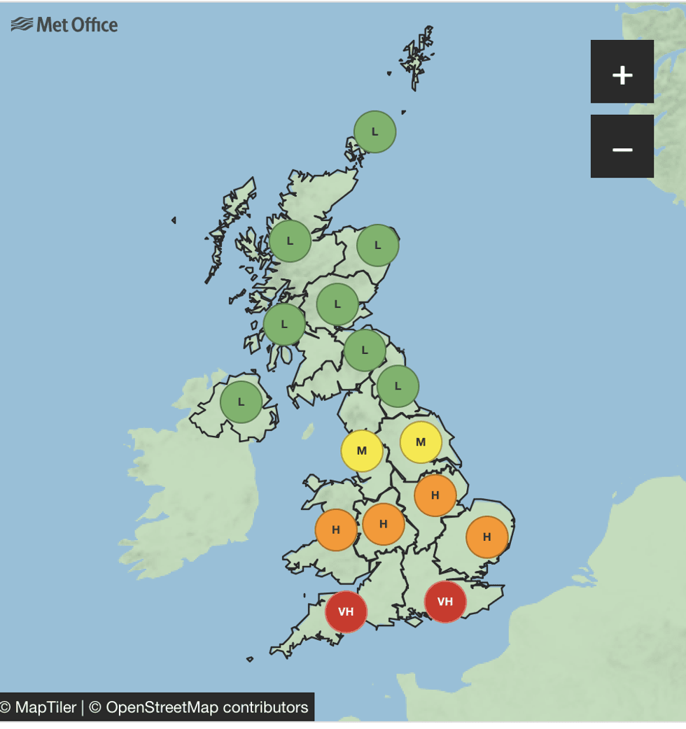
Pollen levels are very high across the south
|MET OFFICE
“It won’t be quite as hot in the south from Wednesday onwards.”
Britain officially fell into heatwave territory on Sunday, the third day in a row meeting threshold temperatures.
A UK Health Security Agency (UKHSA) hot weather alert remains in force until Wednesday.
Elderly and vulnerable people at greater risk of hot weather are urged to take extra care.
Sun-bathers taking a dip in the sea or other open bodies of water are warned to be on alert for cold-water shock.
Ashley Jones, head of water safety and education at Royal Life Saving Society UK (RLSS UK), said: “It’s important people don’t underestimate the risks associated with entering open water.
“Even during a heatwave, water will remain dangerously cold, and cold-water shock is a very real danger.
“Sudden immersion can cause an involuntary gasp, rapid breathing and panic, which can quickly lead to a loss of control in the water - even for strong swimmers.
"We’re urging the public to choose lifeguarded locations wherever possible, where safety measures and supervision are in place.”
Yesterday was officially the hottest May day recorded with the record also falling for the highest minimum after temperatures failed to fall below 19.4C.
Met Office chief operational meteorologist Dan Suri “Further heat is in the forecast for much of England and Wales, with similar temperatures forecast for Tuesday.
“High pressure is forecast to gradually lose its influence later in the week, though maximum temperatures will still remain high and in the low 30Cs for some mid-week and high 20Cs late this week.”