


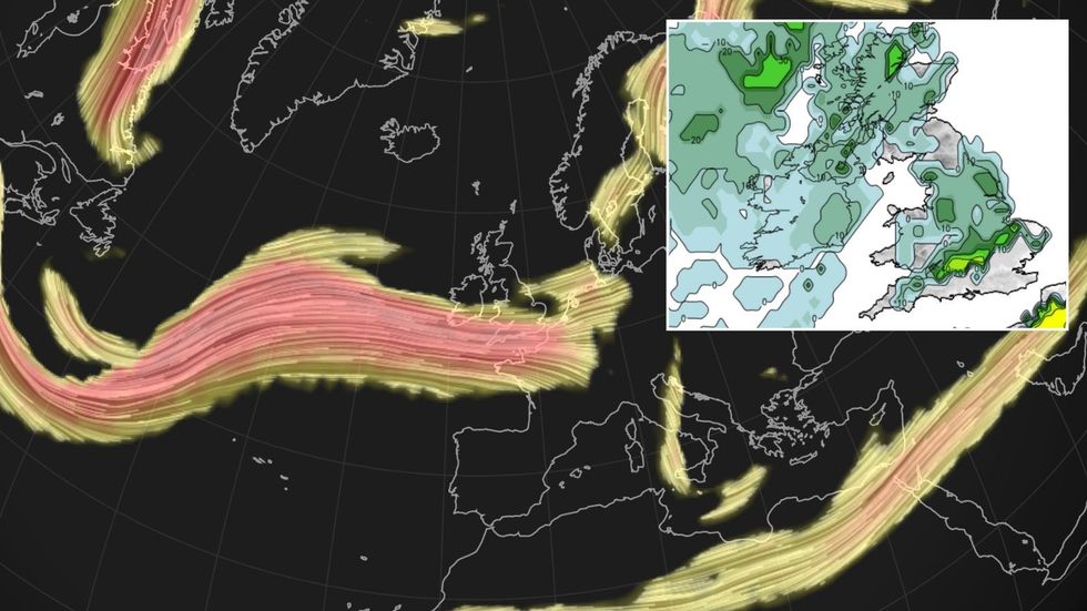
Britain is about to go bang as thunderstorms erupt from a clash between the jet stream, an Atlantic storm and a tropical plume from France.
A complex relationship between the three, though, could decide between a mild crackle and a torrential deluge of giant hailstones.
The trio’s explosive power rests on the storm’s speed as it piggy backs into Britain on the jet stream.
Met Office meteorologist Alex Burkill said: “There is some warm humid air over parts of France, and a plume of this is likely to push its way up into southern parts as we go through the weekend.
Britain is about to go bang as thunderstorms erupt from a clash between the jet stream, an Atlantic storm and a tropical plume from France
|Netweather
“Just a little bit of warming at the surface of the ground means that air could rise quite rapidly, and that is when we get convection.
“This is when we could get some severe thunderstorms with lighting, heavy rain and potentially some large hail.”
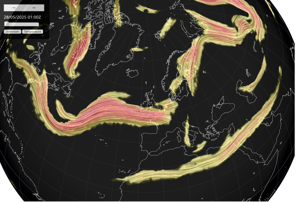
But a twist in the pattern of the jet and the Atlantic means Saturday’s low will zip through quicker than initially expected.
This gives less time for building instability meaning Britons could dodge the intense eruption initially feared, he explained.
He said: “A weather system looks like it is going to come through a bit quicker, and that plume is not going to have as much time across the country.
LATEST DEVELOPMENTS:
The trio’s explosive power rests on the storm’s speed as it piggy backs into Britain on the jet stream
|Netweather
“There is the potential for some showers to develop, but they don’t look to be as intense as the showers that we could have seen had the system been delayed a little bit like it looked like the earlier model runs.
“There will be a rash of showers across some southeastern parts, and some heavier ones and we can’t rule out some thunder, but it doesn’t look as if it will be as impactful.”
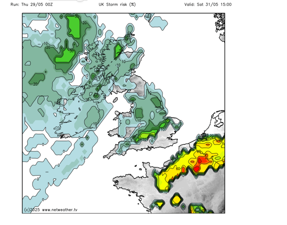
Despite narrowly dodging the thunder bullet, Britons are still in for a wet and potentially windy end to spring.
With the jet steam settled further south than typical for the start of summer, the UK into June will stay in the firing line of bouts of wind and rain.
Jim Dale, meteorologist for British Weather Services and social commentator, said: “There will be a risk of rain across parts of the country for through the end of the month, and some of these showers will be heavy.
A complex relationship between the three, though, could decide between a mild crackle and a torrential deluge of giant hailstones
|Netweather
“We are not looking at a complete washout, and where there are periods of sunshine there will be some pleasant weather around.
“It is after this period when we could start to see temperatures really rise, and there is the chance of some hot weather during June.”
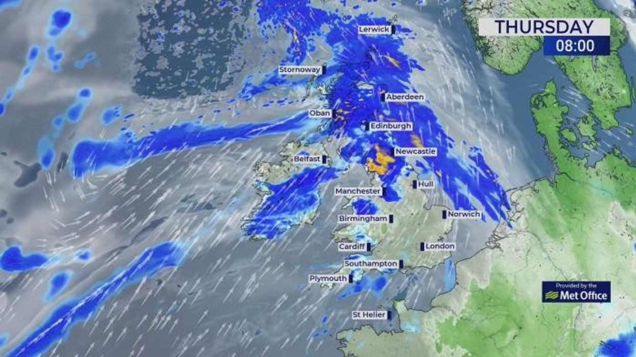
Britain’s current unsettled weather is due in part to the jet stream sweeping the country pulling in Atlantic wind and rain.
The wet and windy picture shows no sign of significant change until the end of the month, Burkill warned.
He said: “The jet stream doesn’t go anywhere particularly far, it still lingers across the UK, with low pressure to the north of us.
“We have a weather system coming through on Thursday and then another showery picture on Friday, so the picture is that a weather system comes through and then it gets a bit quieter and then another weather system comes through with the jet stream driving areas of low pressure as we go towards the weekend.”