


A "flaming June" tropical blast is about to give wind and rain the heave-ho as summer arrives to possible 30C heat.
Britain could be just 10 days from waving goodbye to torrential rain, thundery and chilly northerly winds.
Southern regions will be the first to watch the mercury soar as soon as next week, according to experts.
Jim Dale, meteorologist for British Weather Services, said: “After this week, the warm weather could come back quite quickly, and in the southeast, through the start of June we should see 25C to 27C, and I would not be surprised to see temperatures knocking on 30C.
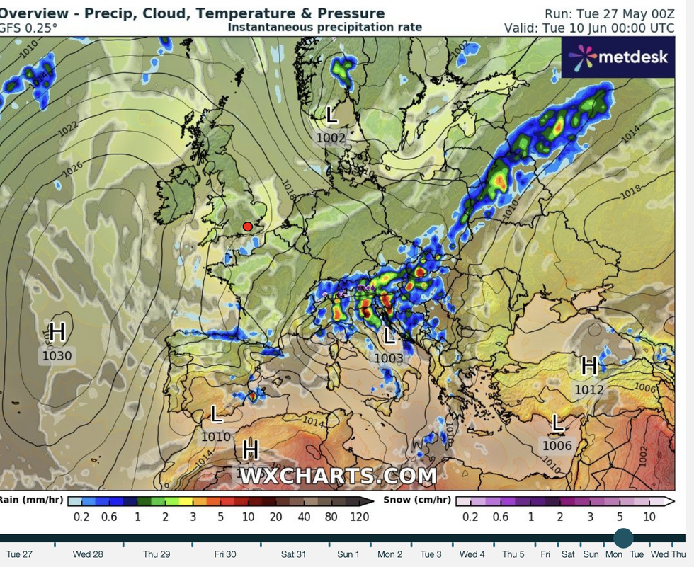
WX Charts map shows high pressure returning to Britain
|WX Charts
High pressure returns in June and brings in the warmth
|WX Charts
“We are looking at about 10 days before the return of the fine weather with temperatures again lifting above average for the time of year, so I think it is safe to start talking about a ‘flaming June’.
“As things turn warmer, it will turn drier which for many is good news, but not for farmers and gardeners which have suffered from the lack of rain so far this spring.”
The dramatic U-turn will come as the jet stream buckles, allowing high pressure to ‘block’ Atlantic lows.
Low pressure systems from the west have driven unsettled conditions, which are expected to hold out through the rest of this week.
These have been hurled towards the UK on an unusually active jet stream which will continue to fire up into the weekend.
LATEST DEVELOPMENTS: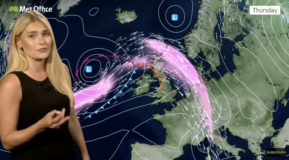
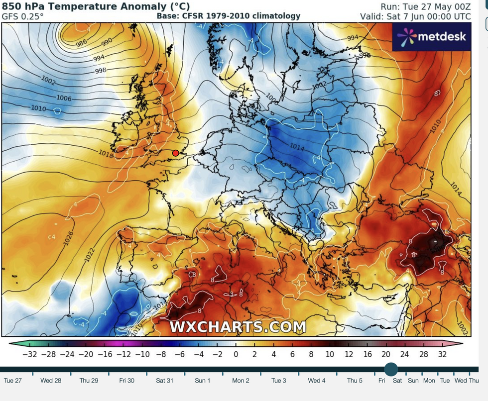
Met Office meteorologist Kathryn Chalk warns that in the meantime, the UK will be at the mercy of low pressure and the jet stream
|Met Office
Met Office meteorologist Kathryn Chalk said: “It is going to be a messy end to May, and there will be some well-needed rainfall but some dry interludes for those that are off on their half term.
“We have a fairly active jet stream, and that is going to be throwing areas of low pressure our way as we go through the week.
“But in between, there will be some ridges of high pressure just helping to settle things down, and we will see a bit of a ridge developing by mid-week.”
Southern and western parts could see temperatures in the sunshine hitting 20C or 21C through mid-week, she said.
Met Office meteorologist Kathryn Chalk describes the interaction between high and low pressure this week
|Met Office
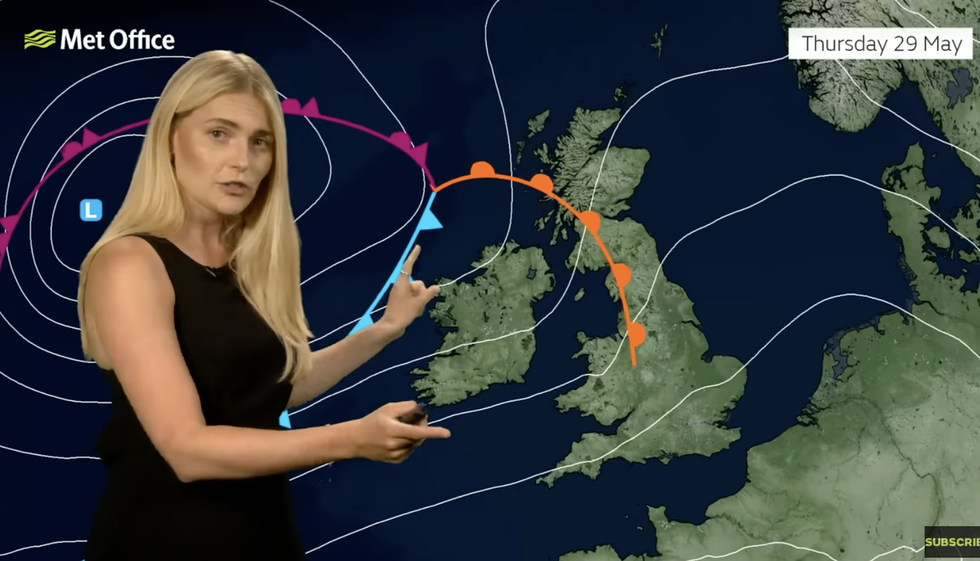
But on Thursday, another choppy low comes in from the Atlantic giving the weather a rattle, she warned.
She said: “On Thursday, we have another area of low pressure moving in and we do have a squeeze in the isobars as well, indicating some stronger winds.
“So, it is turning more unsettled on Thursday with further spells of rain and this time shifted more towards the north.
“Elsewhere, it will be often cloudy but there will be some patchy drizzle just on and off, otherwise it will be a windy day and quite muggy with highs of 21C or 22C.”
As forecasters hint at a return to sunshine, bookmakers have slashed the odds on a sweltering start to summer.
Ladbrokes spokesman Alex Apati said: “June looks set to be a sizzler, and we're already slashing odds and strapping in for record-breaking high temperatures in the next few weeks."
In the meantime, sun-hungry Britons will suffer a few more days of grey skies and rain before the clouds part.
Jason Nicholls, lead international forecaster for AccuWeather said: “Drier and brighter weather will return to the south later in the week, although to the north the showers will persist.”