


A raging jet stream will smash Britain with ‘one-after-another’ bouts of rain ending spring on a chilly damp squib.
Sun-hungry Britons will have to wait at least another week to ditch the brollies as June kicks off to a soggy start.
A powerful jet stream steaming across the Atlantic will pull in areas of low pressure more typical of autumn than the start of summer.
Met Office meteorologist Marco Petagna said: “We have an unsettled week of weather in store across the UK with a fairly active jet stream feeding unsettled weather systems in from the west, one after the other, and at times there will be some fairly windy weather affecting all parts of the UK.
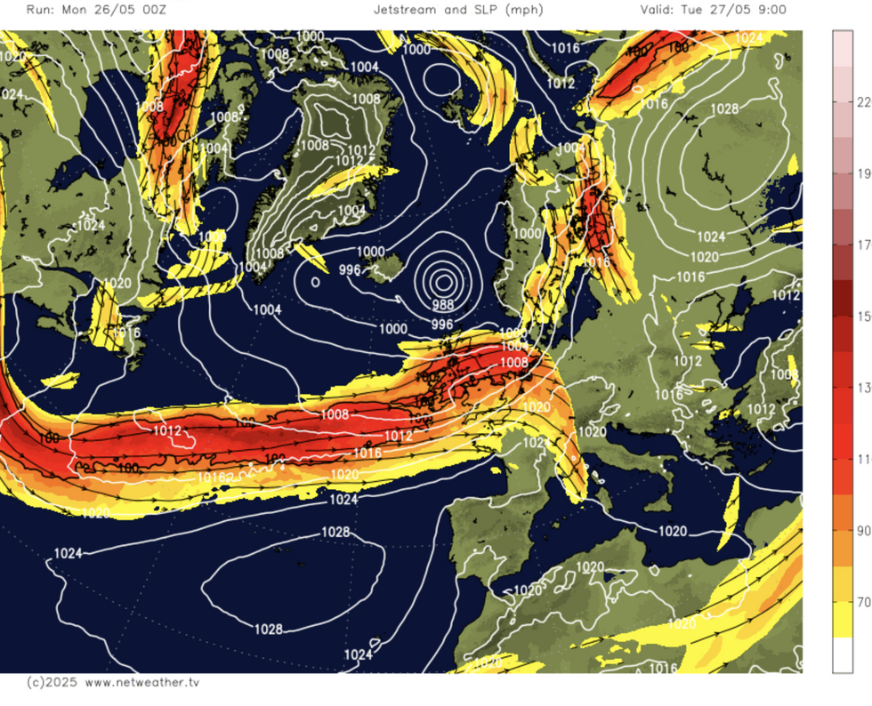
Netweather map shows Jet stream ploughing across Britain
|Netweather
“On Tuesday, some more persistent spells of rain are gathering, and they will push east to north-eastwards across most of the UK through most of the day, with just the north of Scotland heading into the afternoon that will hold on to some sunshine with the scattering of showers.”
Those hoping for warmth will be disappointed as temperatures wallow in the mid-teens through the end of May.
Southern regions will see the warmest weather, although even here the mercury will top a lacklustre 20C.
Petagna said: “Temperatures are down on where they should be for the time of year, certainly out towards the north and west into the low- to mid- and locally upper teens, peaking in the southeast at 20C.”
LATEST DEVELOPMENTS:The change in weather comes after weeks of dominant high pressure brought of clear skies and dry warmth.
High pressure has over the past few days weakened, allowing stormy lows in from the west.
The wet and windy weather will be given a boost by the jet stream, further south than typical for the time of year.
Wind, rain and chilly temperatures could hold out through the rest of the month, heralding a grim start to summer.
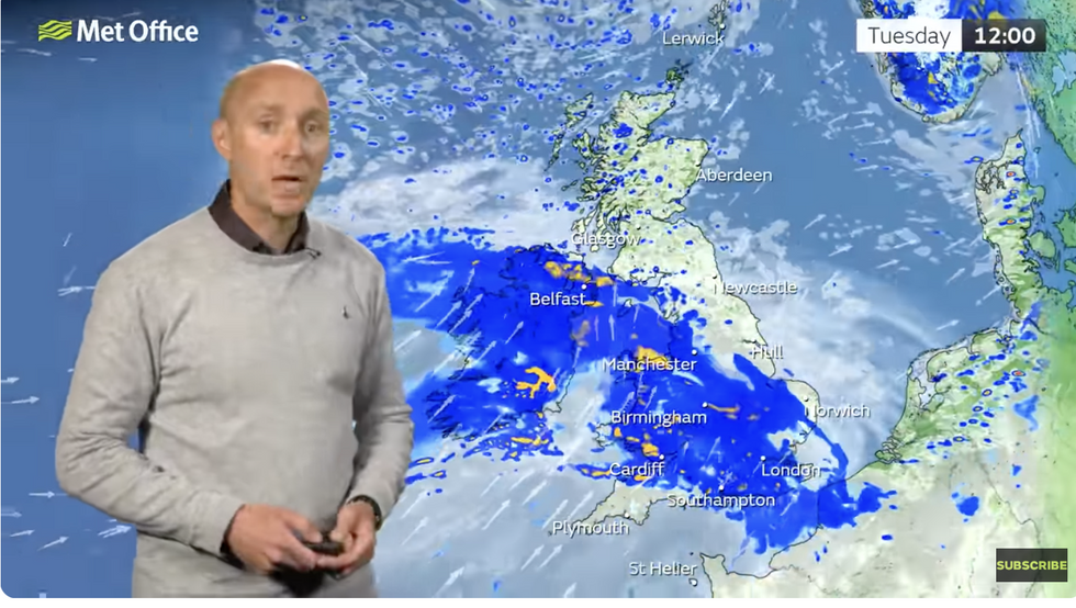
Met Office’s Marco Petagna warns of incoming rain
|Met Office
Jim Dale, meteorologist for British Weather Services and social commentator, said: “We have to wait a bit longer for high pressure to come back, and in the meantime, there will be more rain through the next five or so days.
“This will be good news, though, in in parts of the country where there has been little to no rainfall since the start of spring.
“At the moment, the weather is under the influence of low pressure coming in from the west.”
Britain’s weather will be typically grim for families heading out and about for half term this week.
Heavy rain and strong winds will at times erupt into outbreaks of thunder, according to the Met Office.
A spokesman said: “The half-term week looks set to be a more unsettled period than of late, with further frontal systems running into the UK, bringing rain to many areas at times, but also some drier spells in between.
“Temperatures will probably be close to average, perhaps slightly above at times, but will feel fairly cool in strong winds.”
Jason Nicholls, lead international forecaster for AccuWeather added: “It is going to stay wet across much of the UK through to the middle of the week, although there will be some brighter spells in between.”