


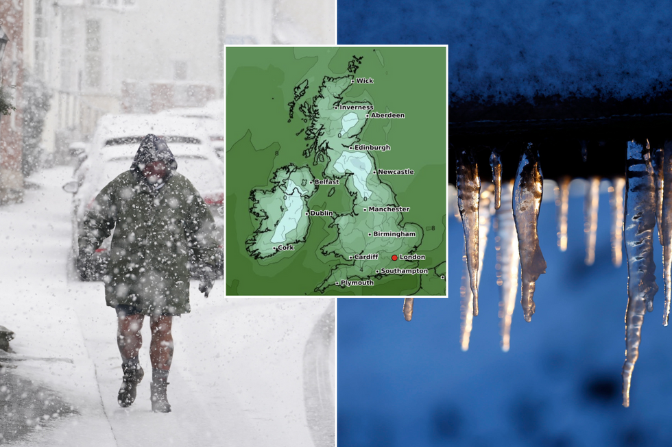
Temperatures are set to fall this weekend as low as -4C with a chance of some snow flurries hitting the UK.
It is currently forecast to remain unsettled throughout the weekend, with a band of thicker cloud and outbreaks of rain moving slowly northwards across the south.
Elsewhere showers returning around coasts with clearer spells inland allowing a rural frost across the north tonight and into the early hours of Saturday morning.
Now, forecasters have predicted sub zero conditions, with the thermometer dropping as low as -4C.
The UK is set to be hit with a cold spell
|WXCharts/PA
Met Office meteorologist Annie Shuttleworth said: "Low pressure will start to arrive into the south on Friday afternoon, and it will bring the threat of cloudier skies and perhaps some outbreaks of rain to end the day.
"Temperatures will start to rise in the milder air to the south, but the rain risk will increase through the afternoon.
"Saturday will see a cold start, and we could see temperatures down as low as -4C in Northern Ireland and Scotland which is fairly cold for the time of year, so there is potential for a frost for northern and western areas.
"Temperatures will likely continue to rise to average if not a little above average for the start of next week. But it could throw up a risk of heavy showers from the near Continent as well."
LATEST DEVELOPMENTS
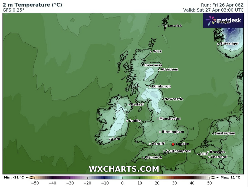
The latest forecast from WXCharts.com
|WXCharts.com
Looking into Saturday, the Met Office currently forecasts that cloud and rain will continue to push northwards through the morning, easing as it does so.
Jo Farrow from NetWeather said: "Saturday will start chilly and bright for Northern Ireland and northern Britain. Further south, cloud and showery rain from the first feature will still linger and edging northwards.
"For England, there will still be a cool easterly breeze off the North Sea, but as the frontal band moves away from south-eastern England, it will feel better with sunny spells.
"During Saturday night, the main weekend, low pressure will appear over northern France. The north-easterly to northerly winds will pick up for central and southwestern England and Wales."
Farrow continued: "As the frontal rain hits the cold air, there will be sleet and hill snow."
While it is currently not forecast, the next storm of the season would be named Lilian.