


Millions of Britons face being hammered by a yellow thunderstorm warning, the Met Office has warned.
The UK's national weather service issued a yellow warning stretching down from north east Scotland to the east of England.
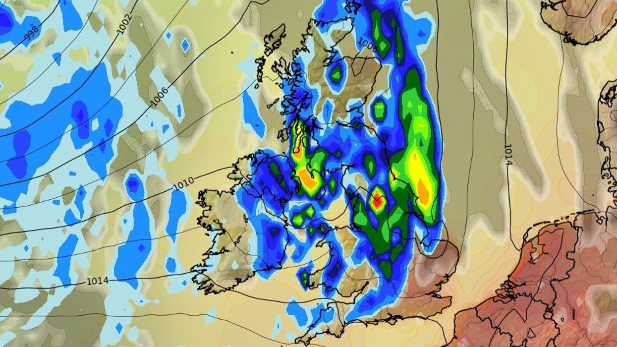
Thunderstorms could cause disruption and localised flooding on Sunday afternoon and evening.
Rainfall could vary significantly but some areas could see 40 millimeters fall over the course of just two hours.
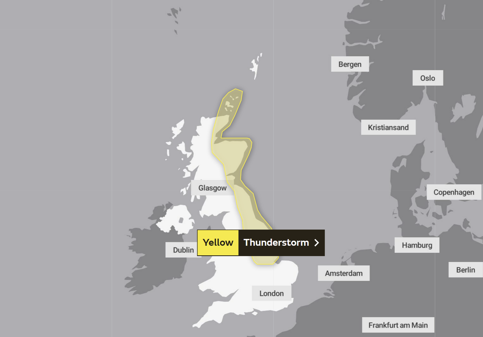
Met Office yellow weather warning for Sunday
|Met Office
Frequent lightning, large hail storms and strong winds could bring additional hazards in places.
Central, Tayside & Fife, Grampian, Highlands & Eilean Siar, Orkney & Shetland and South West Scotland & Lothian Borders have been identified as impacted areas in Scotland.
England's impacted areas include the East Midlands, North East England and Yorkshire & Humberside.
But Sunday is also expected to see temperatures soar.
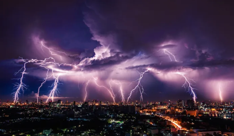
The UK is set to be rocked by thunderstorms
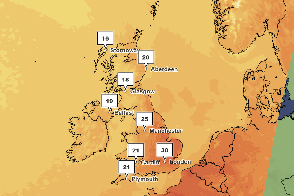
| PAThe Met Office forecast put London at 30C.
Manchester is also expected to feel the heat, at 25C.
Cardiff will remain slightly cooler at 22C and Plymouth marginally lower at 21C.
The UK's national weather service also said: "Remaining hot across the southeast on Sunday but rain in the west, locally heavy and thundery, will spread eastwards and bring fresher conditions into the evening."
Met Office temperatures for Sunday
|Met Office
In its update about the yellow thunderstorm warning, the Met Office added: "Whilst there remains some uncertainty in whether thunderstorms develop as cooler conditions follow from the west, there is a chance that an organised line of thunderstorms could develop across northern Britain during Sunday afternoon before clearing east into the North Sea during the evening.
"This is more likely to happen across eastern parts of the warning area including northeast England and eastern Scotland.
"Rainfall amounts will vary significantly, but some locations could see 30-40 mm in 1-2 hours. Frequent lightning, large hail (up to 3 cm in diameter) and strong, gusty winds will be additional hazards."