


Britons could be waiting until late August for the next hot spell as feuding weather patterns drive a sharp forecasting U-turn.
Hopes of a return this weekend to hot weather are likely to fizzle amid predictions of rain and vanilla temperatures.
High pressure, the vital ingredient to summer heat, is being held in check by low-pressure storms churning off the coast.
A wet, windy and heat-deprived weekend awaits sun-hungry Britons hoping for a return of the summer.
Met Office meteorologist Greg Dewhurst said: “The Met Office model is developing a deep area of low pressure to the southwest of the UK through Saturday and into Sunday.
“The main heavy and persistent rain is largely likely to miss the UK, but there is the potential for some heavier rain in southwestern parts.
“On Friday and into Saturday, temperatures will be above average, and into next week, as we see that westerly mobility starting to develop, temperatures will be back down to nearer average for the time of year, so something a little cooler on the way to end the weekend and begin next week.”
Hot weather through June has been boosted by plumes of warmth surging from the heatwave-struck Continent.
LATEST DEVELOPMENTS: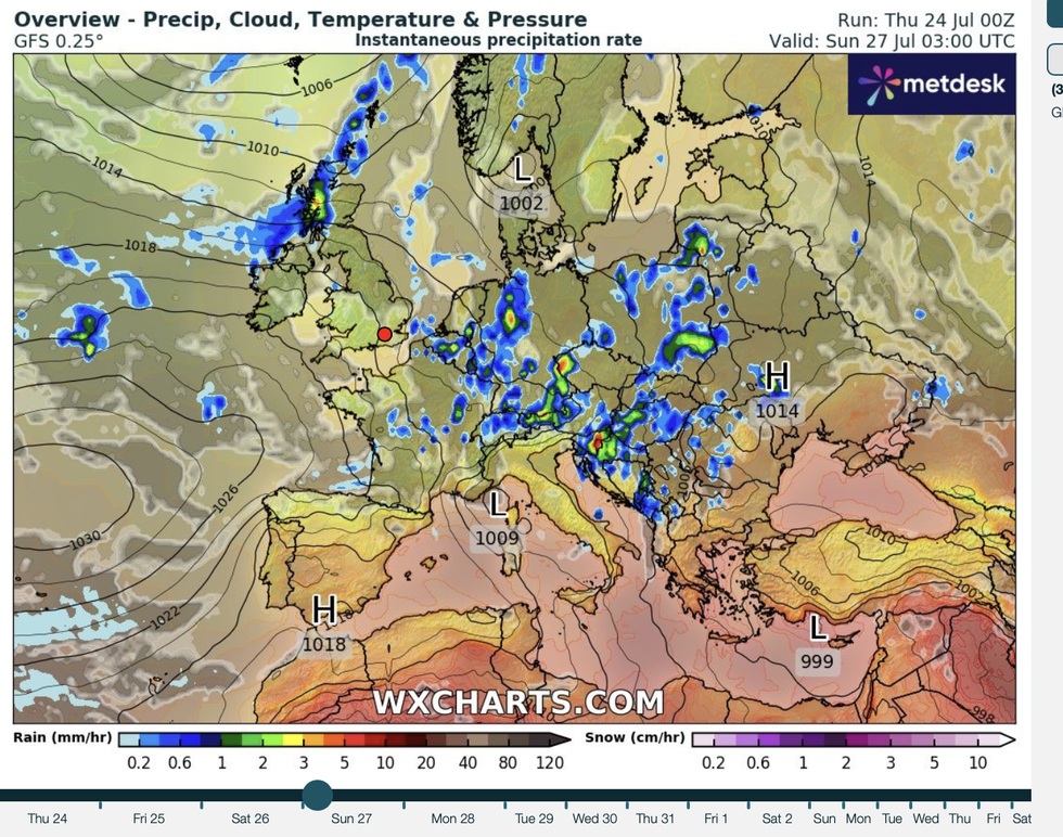
Britain to be stuck between high and low pressure
|WX CHARTS
But as temperatures nosedive over Europe, even a southerly blast will be helpless to rescue summer.
Dewhurst said: “After what has been a hot summer so far across Europe, during the week ahead, temperature anomalies look slightly below normal.
“If there are any chances that we switch our wind direction to more of a southerly, which is looking fairly unlikely, we won’t see a return of the heatwave.
“There is a north-south split between low and high pressure as we end July and go into August, but there are just hints as we get towards the beginning of August, a Scandinavian high and higher pressure to the north of the UK, which may just indicate a settling down of the weather to something warm and dry.”
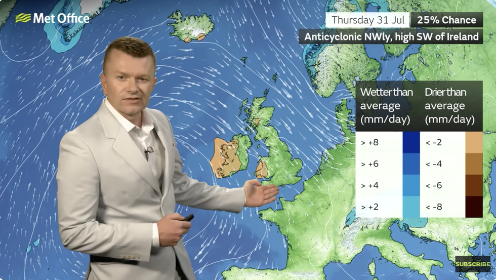
Winds coming from the north will battle the Azores High, according to Greg Dewhurst
|MET OFFICE
The Azores High, while bumping against northerly winds, is unlikely to succeed in turning up the thermostat, he said.
He added: “The Azores High is trying to extend towards the southwest and low pressure towards the north indicates some windier conditions, but also the risk of rain coming in at times.
“High pressure may move around next week, allowing drier than average weather to develop across southern and western parts, but at the same time, the wind direction is still coming in from the north and the northwest.
“Next week, we can see generally we are going to keep a westerly regime.”
However, with another month of summer left, all is not lost with some experts predicting an August return to the warmth.
A generally showery, average picture through the rest of the month may succumb to one last hurrah.
Jim Dale, meteorologist for British Weather Services and co-author of ‘Surviving Extreme Weather’, said: “I would not be surprised to see a return to heatwave conditions through the start of August, when it would not be unreasonable to expect temperatures back in the high-20Cs or 30C.
“It is still all to play for with a month more to go of summer.
“In the meantime, we are looking at largely pleasant weather with some warm temperatures at times, but also the risk of showers.”
Scotland and northern England will fare worst this weekend when it comes to wind and rain.
Jason Nicholls, lead international forecaster for AccuWeather, said: “Drier and brighter weather is expected later in the week and into Saturday, but in Scotland, the risk will remain for isolated showers.
“Through the weekend, this risk will spread east.”