


A trio of storms barrelling in on a supercharged jet stream will unleash a four-day Easter assault.
Britons face torrential rain, gales, snow, thunder and hail as a conveyor belt of foul weather smashes the UK.
Meteorologists warn that from Good Friday to Bank Holiday Monday, three separate storms will roll in, one after the other.
Temperatures will plunge in a plume of chilly air from the north, bringing snow to high ground in the north.
TRENDING
Stories
Videos
Your Say
Met Office meteorologist Alex Burkill said: “There is the potential that we could see an area of low pressure developing on Good Friday, and we are likely to see some wetter weather and some stronger winds towards the northwest.
“But the feature that is causing us slightly more concern is one that arrives on Saturday and looks like we will see a deepening area of low pressure as we go through Saturday and into Easter Day.
“Behind the feature, we have some colder air and wintry showers, and then we concentrate on another area of low pressure which is set to track towards us as we go into Easter Monday.
“So, we could see three relatively deep areas of low pressure running across the UK as we go through the long weekend.”
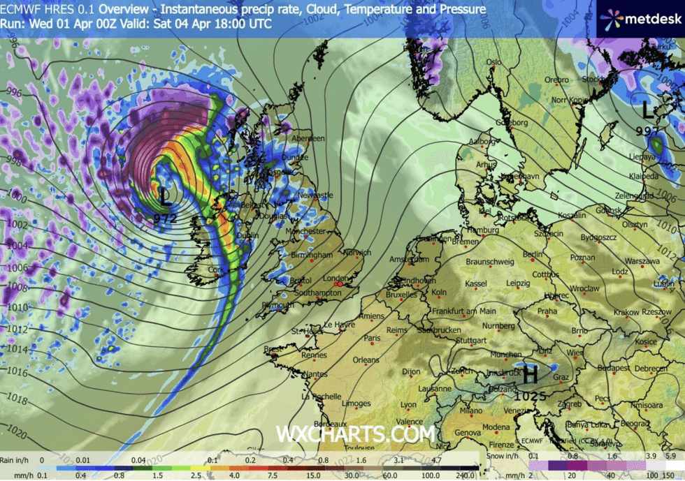
Deep low comes through on Saturday
|WX CHARTS
Britain’s weather will get booted through the Easter weekend by a ferocious jet stream, supercharged by events across the Atlantic.
A cold snap across North America, hitting tropical air to the south of the continent, will fuel jet stream winds leaving the east coast.
Along the way, the jet will whip up areas of low pressure, smashing them into Britain.
Northern and northwestern regions, in the direct firing line of the jet, will bear the brunt of the assault, Mr Burkill warned.
LATEST DEVELOPMENTS:
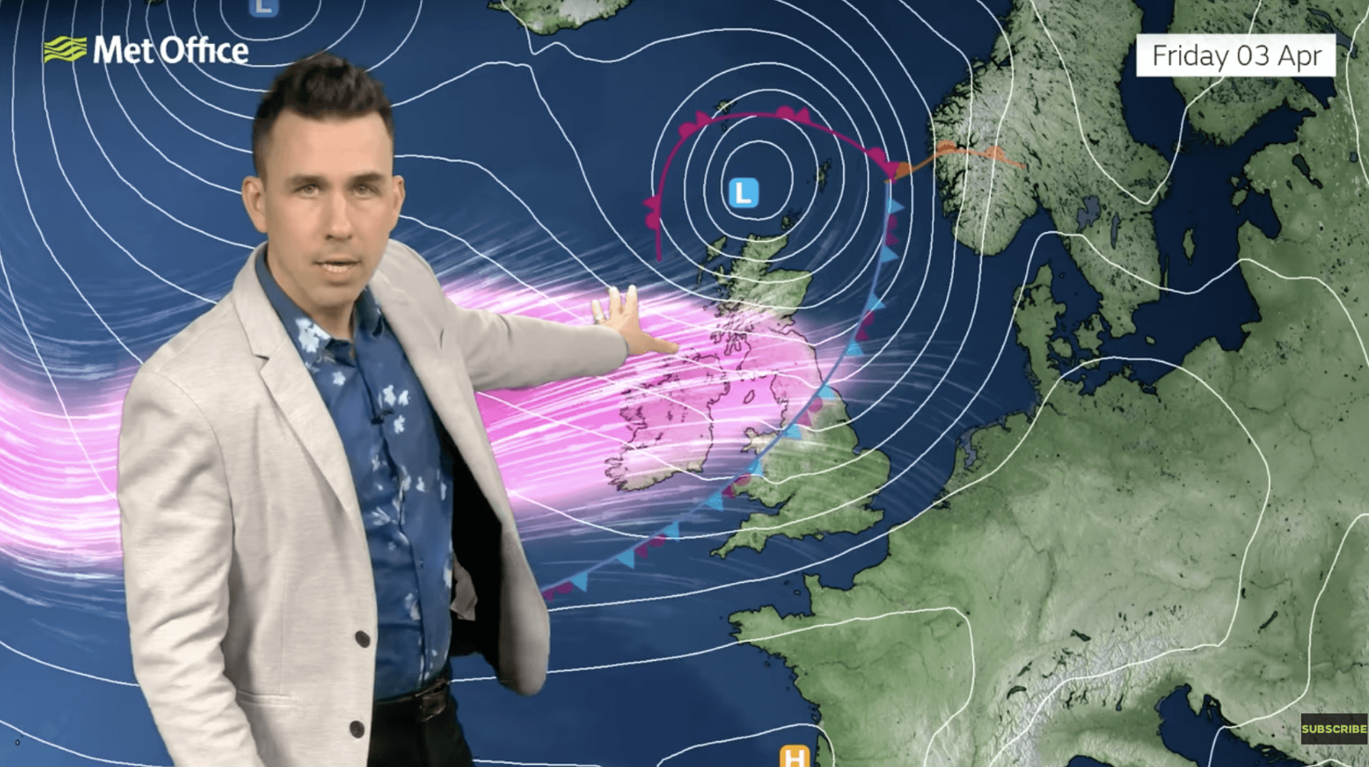
Aidan McGivern warns of a powerful jet stream coming through
|MET OFFICE
He said: “The weather is going to turn pretty unsettled, especially towards the northwest.
“There will be some very unsettled weather as we go through the weekend, and the big driving force is going to be the jet stream, which is very active at the moment.
“And the driving force behind the jet stream is the huge temperature contrast across parts of North America, with cold air in the north and warm air in the south.”
Met Office meteorologist Aidan McGivern added: “We have a cold plunge on the other side of the Atlantic, and that will come up against milder air across the mid-Atlantic, strengthening the temperature contrast and firing up the jet stream.
“That will pick up a weather front and will turn it into a fairly deep low on Good Friday, and that looks like that low will pass northern parts of the UK, so Good Friday increasingly turns wet and windy.”
Britons heading out and about should prepare for disruption on the roads and transport networks.
Although no storm names have been issued for Easter, experts warn winds could be strong enough to trigger Storm Dave – the next in the list.
Jim Dale, meteorologist for British Weather Services and co-author of ‘Surviving Extreme Weather’, said: “We could be looking at storm-force gusts in parts of the country with a major low-pressure system threatening very unsettled weather.
“There is the potential for disruption and damage, and behind this, temperatures will drop as Polar air comes through.”