UK weather: Britain to be lashed by heavy rain today just one day after hottest day of the year with 31.9C
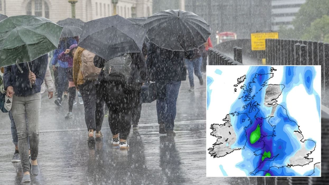
Britons are set to see heavy downpours and thundery conditions today, just hours after the hottest day of the year
|PA/ Net Weather

Forecasters warn that the weekend will feel a lot more 'humid'
Don't Miss
Most Read
Britons are set to see heavy downpours and thundery conditions today, just hours after the hottest day of the year.
Temperatures soared to 31.9C on Friday, but forecasters warn that the weekend will feel a lot more "humid".
According to the Met Office, clouds will move on to rain which will shifting “erratically” eastwards.
Heavy rain is expected in south Wales and southwest England.
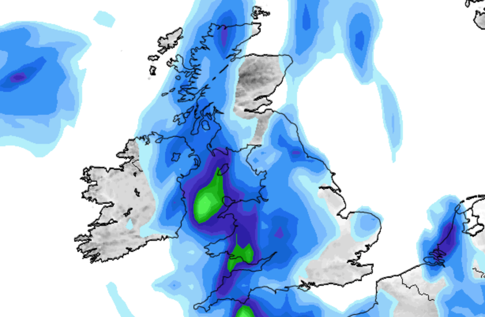 Britons are set to see heavy downpours and thundery conditions today, just hours after the hottest day of the year | Net Weather
Temperatures of up to 30C could still be seen across areas in the east.
Forecasters warn of "very heavy bursts" of rain during the day with possible thunderstorms in eastern England on Saturday afternoon.
The Met Office said: "A warm start on Saturday and a humid feel in places. Bright or sunny at times in the east but cloudier elsewhere with rain erratically edging eastwards, this turning increasingly heavy in south Wales and southwest England.
"We’ll start to see a thundery breakdown from Friday night into Saturday as a front makes its way eastwards, starting on the western side of the UK.
LATEST DEVELOPMENTS:
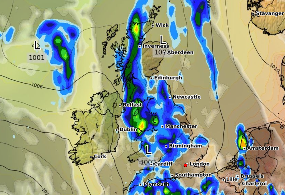
According to the Met Office, clouds will move on to rain which will shifting 'erratically' eastwards
|WXCHARTS
"Timings remain uncertain, but the further west you are, the more likely you are to see that breakdown into the cooler weather earlier in the day on Saturday.
"Areas in the east could still see temperatures of up to 30C on Saturday if the weather front stays at bay long enough.
"We could see some very heavy bursts of rain as the day progresses, with the potential for thunderstorms in eastern England on Saturday afternoon into evening.
"Some heavy rainfall in narrow corridors across the northwestern half of the UK is also likely on Saturday night into early Sunday."
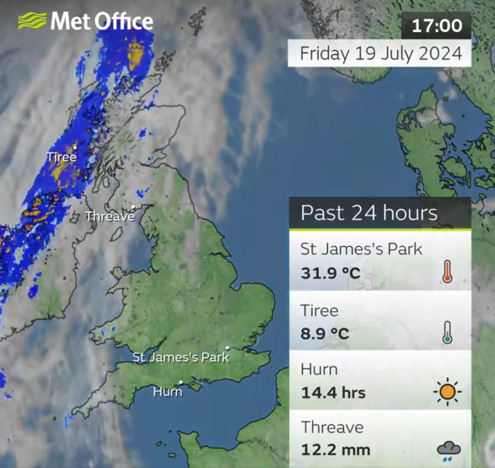
Temperatures soared to 31.9C on Friday, but forecasters warn that the weekend will feel a lot more 'humid'
|Met Office
The rain comes after scorching temperatures on Friday with St James's Park announcing that conditions reached 31.9C.
Meteorologist Annie Shuttleworth explained that Britain has been on the "northern side of the jet stream" and over the next few days, its position will change.
She added: "It becomes a more amplified pattern, diving down well to the south of the UK and taking low pressure systems up to the north and west of the UK.
"As we head towards the weekend, Sunday most likely, will see the return of the stronger jet core to affect the UK, meaning it is going to turn a bit more unsettled and certainly cooler again."


