


Britain could be just days away from another 30C fire blast as a throbbing heat bubble builds in from the tropics.
A cycle of blazing heat followed by cooldown is about to repeat with temperatures next week poised to rocket "with a vengeance".
In the driving seat is the Azores High, a huge high-pressure dome over the Atlantic pulling searing warmth into Britain.
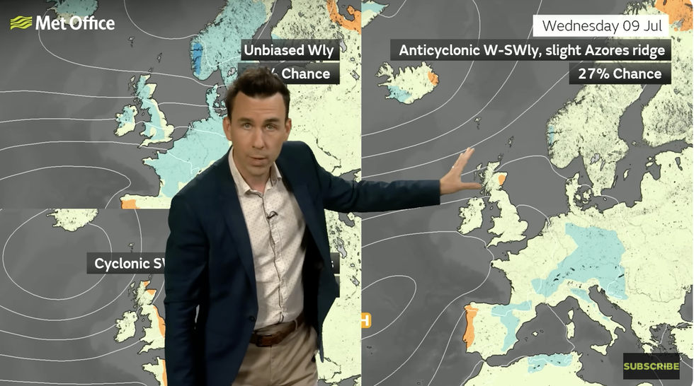
A peculiar "ebbing and flowing" pattern of the high, surging into Britain before retreating, is set to continue, according to the Met Office.
Meteorologist Aidan McGivern said: “During the past two weeks or so, the UK has been through two cycles of what appears to be a repeating weather pattern.
“The Azores High has been ebbing and flowing from the southwest through the past two weeks, hence this repeating cycle.
“Over the next couple of days, the Azores High is going to build back slightly, and that is going to bring fine weather to the south and a build in temperatures once again with a build in humidity across many parts of the UK as humid air from the tropics comes along.”
This weekend will bring a widespread respite from the oppressive heat with temperatures slightly below average for mid-summer.
LATEST DEVELOPMENTS:
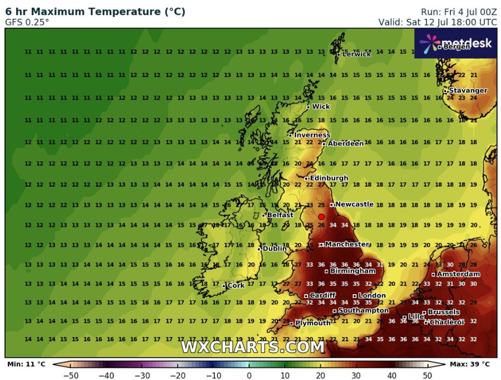
Temperatures could peak at 36C next Saturday, July 12
|WXCHARTS
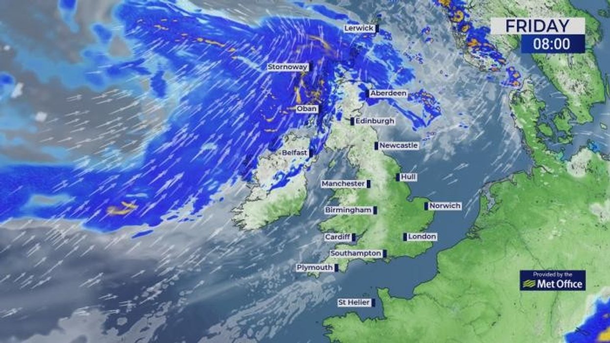
A dip in the jet stream will drive blustery showers across northern regions as sunshine and blue skies warm the south.
A north-south split through the coming days will bring heavy rain to western Scotland and northern England.
But fierce heat looks set to return by the middle of next week as Britain braces for a third hit from the Azores High.
McGivern said: “We keep a blustery north-westerly into next week as the jet stream dips to the south, and it is going to be cooler than average across most of the UK, but this is the point that high pressure over the Azores could start to build in again.
A dip in the jet stream will drive blustery showers across northern regions as sunshine and blue skies warm the south
|MET OFFICE
“After a cool showery start to the week, the Azores High is likely to return to the UK, but whether is sticks just to the southwest or whether it builds across the whole of the UK as it did during the last two heatwaves through June is something we will have to wait and see.
“As the Azores High builds, we are likely to see a return to some warmer than average weather, and while there is some uncertainty over the extent to which the Azores High builds in, it looks likely the Azores High will be building to the southwest next week.”
A plume of hot air ‘from the furnace’ could push temperatures back into the mid-30Cs, experts warn.
High pressure from the south, already warm ground and sea temperatures and a general trend of climatic warming could once again put records under threat.
Jim Dale, meteorologist for British Weather Services and co-author of ‘Surviving Extreme Weather’, said: “The goal posts have really moved, and next week we could see hot weather return with a vengeance.
“A plume of hot air is set to come back out of the furnace that is the Continent, and we could see temperatures back into the 30Cs.”