


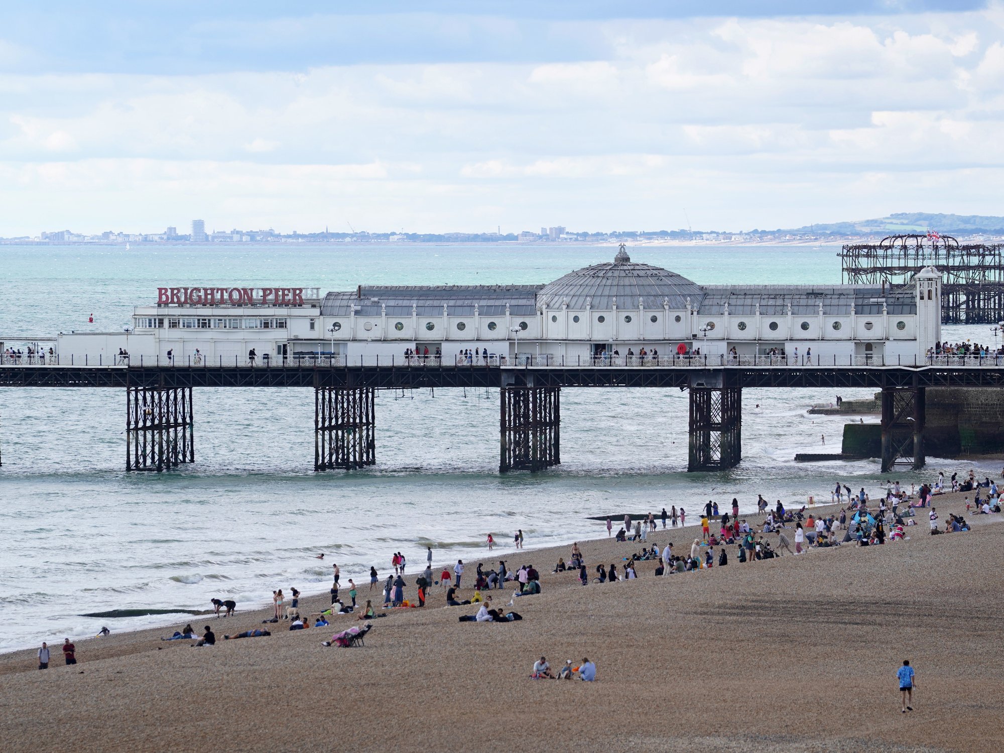


A giant "supermoon" filling the sky as torrential rain-loaded storm clouds gather threaten days of flood misery.
As wind and rain sweep in from the Atlantic, a full autumn moon will sweep past the Earth drawing high spring tides.
Heavy downpours will hit western and southwestern parts as coastal waters swell under the lunar pull.
Deborah Byrd, editor-in-chief of EarthSky, said: “Around each new moon and full moon, the sun, Earth, and moon lie more or less along a line in space.
TRENDING
Stories
Videos
Your Say
“The pull on the tides increases, because the gravity of the sun reinforces the moon’s gravity.
“Spring tides bring the most extreme high and low tides every month, and they always happen around full and new moon.”
Astronomical scientist Stephan Schramm added: “The moon takes an elliptical path around the earth, and the supermoon happens when it is close to the Earth, and you have a full moon.”
As the silver satellite reaches its zenith, western counties will brace for a separate barrage of low-pressure storms.
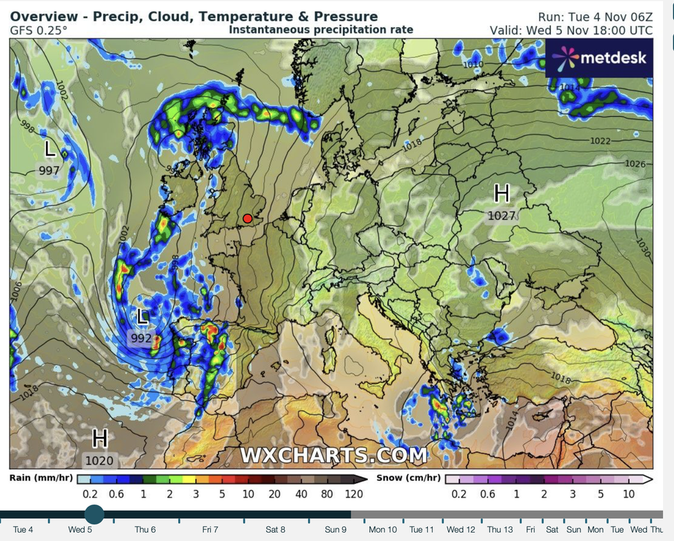
Heavy downpours will hit western and southwestern parts as coastal waters swell under the lunar pull
|WXCHARTS
Coastal regions face the heaviest downpours as Britain takes cover for a bout of "erratic" weather.
Met Office meteorologist Aidan McGivern said: “By bonfire evening, there will be some showery rain around, but it is a very erratic situation with showery rain migrating north through the day.
“There is some very wet weather around this week, and there are a number of warnings are in force.
“Another area of low pressure turns up from the west, and it is an active feature bringing some heavy rain, and these fronts will push along a little quicker.”
LATEST DEVELOPMENTS
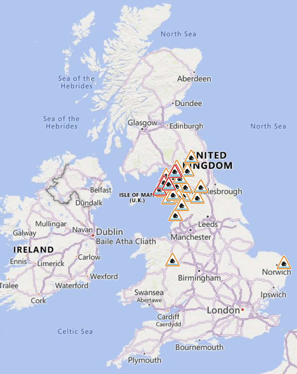
Flood risks are in place in parts of the country
Despite the wind and rain, temperatures will reach freakish highs with parts of the country to hit 17C, he added.
He said: “There is going to be a mild airflow with winds coming from the south and the southwest.
“It is going to be very mild with temperatures, even at 10pm, at 15C in the south, and 11C or 12C in the south.
“Thursday is drier and it is a mild afternoon with temperatures of 16C or 17C.”
The Met Office’s Alex Deakin said: “It will stay fairly soggy with further outbreaks of rain and heavy rain at times across Wales and southwest England could cause disruption.
“Some sunny spells are possible across northern Scotland, and it may brighten up across East Anglia and the Southeast, and if it does temperatures will reach 15C, 16C or 17C.
“There is more wet and windy weather to come through the rest of this week.”
The threat of heavy rain and high tides has prompted the Environment Agency to issue a raft of flood alerts.
Most at risk are northern and western regions under 25 flood alerts and six more serious warnings.
An EA spokesperson said: “Local flooding is possible more widely along the coast of England on Wednesday and Thursday. Properties may flood and there may be travel disruption.”
Unsettled weather is expected to dig in through the week and into the weekend before it calms.
Jim Dale, meteorologist for British Weather Services and co-author of ‘Surviving Extreme Weather’, said: “The rain will be the main issue, although there could be some strong winds about.
“This is a change from the calmer weather we have had so far this autumn, with more of an influence from the Atlantic. With the rain will be a risk of thunder.”