


Britain will swelter in a 70F plume of tropical humidity before the heavens open in an eruption of thunderstorms.
A volatile air mass sweeping in from the continent ahead of the bank holiday will spark an electrical deluge.
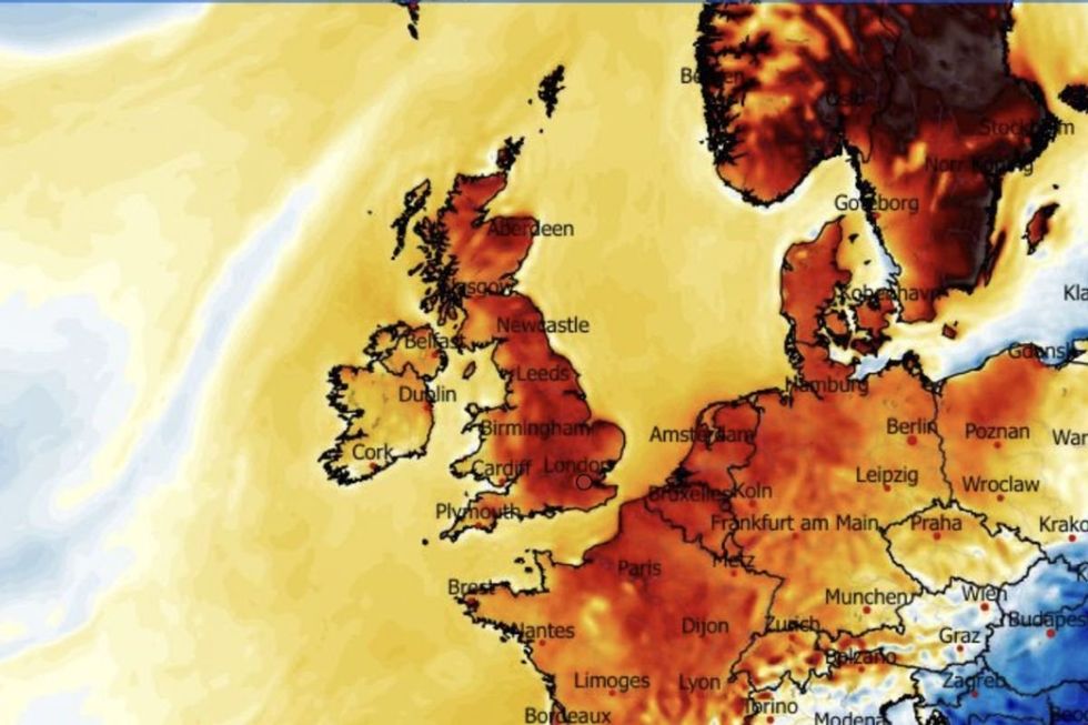
However, sultry southerly winds will push temperatures back towards the mid-20Cs, with Friday likely to be the hottest day of the week.
Met Office meteorologist Clare Nasir said: “The breeze will pick up in many areas through Thursday, and it has changed direction slightly and is slightly warmer across the east coast.
“There will be blue skies and sunshine elsewhere, and temperatures are rising, and we could see 23C towards central and southern parts of England and Wales.
“Overnight a feature continues to push northwards, and it turns a bit more humid, and Friday will be warmer still with a bit more cloud towards the west.”
Southern counties will enjoy the highest temperatures, she added, with thundery downpours crackling through the end of the week.
She said: “There is a risk of some heavier downpours through Friday and there is a risk of thunder.
Temperatures look set to get warmer over the bank holiday weekend
|WXCHARTS
“Over the weekend, it is fresher in the north with more cloud but some sunshine coming through and the chance of showers with the risk of thunder.
“There are some subtle changes Thursday into Friday, and the air will be more humid as low pressure brings unstable conditions, and there is the chance of showery bursts which could turn thundery.”
Rising humidity will be one of the drivers for change, ploughing the atmosphere with moisture and unstable energy.
High pressure, the driver of the fine weather so far this spring, will cling on until today when volatile low pressure takes hold.
LATEST DEVELOPMENTS
Jim Dale, meteorologist for British Weather Services and co-author of ‘Surviving Extreme Weather’, said: “High pressure will stay in charge until Thursday, and then it is going to change, and the weather turns more unsettled into the start of the bank holiday.
“Rain will be heavy in parts of the country, and while this is good news where there has been very little for weeks, there will be a risk of flooding.
“Humidity is going to be a key factor, rising with the change in wind direction, and this is going to be the trigger for thunderstorms.”
Coastal regions risk waking to thick morning fog as overnight temperatures fall from the mid-20C highs, he said.
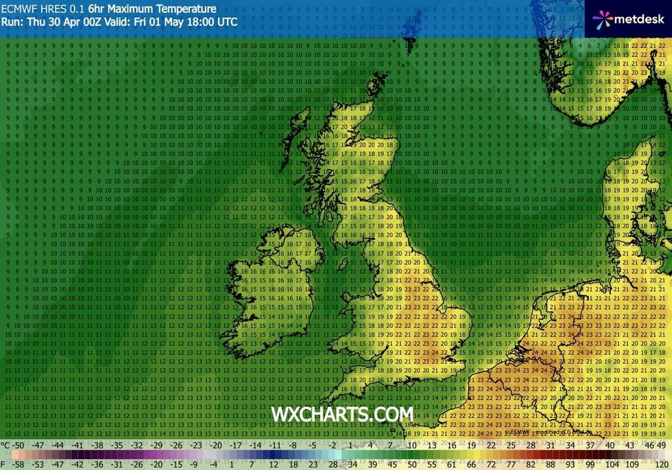
Temperatures will surge to 24C tomorrow
|WXCHARTS
Cold mornings could see temperatures in exposed regions dip close to or below freezing, he warned.
He said: “As temperatures drop overnight, humidity is going to bring the risk of morning fog and mist, particularly in coastal areas.
“Then as we lose high pressure, and low pressure comes in, the weather will turn much more unsettled.
“This looks like the picture through the start of May.”