


A ‘split Polar vortex’ could see Britain grappling icy conditions into spring as the nation braces for a -15C snow blast.
Unusual wind patterns above the atmosphere threaten extended periods of ‘blocked’ weather, which favour lower temperatures, through February and March.
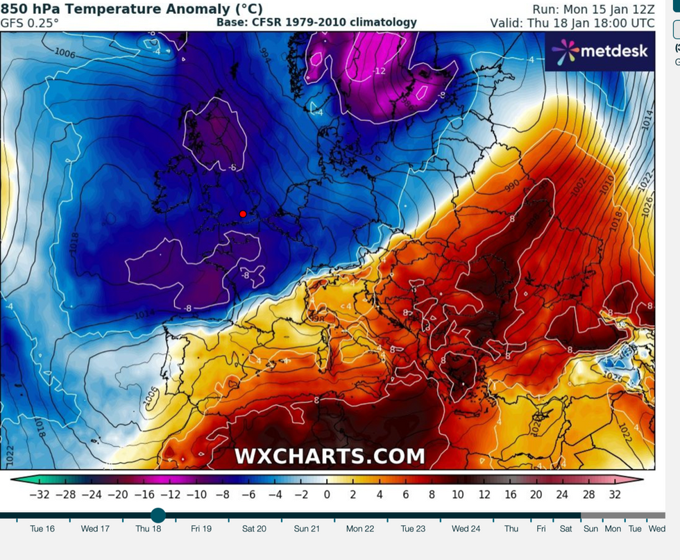
The stratospheric Polar Vortex – the swirling band of strong winds that circles the Arctic stratosphere – could fracture, raising the risk of prolonged cold, experts warn.
Dr Todd Crawford, meteorologist for Atmospheric G2, said: “Models are now depicting a complete split of the stratospheric polar vortex [this] week, with a snapback cooling/strengthening later in the month heading into February.
UK snow forecast: ‘Deep laying snow’ to cover Britain amid freezing -15C Arctic plunge
|WX charts
“…it does appear that there are higher odds of downward propagation of the weaker vortex that may result in longer spells of blocking in February and potentially into March than we’ve seen so far this winter.”
It comes as Britain hunkers down for what is feared will be the most savage winter blast of the season.
A freezing Polar blast has pushed temperatures towards -10C in the past few days as government forecasters issue a raft of snow warnings.
Thermometers could hit -15C in the coming days with up to four inches of snow forecast in parts.
LATEST DEVELOPMENTS: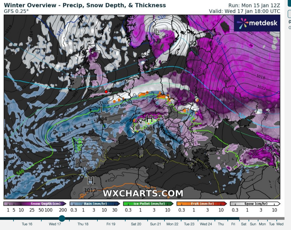
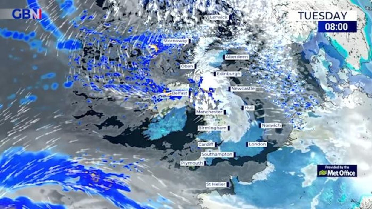
Cold weather grips the UK
|WX charts
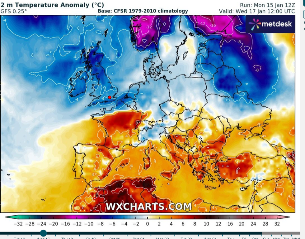
Even out of the valleys and hills, the mercury could touch a shivering -2C as bitter Arctic air engulfs Britain.
Jim Dale, social commentator and meteorologist for British Weather Services, said: “This is going to be the coldest period of the year and I would not be surprised to see temperatures through this week dip to -15C in exposed regions of the north.
“More widely we are looking at -1C to -8C, and even in London we could get as low as -2C.”
Scotland and northern England will be first in the firing line for a blast of snow from the Arctic before the risk grows for the rest of the country.
Temperature anomaly map
|WX Charts
Low pressure sweeping in from the west could bring heavy downpours more widely to northern Britain and along the west coast.
Dale, co-author of the forthcoming ‘Surviving Extreme Weather’, said: “As we go through the week, the risk will grow of more significant and longer spells of snow.
“In Scotland, this will come in from the Arctic, whereas elsewhere it will be the result of low pressure bringing moisture in from the west which will interact with the cold air over the UK to produce snow.
“With the windchill, it is going to feel very cold in parts through until the end of the week.”
The Met Office has issued a raft of weather warnings through the week for snow and ice across Scotland, northern England and parts of central England.
A spokesman said: “The UK is now in the grip of a cold plunge of Arctic air which has moved in from the north across the whole of the country.”
Met Office chief meteorologist Andy Page added: “Where and how much snow we will get will vary throughout the week.
“There will be widespread frost this week and we could see some fairly deep laying snow in parts of northern UK and strong winds could result in drifting or blizzard conditions at times.
“The snow and ice will be disruptive and could potentially impact travel plans, make driving dangerous and pavements slippery.”
Meteorologists are carefully watching the evolution of a Sudden Stratospheric Warming (SSW) event which could prolong the cold weather.
SSW was one of the drivers of the 2018 Beast from the East, although it does not always lead to cold weather in the UK.
But it could mean a higher chance of colder weather compared to warmer weather through February, according to Atmospheric G2.
However, it is too early to say with confidence how the split vortex will affect the weather through the start of spring, Dr Crawford said.