


Britain is facing a ‘horror show’ week of violent storms hurled across the Atlantic on a supercharged jet stream as the big freeze melts into cyclonic hell.
Storms will hurtle one by one into the UK through the coming days driving torrential downpours and gales while snow melt threatens flood chaos.
Milder air will push temperatures into double figures in southern and southwestern regions, although Scotland and the north will stay in the freezer.
Severe weather is likely to trigger further disruption after parts of the nation were crippled by heavy snow at the weekend.
WATCH: Met Office weather forecast
Jim Dale, social commentator and senior meteorologist for British Weather Services, said: “After the very cold weather, we are swapping one horror show for another, as this week the warnings will be for very strong winds, rain and the risk of floods.
“There may be some more mountain snow, and to the north the temperatures are going to remain low, especially on Tuesday when it turns a bit colder generally, and there may be some frosts about.
“Where there has been snow, with snow melt from rising temperatures and the new threat of heavy rain, there will be the added risk of flooding.”
A barrage of storm systems is lined up to the west of Britain with the first due on Wednesday before another hacks through at the weekend.
They will be fired up by an unusually strong jet stream which doubling up as a 150mph storm conveyor belt.
Dale said: “The first system comes in on Wednesday and then another arrives on Thursday and Friday.
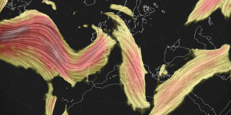
Jet stream ploughs across UK
|NETWEATHER
“It is a pretty miserable picture through the week, and in parts of the country we could see two to three inches of rain, which is above average for the time of year.”
Freezing temperatures and snow through the start of December were driven by a plunge of Arctic air flooding across the UK.
A battle between the Arctic and the Atlantic is now underway with colder conditions persisting in the north while Atlantic storms break through to the south.
Low pressure, the driver for unsettled weather, will ‘fire in’ from the west on a very strong jet stream, according to the Met Office.
Meteorologist Aidan McGivern said: “Through this week the more typical Atlantic driven weather returns.
“Looking out to the west there is another series of lows waiting to come in with even milder air heading our way carried by a very strong jet stream, and it is the power of this jet stream that will fire these lows in from the Atlantic and make a return from later Wednesday and later in the week to wet, windy and milder weather.
“Although, the colder conditions will cling on to the far north later this week and it is not going to feel particularly mild even though the thermometers may be rising.”
Southwestern regions will bear the brunt of the wind later in the week, while temperatures hit double figures, he added.
He said: “It is an unpleasant picture first thing on Thursday.
“It’s towards the southwest that the wind really picks up later in the day on Thursday as another area of low pressure spins up, and this could lead to some gales or even severe gales around southwestern shores and through the Irish Sea.
“That low is with us for Friday with areas of rain and showers swirling around it and some very heavy rain in places, especially western parts of the UK.
“Temperatures will be above average in the south on Friday, another low sends its weather front carried on a very strong jet stream.”