


Britain is set to be colder than Iceland next week as temperatures plummet to -6C in another cold snap.
Forecasters suggest high pressure could be blocked from the UK which will see "cold air masses" - causing temperatures to rapidly decrease.
Cold air is expected to move south from Greenland bringing sub-zero temperatures and heavy snow fall.
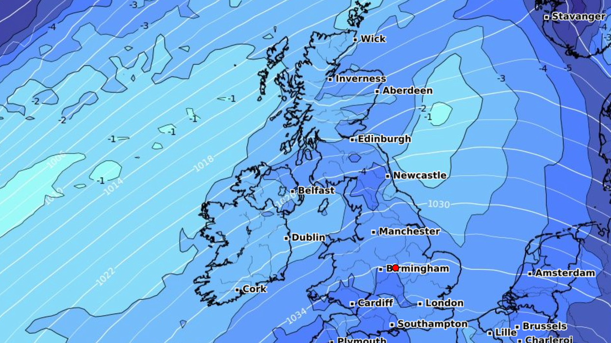
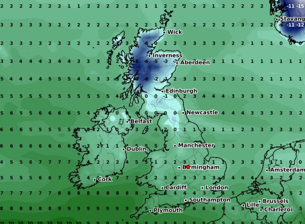
The latest weather maps predict that daytime temperatures will drop to as low as -6C on Monday, February 5.
Cold air is expected to move south from Greenland bringing sub-zero temperatures and heavy snow fall
|WXCHARTS
The cold snap comes just days after forecasters suggest snow could blanket most of Britain.
Conditions across the UK will largely be colder than Reykjavik, Iceland, which experiences temperatures between -3C and 3C on average at this time of the year.
The coldest places on Monday, February 5 includes the Scottish Highlands and northern England, the WXCharts show.
It will also be below-freezing across the Pennines.
LATEST DEVELOPMENTS:
Ian Simpson, meteorologist with NetWeather, said: "The weather will start off fairly mild with variable cloud and mostly dry away from northern Scotland.
"But will increasingly turn cold and sunny with northerly winds and potential for some snow, particularly in northern Scotland, and widespread overnight frosts".
He adds that the next cold snap between Monday, February 5 and Sunday, February 11, is likely to last most of that week as "cold air masses" sweep south.
Forecasters predict that "some major snow and cold weather" will return from February 2 and 3.
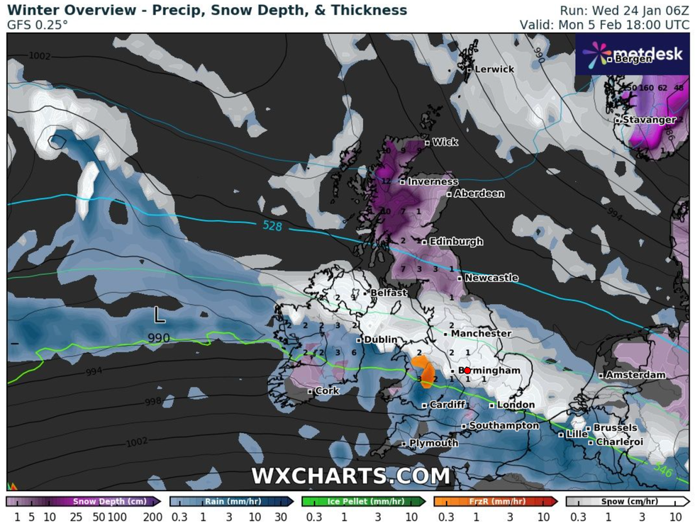
Forecasters predict that 'some major snow and cold weather' will return from February 2 and 3
|WXCHARTS
Heavy snow looks set to hit swathes of Scotland and north east England on February 3.
According to the latest weather maps, snow will continue to fall across the rest of Britain until February, 8.
ExactaWeather's James Madden suggests a "strong Greenland blocking pattern" could bring in the cold snap.
"Our projections are consistently showing up the potential for another temporary snow event towards the end of the working week and into next weekend that could bring further heavy snow to the north/ Scotland, and potentially to parts of northern England, Wales and Northern Ireland/Ireland within this period," he told The Daily Star.