
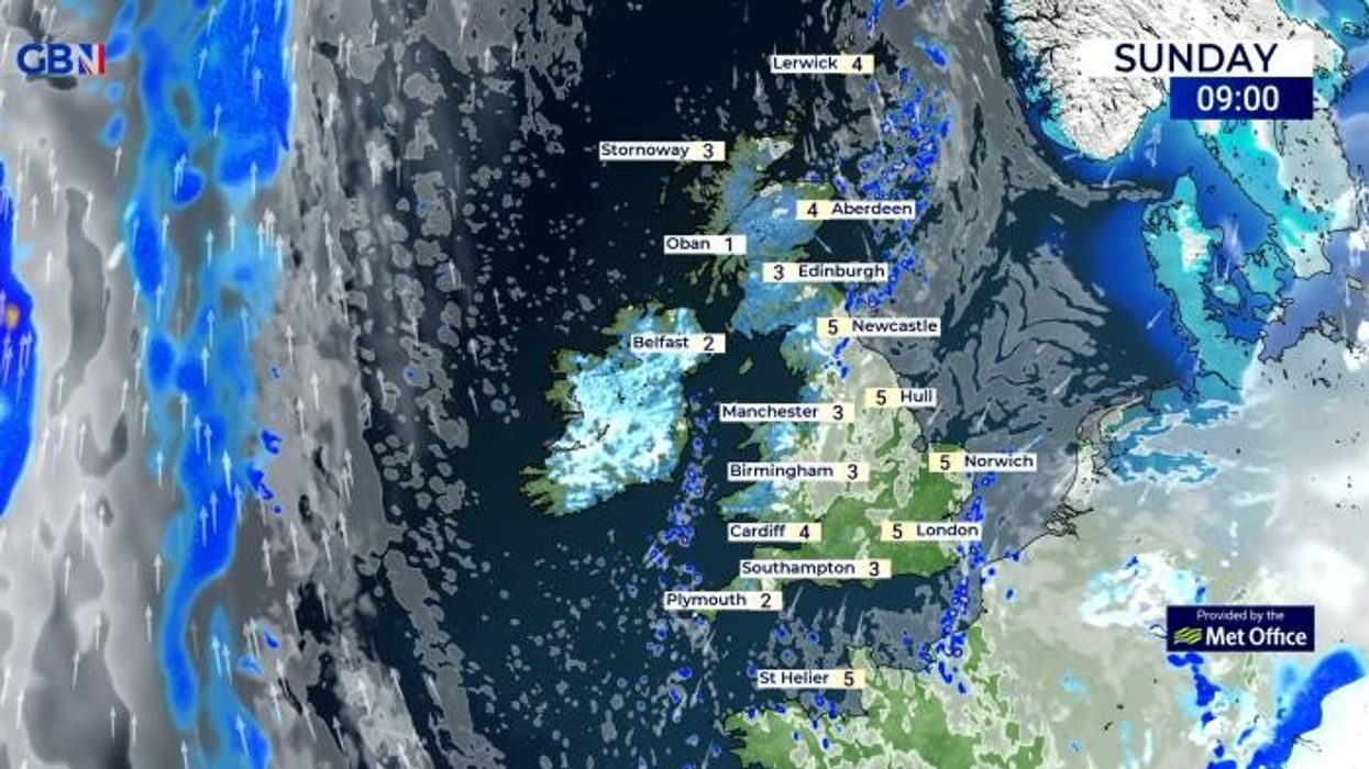


Snow could sweep across Britain as sub-zero temperatures bring a double ice warning, meteorologists have warned.
Mercury plummeted to as low as -7C in Altnaharra in Scotland overnight, with Castlederg in Northern Ireland witnessing temperatures drop to as low as -5C.
England will likely register slightly milder temperatures but mercury is still hovering around freezing, with -1C recorded in the Lake District and -2C in Somerset overnight.
Weather experts at NetWeather have warned cool air is blustering towards Britain via the Baltic Sea.
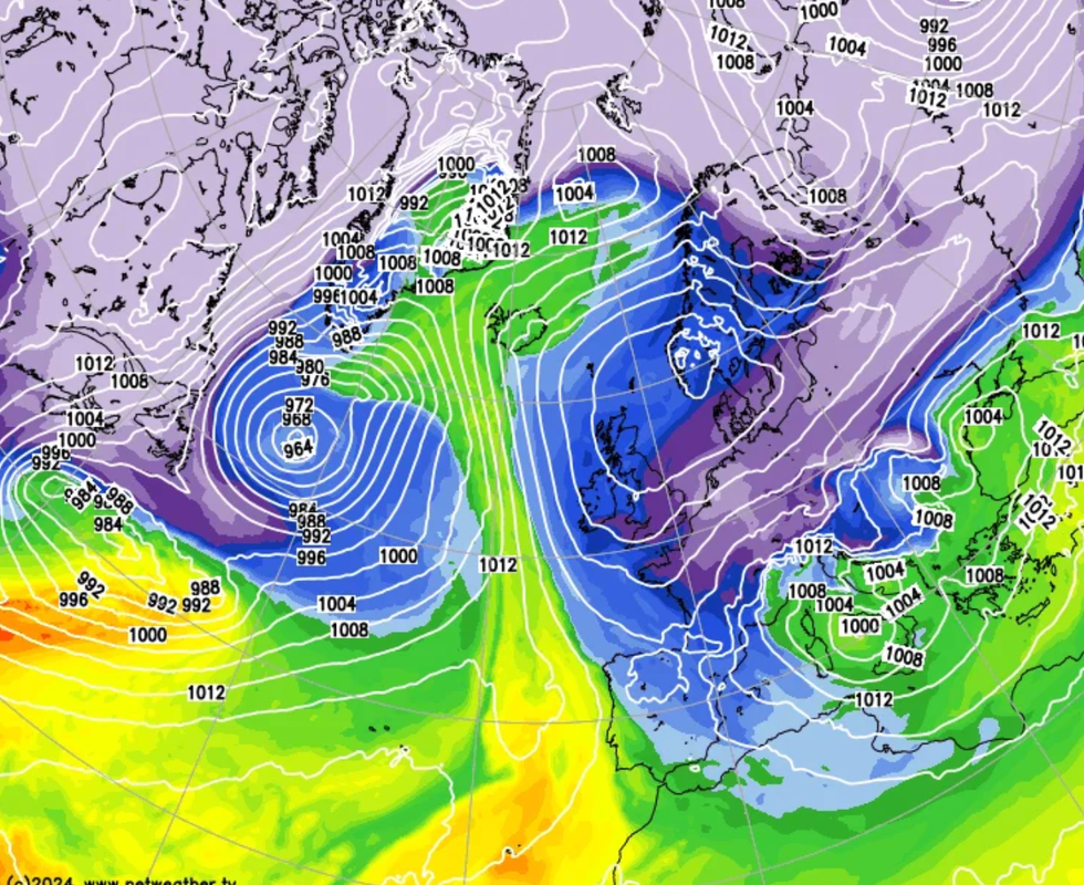
High pressure in control this week, but pulling in some bitterly cold air from the east across the south for a time early in the week
NET WEEATHER
It said: “A pool of deep cold air currently over the Baltic Sea will move west-southwest and cross southern England on Monday, so Monday will be a particularly cold day.
“This cold pool and breeze convergence will also support sleet and snow showers across southern Britain during Monday, perhaps forming localised more persistent bands or streamers of snow showers across SE England in the afternoon and evening.
“These streamers of showers could give a covering of 1-3cm in places, especially to the south of London, as per Met Office ice warning in force, but I think there could be locally more than this if showers turn heavy or snow turns persistent, especially over higher ground such as the North Downs and High Weald.”
NetWeather’s bleak forecast comes as the Met Office issued two yellow ice warnings today.
LATEST DEVELOPMENTS: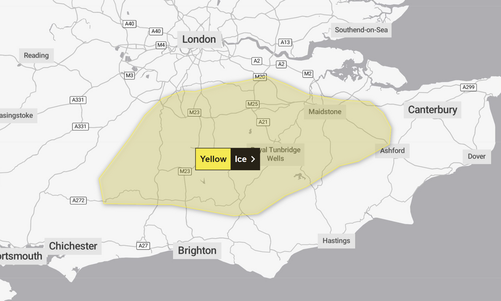
East Sussex, Greater London, Kent, Surrey and West Sussex face a warning between 4am and 10am.
The UK’s national weather service said: “A mix of sleet and snow showers will move in from the east later on Sunday night along with temperatures near zero.
“Given these wintry showers, and also wet surfaces after recent wet weather, some icy patches are likely on untreated surfaces.
“Additionally a few of the snow showers could turn quite heavy; these probably only affecting a narrow zone but a few places could see 1-3 cm, mainly over the north Downs and on grassy surfaces.”
A separate warning is in place covering County Armagh and County Down from 5am to 10am.
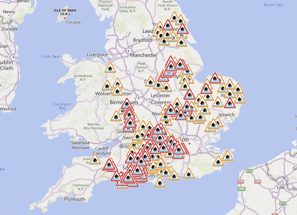
England's Environment Agency issued a number of flood warnings and alerts
|ENVIRONMENT AGENCY
“Showers moving inland across south-eastern parts of Northern Ireland will lead to rain falling onto sub-zero surfaces and development of ice on some untreated surfaces,” the Met Office added.
Plummeting temperatures come just days after Storm Henk wreaked havoc across much of the UK.
A number of flood warnings have been issued as Britons continue to grapple with the situation.
England faces 152 warnings and 152 alerts, the Environment Agency has said.
Natural Resources Wales issued an additional flood warning and four flood alerts.