


A huge pressure ‘lid’ will trap Britain under a dome of shivering North-Sea winds amid warnings the nation is about to freeze until mid-January.
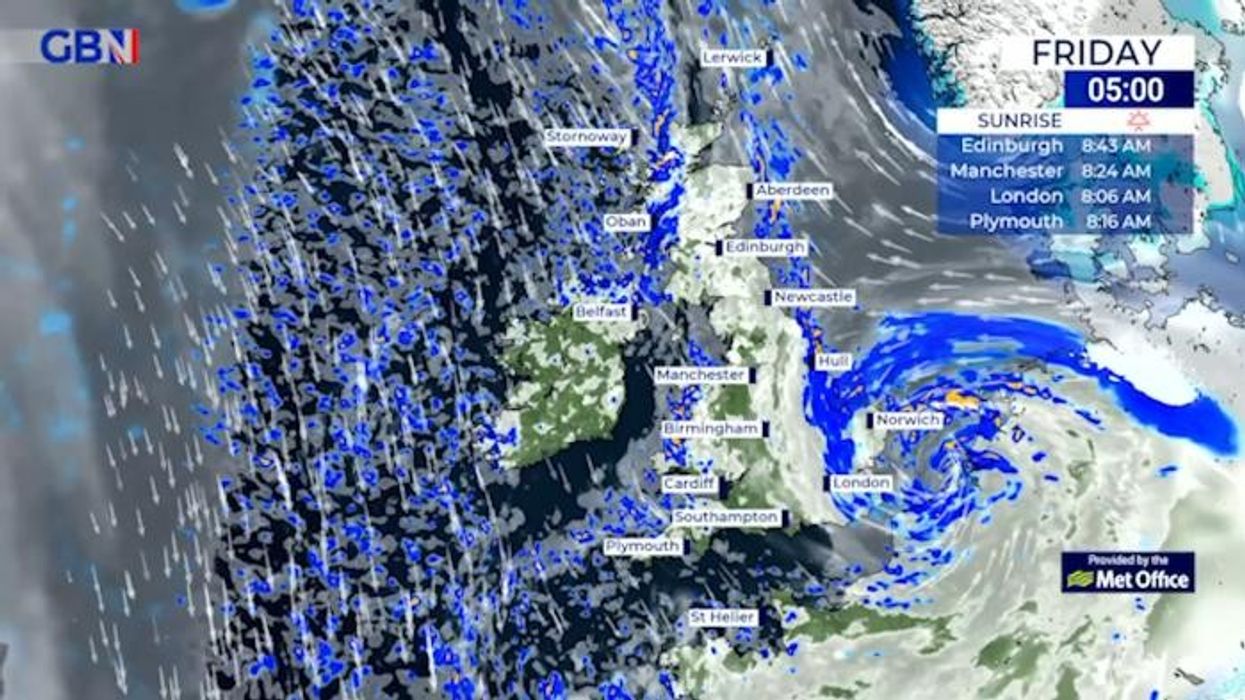
Relentless storms will give way to sub-zero temperatures and harsh frosts this weekend which will make parts of the UK feel close to -10C.
While initial forecasts are cold and dry, long-range experts say heavy snow could be the next weapon in the weather’s arsenal.
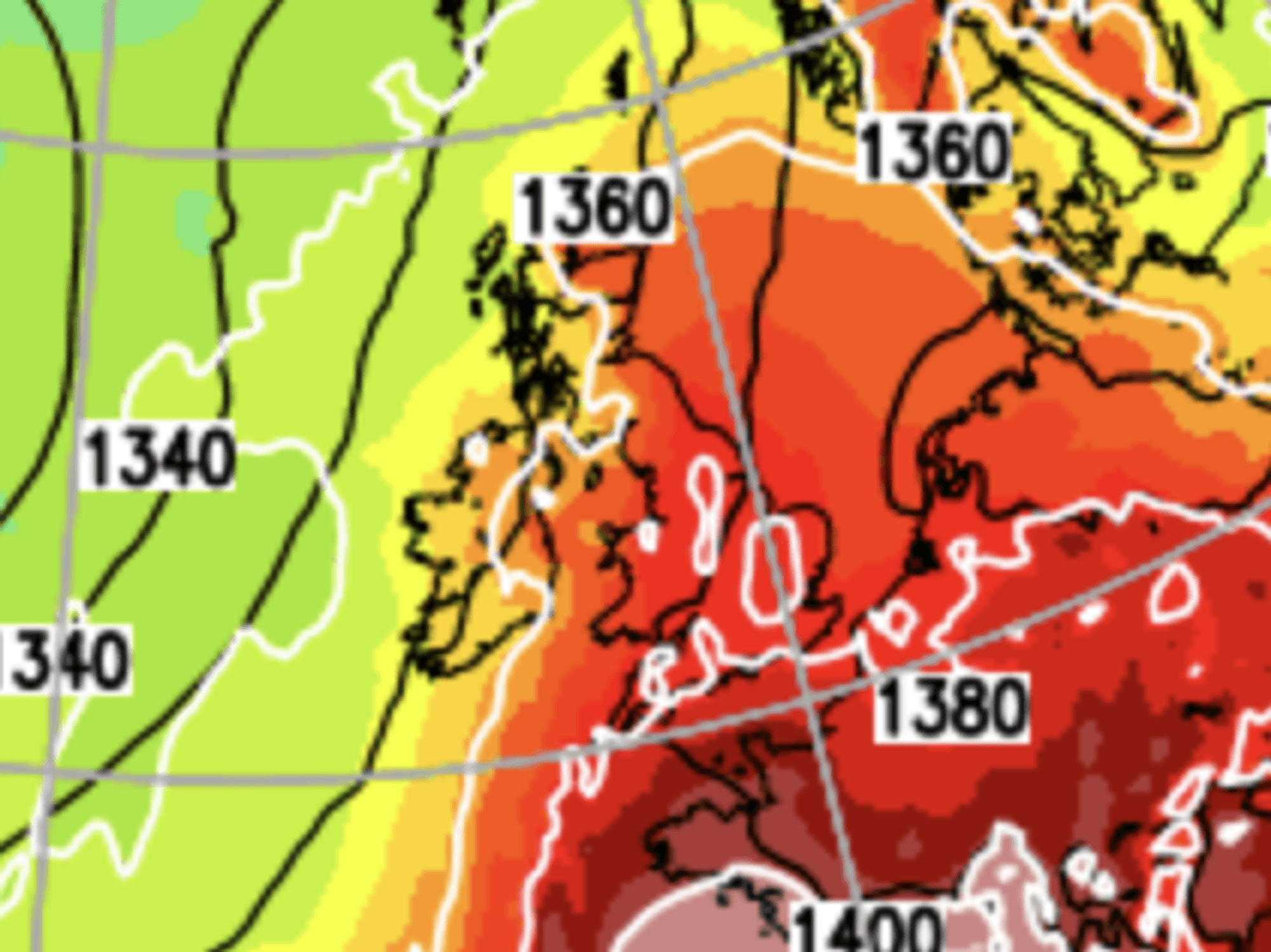
The dramatic change is due in part to the jet stream, which has buckled and swerved over the UK, thrusting winds in from the north.
UK cold weather: North Sea winds to bring harsh -9C chill as Britain tipped for heavy snow
|netweather
Met Office meteorologist Alex Deakin said: “A dip in the jet is spinning up a number of areas of low pressure, and they are buckling the jet stream.,
“That is pushing the jet stream further north so that by the time we get to the second half of the weekend the jet is way up to the north of the UK, and that shift means that at the surface the pressure will change from low to high.
“Sunday may will be colder still with temperatures struggling to get above four or five degrees and by then we could start to see a breeze pick up coming in from the north sea and that will bring something of a chill, feeling barely above freezing.”
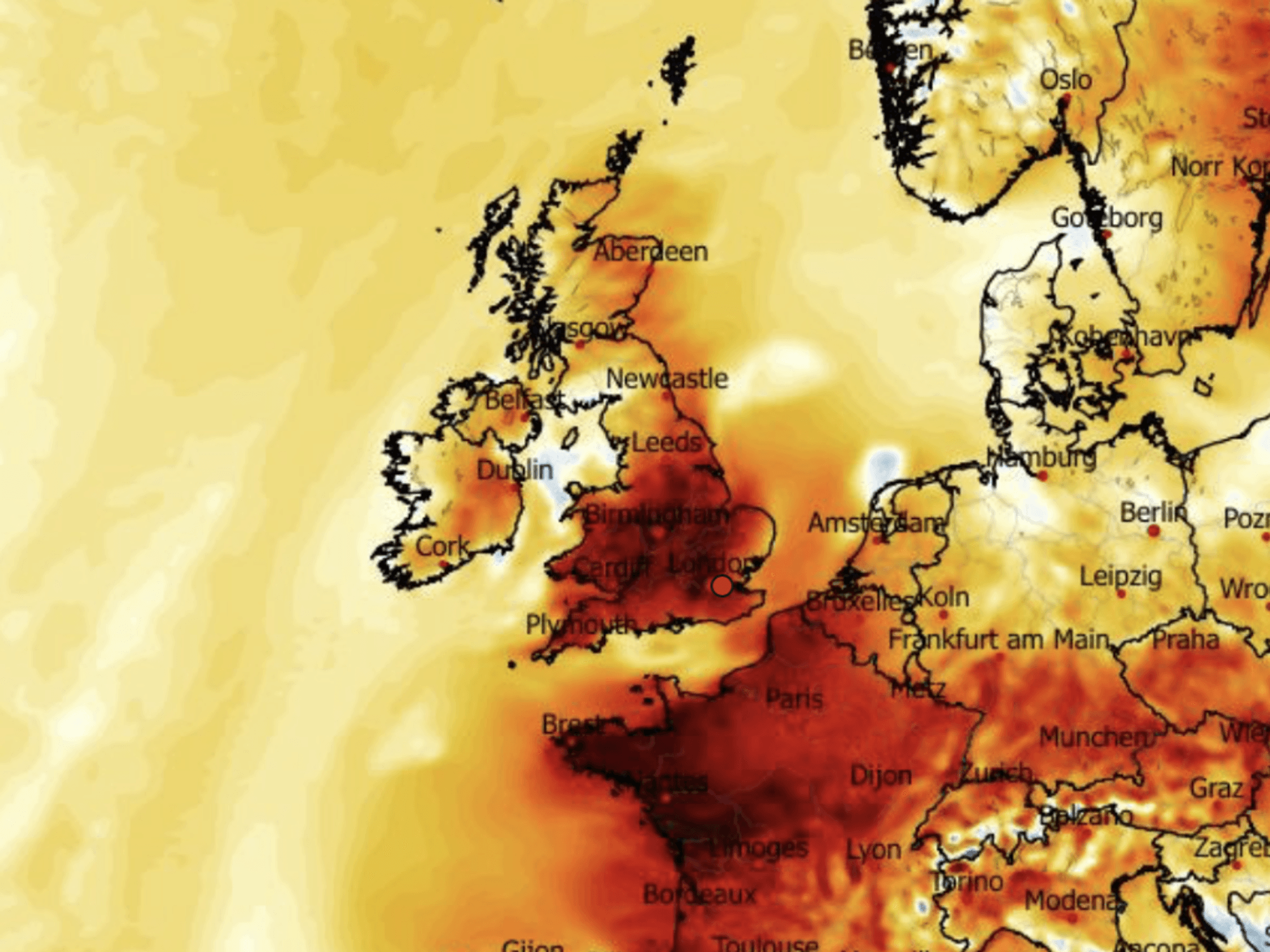
Low pressure responsible for the recent run of storms will give way for a large high to build to the north of Britain.
LATEST DEVELOPMENTS: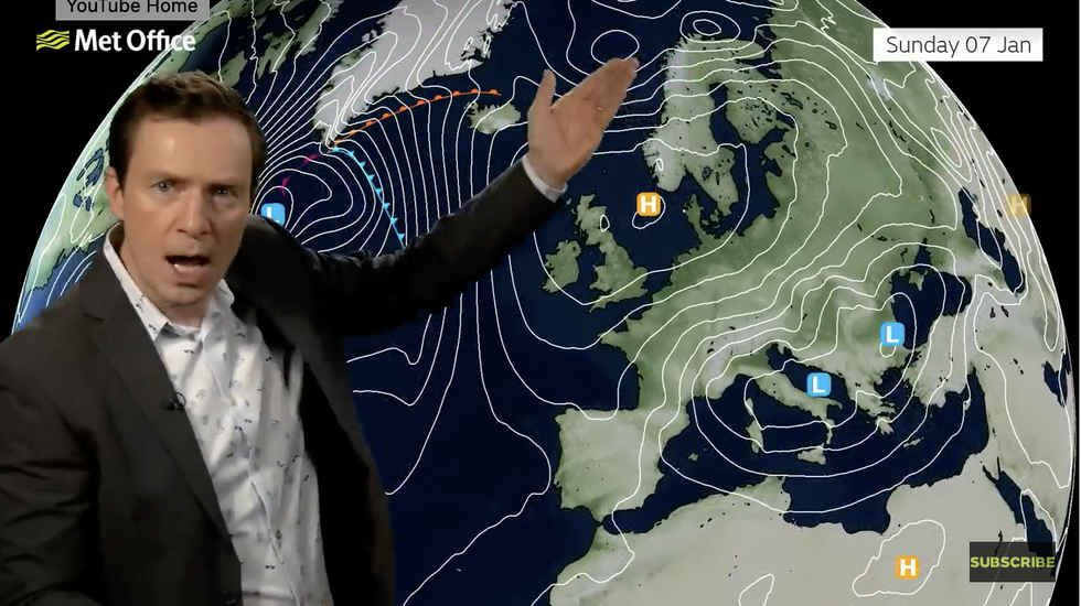
Met Office’s Alex Deakin warns high pressure will sit over the UK like a ‘lid’
|Met Office
Sharp, frosty winds will bring a more wintry feel to the country by the start of next week.
And the cold theme will hold out until the following weekend, as Britons are warned to wrap up for a bit of winter.
Deakin said: “It could be quite a brisk and cold wind along the south coast through Monday and Tuesday.
“There is a strong signal that high pressure will dominate our weather through next week, so yes, it is going to turn a bit colder.
“A lot of models are agreeing that high pressure will be sitting to the north of the UK for much of next week, acting like a lid on the atmosphere keeping things very dry but also trapping the colder air in.”
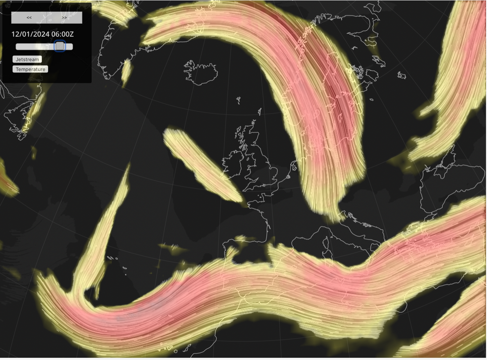
Jet stream rockets to the north of the UK
|Netweather
Those hoping for snow will be out of luck, at least through the start of the cold snap when little precipitation in forecast.
Long-range forecasters, however, warn of a precursor to a savage snow blast flexing up to strike later this month.
Exacta Weather forecaster James Madden said: “The weather is about to change to something much colder and drier, and this will be the pattern for many parts of the country over the next several days.
“But from around mid-January, the drier colder theme will make way for something heavy and widespread snowfall.
“This could happen a little earlier than mid-January.”
Jim Dale, meteorologist for British Weather Services, added: “There is possibly some snow later in the period, probably during the final third of the month.
“This is something we are still watching.”
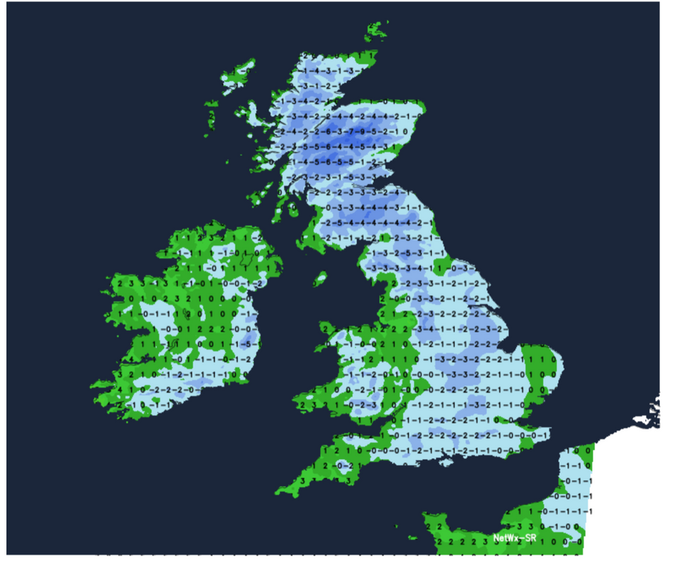
Weather models show temperatures through the coming days dropping widely to freezing or just above.
Wind-chill charts show bitter gusts from the north making it feel close to -10C in Scotland and parts of the north by the start of next week.