


An Arctic blast could return to Britain in just a few days time as snow sweeps down from the Nordic region of Europe, weather maps have shown.
Weather forecasting website WXCHARTS have shown snow will likely hit the UK on January 14 and stay in place for much of the week.
Low levels of snow are only expected in Scotland on January 14.
However, it could stretch down to the Midlands on January 15, before bashing much of England and Scotland the following day.
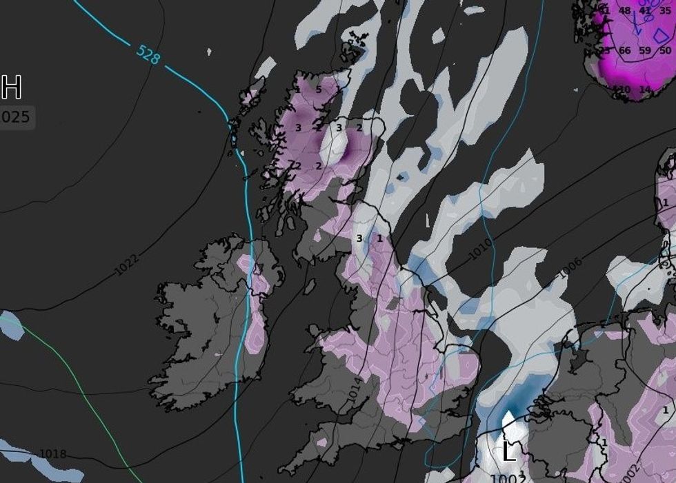
WXCHARTS is forecasting the return of snow
|WXCHARTS
Despite the return of snowfall, conditions are not expected to result in much depth.
Mercury is poised to plummet to as low as -6C in parts of Scotland.
Wales could see temperatures drop to as low as -2C and England will see mercury dip below freezing.
The North West of England is expected to record the coldest temperature, with WXCHARTS suggesting it could fall to as low as -3C.
The change in temperatures would come after relatively mild temperatures as Britain gets battered by Storm Henk.
Storm Henk has wreaked havoc across much of the UK, with 268 flood warnings and 288 flood alerts issued acorss England.
LATEST DEVELOPMENTS: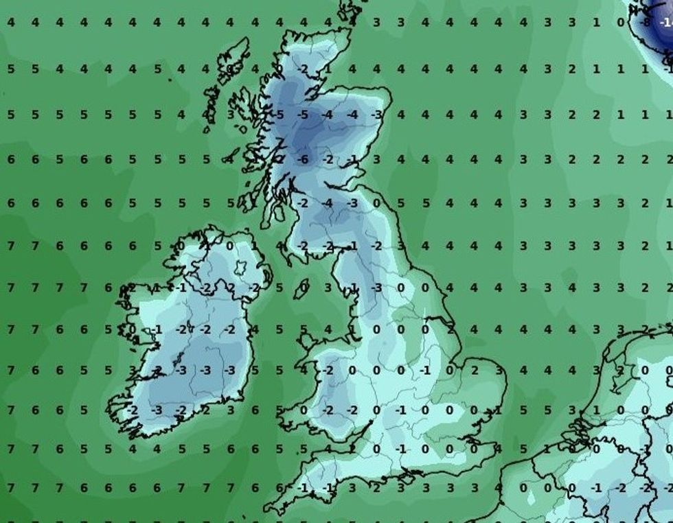
Minimum temperatures across the UK later this month
|WXCHARTS
Natural Resources Wales issued a further two flood warnings and eight flood alerts.
The Met Office’s forecast for tomorrow suggests the worst of Storm Henk could have been and gone.
It said: “High pressure builds through Saturday with showers becoming less frequent and lighter. Still rather cloudy in eastern parts. Feeling cold.”
However, the UK’s national weather service is not expecting temperatures to drop as low in a couple of weeks time.
It added: “Next week will begin mostly dry with variable amounts of cloud and some sunny spells.
“The sunniest weather is likely to be in the north and west.
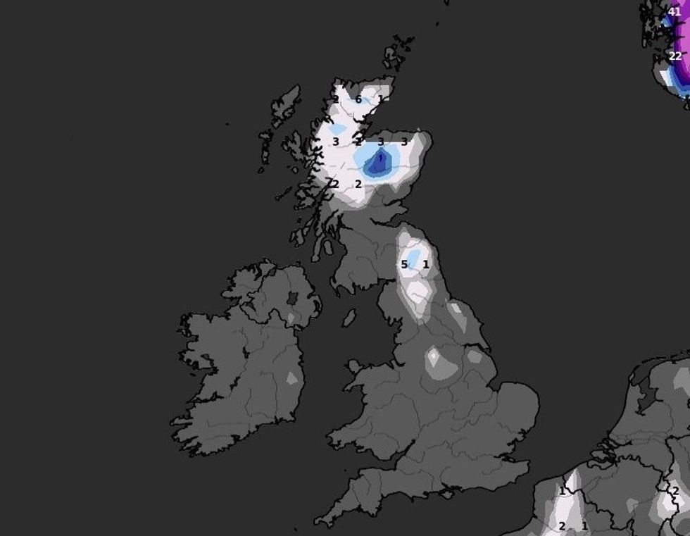
Snow depth is not expected to be high
|WXCHARTS
“Elsewhere, probably mostly cloudy with a cold easterly breeze developing in the south.
“By the middle of next week, the wind should ease and, with high pressure in charge, there should be a good deal of dry weather.
“Cloud amounts will continue to be quite variable, but all areas should see some sunshine at times.
“Much colder than recently, with frost probably becoming quite widespread and some freezing fog patches are possible in places.
“Beyond next week, conditions are likely to remain cold, with an increasing chance of some snow showers, developing particularly in the north.”