


Britons should brace for a "plunge of Arctic air" heading into the weekend, meteorologists have warned, as bitter wind chills across the land threaten to send temperatures sub-zero across the UK and Ireland.
Today, March 20, is the first day of spring in the UK - and people in the south of England can expect positively balmy weather as a result, with thermometers hitting the mid-to-high teens by the afternoon.
But the pleasant conditions today won't even last until the weekend, according to figures from MetDesk - by Saturday morning, a cold snap will see temperatures languishing at 0C.
While thermometers sink to low single digits, westerly gales from the north Atlantic will ratchet up the wind chill factor around the UK, with the air set to feel consistently below zero across the rest of the country, reaching lows of almost -4C in the Scottish Highlands on Saturday.
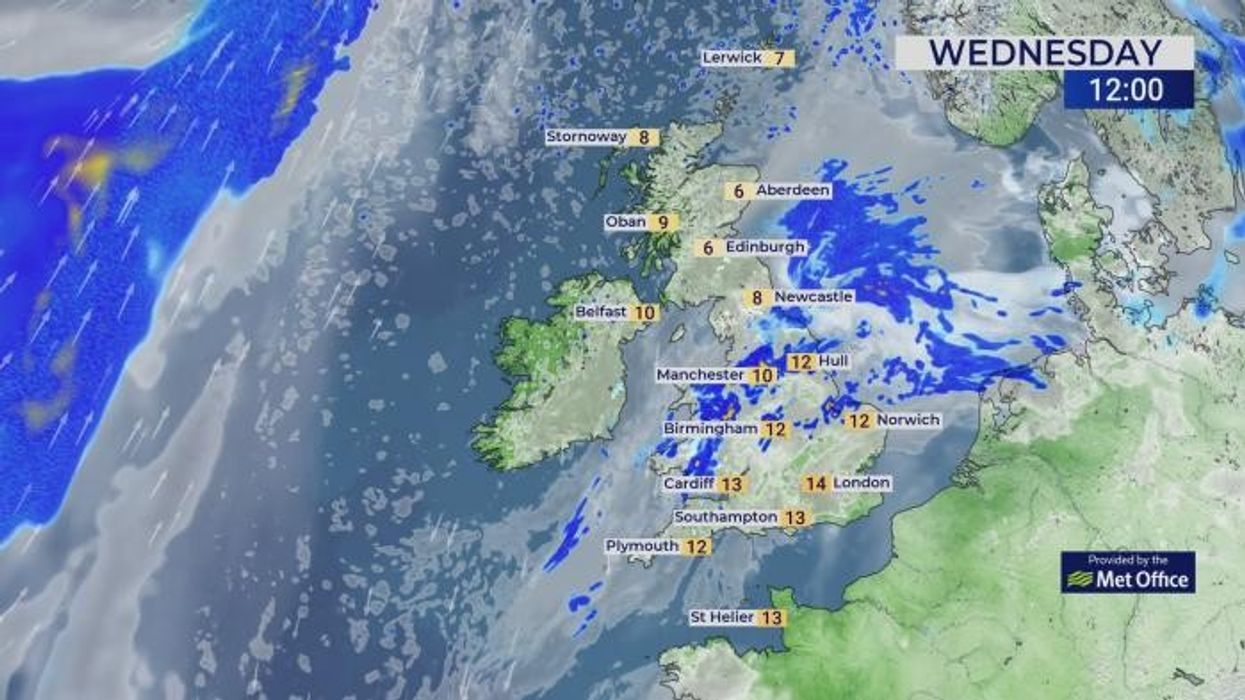
Wednesday's balmy weather is set to give way for icy wind chills across Britain and Ireland
|WXCharts/MetDesk
Around the country, only coastal areas are set to avoid sub-zero wind chills, with bracing air temperatures predicted as the weekend goes on.
A leading factor behind this disappointing drop-off is a "plunge of Arctic air", meteorologist Jo Farrow said - Thursday night will see a deepening area of low pressure sweep across Iceland, with the UK and Ireland bearing the brunt of its resulting cold front.
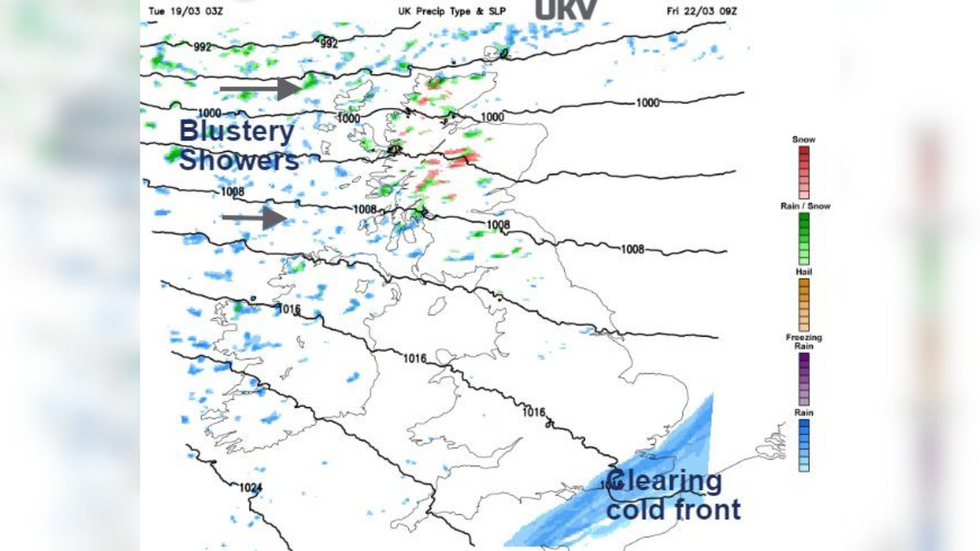
Everywhere but Scotland will avoid a nationwide blanketing of snow - and all the disruption that heralds - but a band of icy-cold rain will work its way across the UK from Friday to Saturday.
As the weekend begins, wet snow and hail will hit Scottish mountains and the west of the country, with chilly westerly winds giving way to colder gusts from the north-west.
MORE WEATHER NEWS:
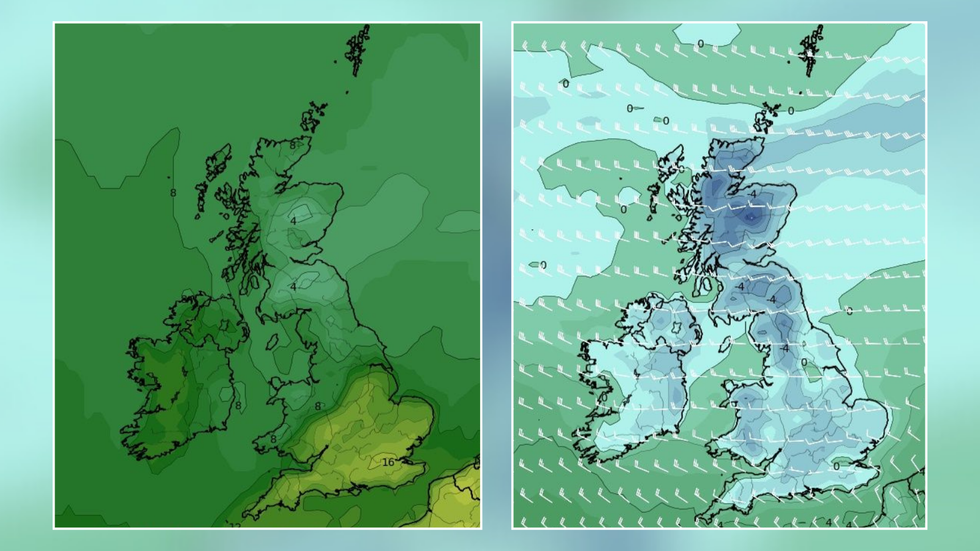
The Met Office's UKV modelling shows westerly showers slamming into the UK and Ireland by the end of the week
|Netweather.tv
Northern Ireland's Sperrins, as well as Snowdonia and the Brecon Beacons, are set for flurries on Friday Night, Farrow said, while Dumfries and Galloway should expect a "slight temporary covering".
And while she downplayed reports of snow blanketing the nation, she stressed that Scotland would remain the "focus of any snow showers" as Sunday comes to a close.
The weekend's cold snap is due to give way by next week, however; much of England and Wales will be reassured to hear the spring-like mid-teens will be back as the Easter Bank Holiday weekend rolls around.
The Met Office's long-term forecast for Easter paints a drab picture, despite Netweather's Nick Finnis highlighting the fact it was "more likely to snow in Easter than Christmas if Easter falls in late March" earlier this month.
Their long-term prediction states: "Increasing sunny spells in western areas on Sunday with showers developing in central and eastern areas after a rather cold start.
"The showers heavy and thundery at times, these gradually dying out from the northwest, with most places dry by the evening though cloud and rain rolling into Northern Ireland by end of the day.
"Monday to Wednesday likely to see a couple of systems bringing wind and rain across the UK, heaviest across southern areas with strong winds at times. Temperatures at or just below normal.
"Uncertainty increases from mid-week with potential for further weather systems to develop across the southwest though all areas will likely see periods of wet weather, with some drier spells in-between. Rainfall amounts highest in the south, with northern areas slightly drier but cooler."