


An Arctic storm will unleash a 70mph torrential deluge before winter returns in a blast of freezing winds, snow and ice.
Britons are about to go on an early spring rollercoaster as mild temperatures mid-week give way to a polar blast.
The weather will take its first turn today as a barrage of cyclonic storms barrel in on the jet stream.
A large low-pressure system swirling close to Greenland and the Arctic region will put Britain in the crosshairs of a plume of freezing winds.
TRENDING
Stories
Videos
Your Say
Met Office meteorologist Annie Shuttleworth said: “An area of low pressure pushes in through the early hours of Thursday morning to bring some wet and windy weather, and then it is going to turn colder to end the week.
“The jet stream is firing up from mid-week across the Atlantic and that is going to drive a series of low-pressure systems across the UK.
“Winds could reach 60mph to 70mph across the far north for a time on Wednesday, and this could bring some disruption.”
Ahead of the Arctic bite, a ‘warm sector’ laden with rain will sweep Britain unleashing the first deluge.
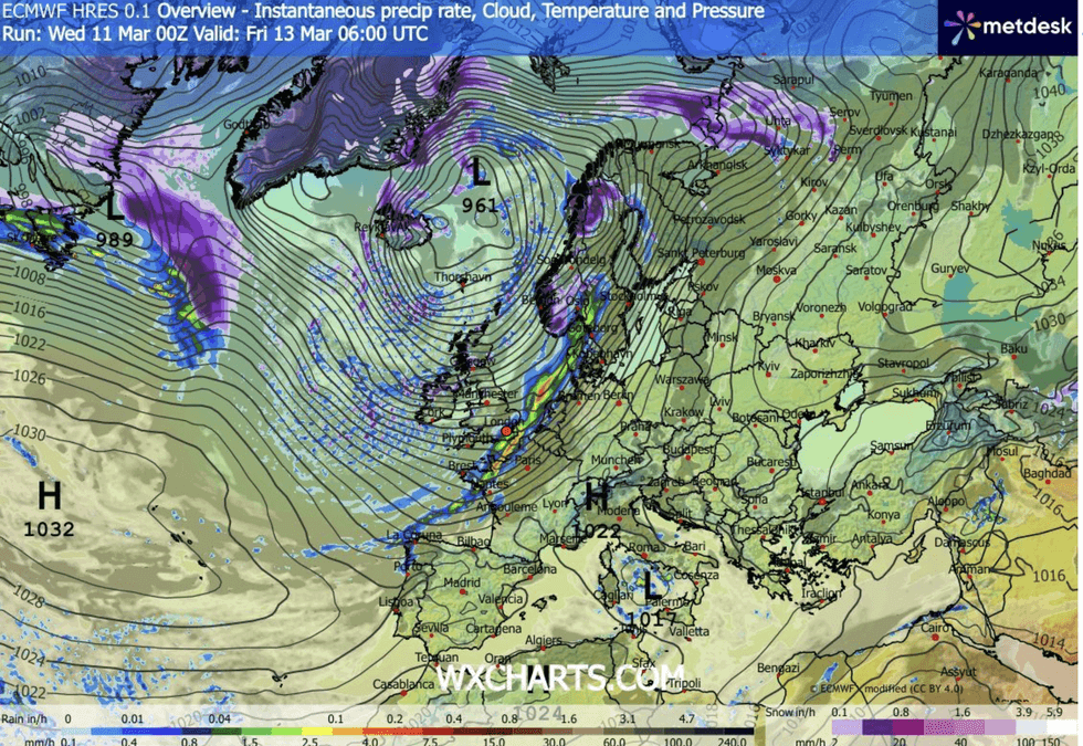
Giant low pressure storm swirls close to Greenland
|WX CHARTS
Western counties, the target of relentless downpours through winter, are in the firing line for inches of rain.
Temperatures will widely reach the mid-teens before the Arctic gates open ahead of the weekend.
Shuttleworth said: “We get stuck in a warm sector on Thursday, and that is going to be the wettest day of the week for many of us.
“Behind it, it will turn colder and rain will fall as snow over the high ground of Scotland on Thursday afternoon.
LATEST DEVELOPMENTS:
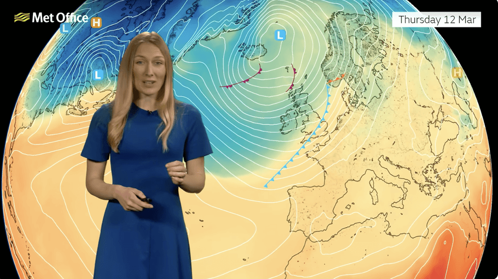
Annie Shuttleworth describes the cold incoming
|MET OFFICE
Temperatures will be 12C to 13C quite widely where we see this warm sector, but it is going to be pretty wet and cloudy in these areas.
“It turns colder to end the week, and quite a notable change in the airmass will bring a very different feel in the weather with a frost in sheltered areas.”
Snow is most likely over the Scottish hills although experts warn of flurries to lower levels.
Friday is forecast to bring the peak of the cold snap with the weather turning wetter and windier into the weekend.
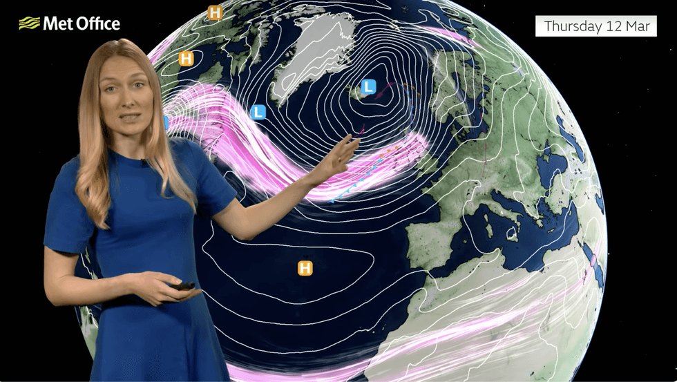
Annie Shuttleworth describes the cold incoming
|MET OFFICE
Jason Kelly, chief operational meteorologist for the Met Office, said: “A notable shift in wind direction to a north-westerly flow will bring a markedly colder day nationwide on Friday.
“There is the potential for a mixture of sunny spells, heavy showers, coastal gales, and snow over high ground.
“There’s also the possibility of accumulations on lower hills.”
Jim Dale, meteorologist for British Weather Services and co-author of ‘Surviving Extreme Weather’, added: “Spring is on hold at the end of the week, and we are going to go back into winter.
“We are never out of the woods this early in spring, and the next few days will be an example of that.”