


The Met Office has issued weather warnings across the UK as Britain braces for thunderstorms this weekend.
Despite surging temperatures reaching 30C, eight warnings have been issued from 2pm on Sunday until midnight.
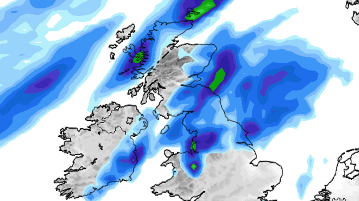
Forecasters have warned that the wet and stormy weather could bring disruption during Sunday afternoon and evening across East Midlands, North East England, North West England, Yorkshire and Humber, Wales, central Scotland, Tayside and Fife, Northern Ireland and the Dumfries, Galloway, Lothian & Borders areas of Scotland.
The Met Office said: "Flooding of homes and businesses could happen quickly, with damage to some buildings from floodwater, lightning strikes, hail or strong winds."

Despite surging temperatures reaching 30C, eight warnings have been issued from 2pm on Sunday until midnight
|WXCHARTS
Britons are also being warned that flooding and lightning strikes could disrupt travel with rail and bus routes potentially closed.
The warnings come as glorious sunshine bakes down on Britain with the the hottest day of the year so far recorded on Thursday with 32.6C (91F) recorded in Wisley, Surrey.
Weather experts suggest that as thunderstorms hit, temperatures will remain high.
Today, areas including Manchester, Hull, Stoke-on-Trent, Nottingham, Peterborough, Birmingham and Oxford have been issued with yellow warnings for thunderstorms.
The Met Office has warned that possible heavy showers and thunderstorms could strike.
Motorists are also been urged to take care when driving as sudden flooding and road spray could lead to difficult driving conditions.
Weather maps show localised thunderstorms hitting the north of England and Scotland and Northern Ireland while the south will remain hot.
Chris Wilding, Flood Duty Manager at the Environment Agency, said: “Significant surface water flooding is possible but not expected across parts of England on Saturday afternoon and evening due to isolated intense downpours.

The Met Office has warned that possible heavy showers and thunderstorms could strike
|Met Office
“We urge people not to drive through flood water – it is often deeper than it looks and just 30cm of flowing water is enough to float your car.”
Met Office Chief Meteorologist Paul Gundersen added: “Although much of the UK will see high temperatures and sunny skies continue on Saturday, in what has a possibility of being the hottest day of the year so far, there’s also the potential for some thunderstorms, which has resulted in a Yellow Warning being issued for much of central England and parts of east Wales.
“Temperatures will begin to trend downwards from Saturday in the far northwest of Scotland, with a cold front gradually moving south through the weekend, bringing with it the risk of some heavy and thundery downpours on Sunday as well.
"However, the southeast will hold on to the high temperatures the longest and could still reach 32C on Sunday.”