


The Met Office has issued new yellow rain and thunderstorm alerts, warning of "disruption and flooding" across Britain that is set to last for three days.
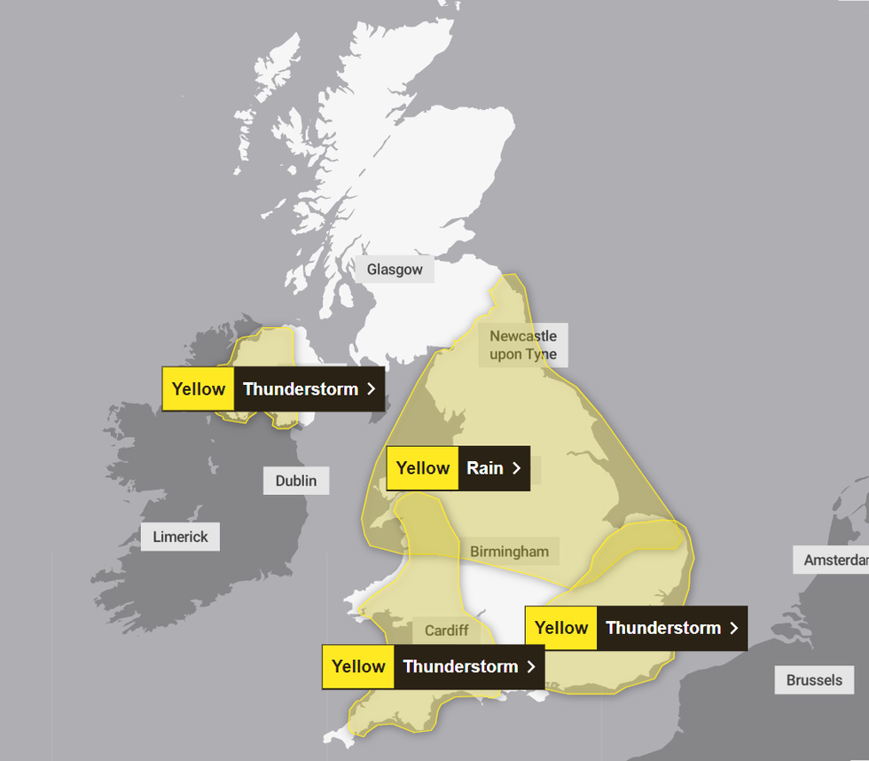
Today, there are three separate thunderstorm warnings that span much of the UK, with the first in Northern Ireland coming into effect at 8am this morning.
A rain warning covering much of the Midlands and the North then begins at 00.15am tomorrow and lasts until the early hours of Thursday morning, becoming inactive at 6am on May 23.
An additional rain alert, this time covering huge parts of Scotland, will begin at 12pm tomorrow and last until 6pm on Thursday evening.
Met Office issues THREE DAYS of rain and thunderstorm warnings as Britain set for torrential downpours
|Met Office
"While some places will miss them, heavy showers and thunderstorms are likely again on Tuesday, potentially bringing disruption and flooding," the Met Office announced.
The first of the three thunderstorm alerts issued for today covers the following areas in Northern Ireland: County Antrim, County Armagh, County Down, County Fermanagh, County Londonderry, and County Tyrone. It ends at 9pm tonight.
The second alert, beginning at 12pm and lasting until 9pm, covers much of the South West and Wales, including Bristol, Cornwall, Devon, Dorset, Wiltshire, Cardiff, Newport, Pembrokeshire and Swansea.
Meanwhile, the final warning also begins at 12pm but lasts until 12am. It covers much of the South East and London, including Cambridgeshire, Essex, Hertfordshire Luton, Norfolk, Suffolk, Brighton and Hove, Buckinghamshire, East Sussex, Greater London, Hampshire, Kent, Oxfordshire, Portsmouth, Reading, Southampton, and Surrey.
LATEST DEVELOPMENTS:
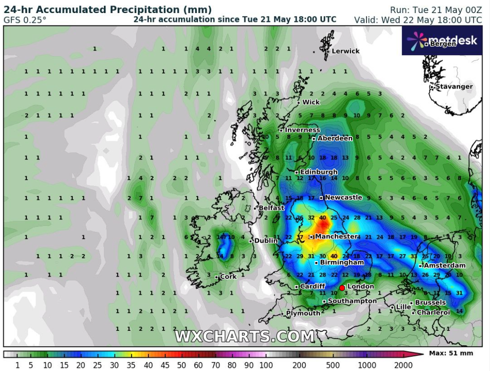
Heavy rainfall is set to batter parts of the UK in the coming days
|WXCharts
The Met Office also cautioned that spray and flooding could create treacherous driving conditions and lead to some roads being closed.
Cancellations to public transport services are also likely in areas where flooding or lightning occurs.
"There is a slight chance that power cuts could occur and other services to some homes and businesses could be lost," the weather office added.
"There is a small chance that homes and businesses could be flooded quickly, with damage to some buildings from floodwater, lightning strikes, hail or strong winds."
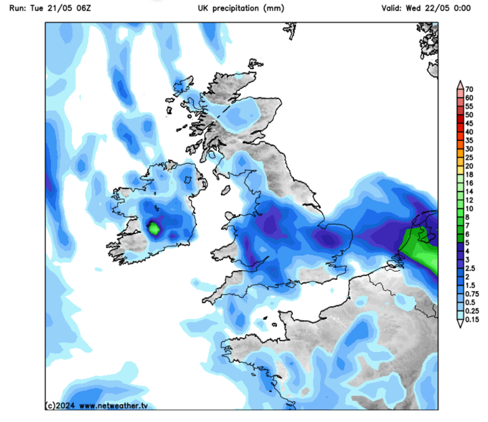
Poor weather conditions could last for three days
|Netweather
Despite the thunderstorm warnings clearing by the early hours of tomorrow, the bad weather is set to continue over the next couple of days, as yellow rain alerts come into place.
The weather office has warned that "heavy rain may produce some flooding and transport disruption".
As well as the possibility of power cuts, the Met Office said that rural communities may be cut off by flooding.
Advising those who may be impacted by the treacherous weather conditions, the weather office said: "Check if your property could be at risk of flooding. If so, consider preparing a flood plan and an emergency flood kit. Give yourself the best chance of avoiding delays by checking road conditions if driving, or bus and train timetables, amending your travel plans if necessary."