


The Met Office has issued a warning for snow and ice over a vast area of England and Scotland as Arctic air will send temperatures spiralling.
The yellow alert will come into force at 4pm on Thursday and last until midday on Friday across all of Scotland.
In Northern England the warning will start slightly later, at 7pm on Thursday but also finishes at midday.
The worst-affected areas will be limited to North East and North West England but the meteorological agency also warns parts of Yorkshire & Humber, East Midlands, and West Midlands will be impacted.
TRENDING
Stories
Videos
Your Say
For Scotland, the Met Office warned: "Snow showers affecting high ground are expected to start to fall to low levels through Thursday evening and overnight.
"Due to the showery nature, accumulations of snow will vary, but on low ground, 1-2cm is possible in places by Friday morning, while on hills above 300 metres, accumulations of 2 to 5, perhaps very locally 10cm are possible.
"In addition to the snow, temperatures will fall quickly, and this is likely to lead to ice on untreated surfaces."
Britain's national forecaster added "snow showers and icy roads could lead to some travel disruption".
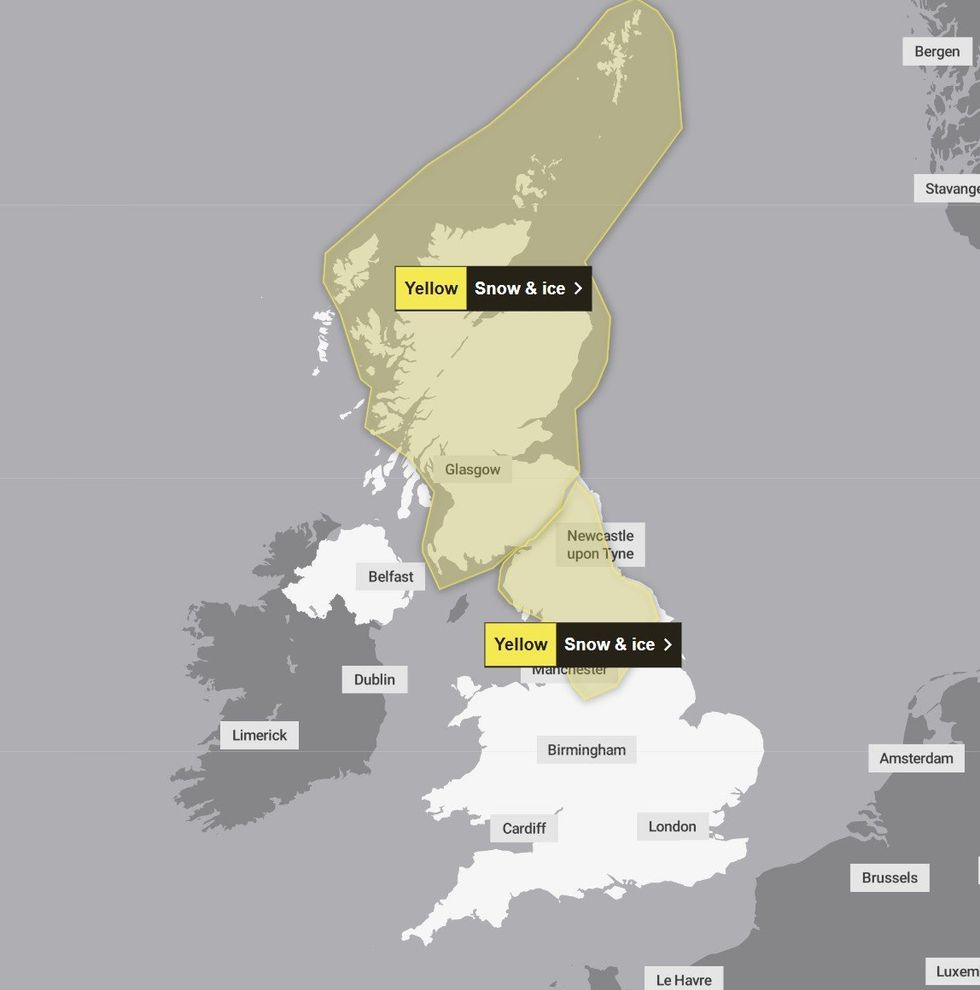
The yellow alert will come into force at 4pm on Thursday and last until midday on Friday
|MET OFFICE
For England, the Met Office said: "Outbreaks of rain will fall as snow over higher hills initially, before the snow starts to fall to lower levels through Thursday evening.
"Any settling snow will mainly be confined to high ground, above 200 metres 2 to 5cm is possible, and above 300 metres, a few locations may see as much as 10cm.
"The rain and snow is expected to clear south during the early hours of Friday with temperatures expected to fall quickly as skies clear, leading to ice on untreated surfaces."
The forecaster added: "Outbreaks of rain, sleet and snow likely to lead to icy surfaces and some travel disruption."
LATEST DEVELOPMENTS:
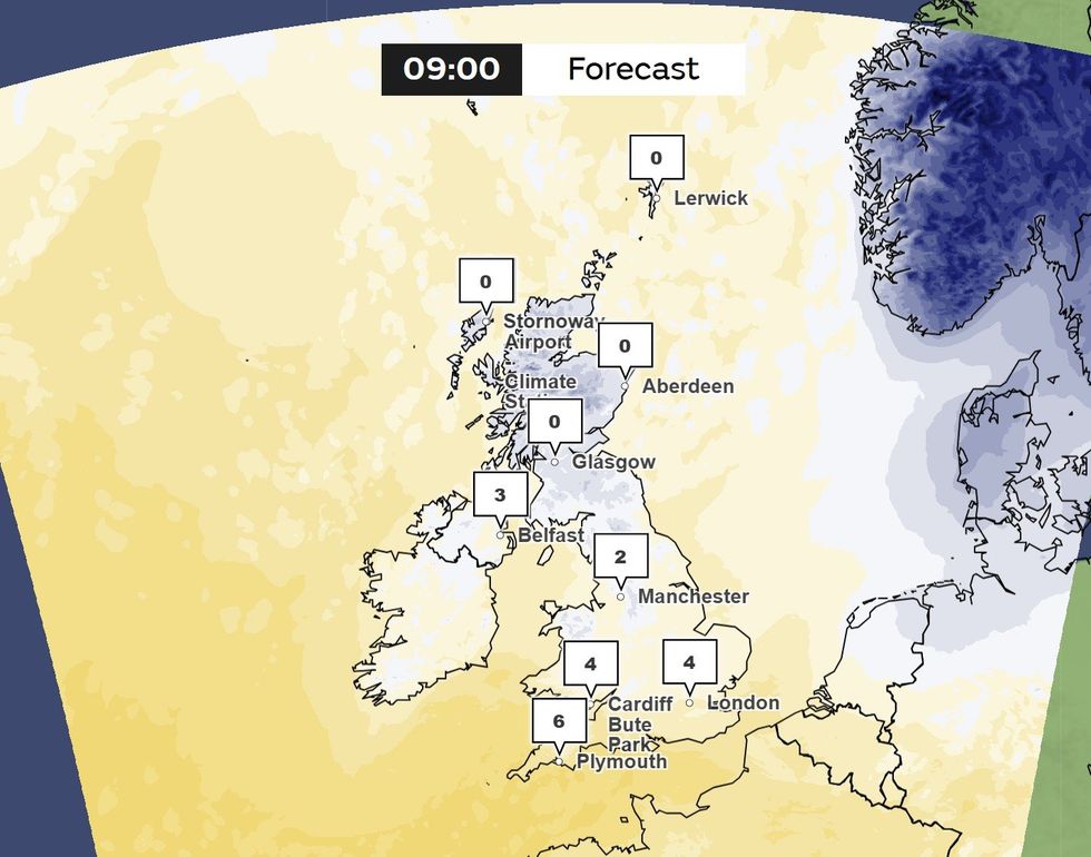
Met Office maps show temperatures lurking in the low-single digits even by 9am on Friday
|MET OFFICE
Britons have been advised that "some injuries from slips and falls" could occur on icy surfaces.
To help prepare, the Met Office advises drivers to "make sure you have some essentials in your car in the event of any delays (e.g., warm clothing, food, water, a blanket, a torch, ice scraper/de-icer, a warning triangle, high visibility vest and an in-car phone charger)".
Shortly after the Met Office warning was issued, the UK Health Security Agency (UKHSA) issued a yellow cold health alert.
Its warning will impact East Midlands, West Midlands, North East, North West, Yorkshire and the Humber from 6am on Thursday February 13 and last until February 16.
The UKHSA warns the cold weather will lead to "increased use of healthcare services by vulnerable people and greater risk to life of vulnerable people."
Looking ahead to next week, the Met Office long-range forecast for February 15 - February 24 reads: "Showers or longer spells of rain are expected as Atlantic low pressure systems dominate in the vicinity of the UK.
"Some heavy rain is likely in places, probably focused on western hills, with some snow at times in the north, mainly on high ground.
"Strong winds are possible at times, especially around coasts. Temperatures will probably be near normal.
"Later in the period, there is a chance that drier, more settled conditions may begin to develop."