Archaeological breakthrough after oldest map of the world finally deciphered

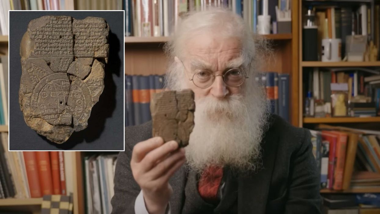
Researchers have successfully decoded the Imago Mundi, a 3,000-year-old Babylonian tablet considered the oldest known map of the world
|British Museum

The artefact was created between 2,600 and 2,900 years ago
Don't Miss
Most Read
Latest
Researchers have successfully decoded the Imago Mundi, a 3,000-year-old Babylonian tablet considered the oldest known map of the world.
The artefact, created between 2,600 and 2,900 years ago, offers a unique glimpse into ancient Babylonian beliefs about creation, mythical creatures, and their understanding of the known world.
Dr Irving Finkel, a British Museum expert, has revealed that the cuneiform writing on the tablet provides insights into the ancient civilisation's worldview and religious beliefs.
The Imago Mundi was originally unearthed in 1882 by renowned archaeologist Hormuzd Rassam in Sippar, an ancient Babylonian city - which is Iraq today.
 Researchers have successfully decoded the Imago Mundi, a 3,000-year-old Babylonian tablet considered the oldest known map of the world | British Museum
However, the tablet remained hidden in a box of excavation findings for nearly 150 years.
It was rediscovered in Iraq 29 years ago and is currently held at the British Museum in London.
Since acquiring the tablet, researchers at the British Museum have been able to glean insights into the Neo-Babylonian Empire's beliefs in mystical creatures and its regional dominance.
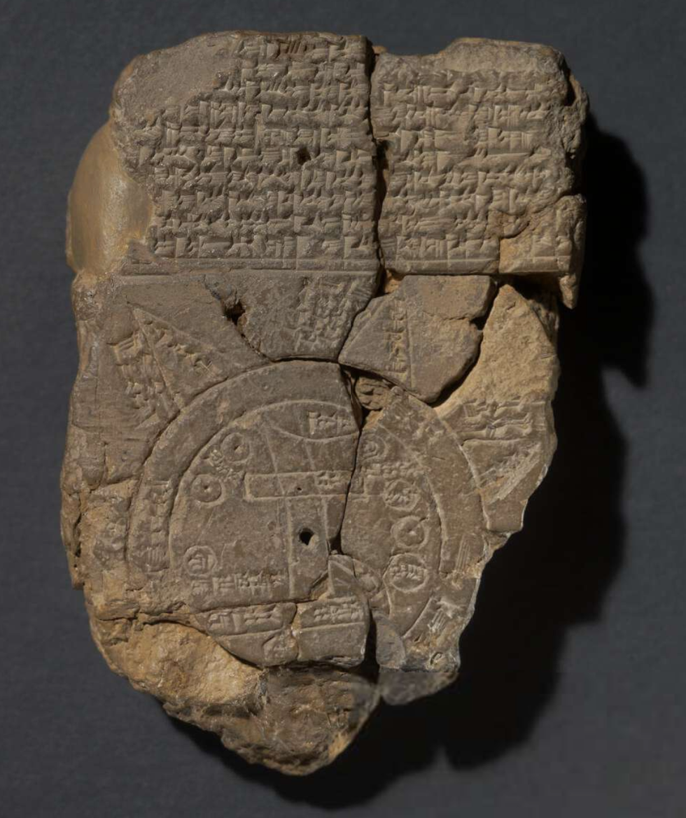
The circular map on the tablet depicts Mesopotamia, which the Babylonians believed to be the centre of the world.
Dr Finkel explained in a YouTube video: "The double ring is very important because it has cuneiform writing in it which says 'bitter river' and this water was deemed to surround the known world."
The "Bitter River" encircled Mesopotamia, reflecting the Babylonians' understanding that they were the only nation in the world.
LATEST DEVELOPMENTS:
The map also features the Euphrates River cutting through ancient Mesopotamia from North to South. Several regions are labelled in cuneiform, including Assyria, Der, and Urartu, providing a comprehensive view of the known world at that time.
The Imago Mundi's cuneiform text reveals the Babylonians believed in mythical creatures inhabiting various regions. These include a winged horse, sea serpent, scorpion-man, and bull-man.
The tablet also alludes to the God of Creation, Marduk, who was revered as the patron God of Babylon and associated with justice, compassion, healing, and magic.
Triangular shapes on the map's edge represent mountains where "the Sun is not seen", indicating areas beyond the known world.
Dr Finkel noted that while some of the text is fragmented, it mentions "ruined cities ... whom Marduk watches".

The circular map on the tablet depicts Mesopotamia, which the Babylonians believed to be the centre of the world
|British Museum
Dr Irving Finkel emphasised the significance of the Imago Mundi, stating it has "given us a tremendous insight into many aspects of Mesopotamian thinking".
He highlighted the tablet's importance in understanding ancient Babylonian beliefs and worldviews.
Finkel also noted the exciting nature of such discoveries, saying: "It's also a triumphant demonstration of what happens when you have a very small, totally uninformative and useless fragment of dead boring writing that no one can understand and you join it onto something in the collection which is much bigger and a whole new adventure begins all over again!"
The decoding of the Imago Mundi provides a remarkable window into the ancient Babylonian civilisation and their perception of the world. This 3,000-year-old artefact not only represents the oldest known map of the world but also encapsulates the beliefs, mythology, and geographical understanding of a sophisticated ancient culture.
The tablet's intricate details, from its depiction of Mesopotamia as the centre of the known world to its references to mythical creatures and deities, offer insights into Babylonian cosmology and religious practices.


