


Britain has been told to resolve a long-running Himayalan border dispute using colonia-era maps.
Nepal's Prime Minister Balendra Shah said the 19th-century British maps support his country's claim over a strategically important area between India, Nepal and Chinese-controlled Tibet.
With India insisting the territory belongs to its northern Uttarakhand state, the nation has consistently brushed off Nepal's claims.
Now, the Nepalese Government has formally asked the UK to act as a mediator as they accost the controversial claim.
"We have spoken not only with India and China but also with the British Government," Mr Shah said.
"Our view is that England should also take an interest, as the issue dates back to the period when the British ruled India.
"So all these matters should be resolved through dialogue and diplomatic negotiations."
Nepal's bid rests on its reading of the Treaty of Sugauli, settled between Nepal and British India back in 1816.
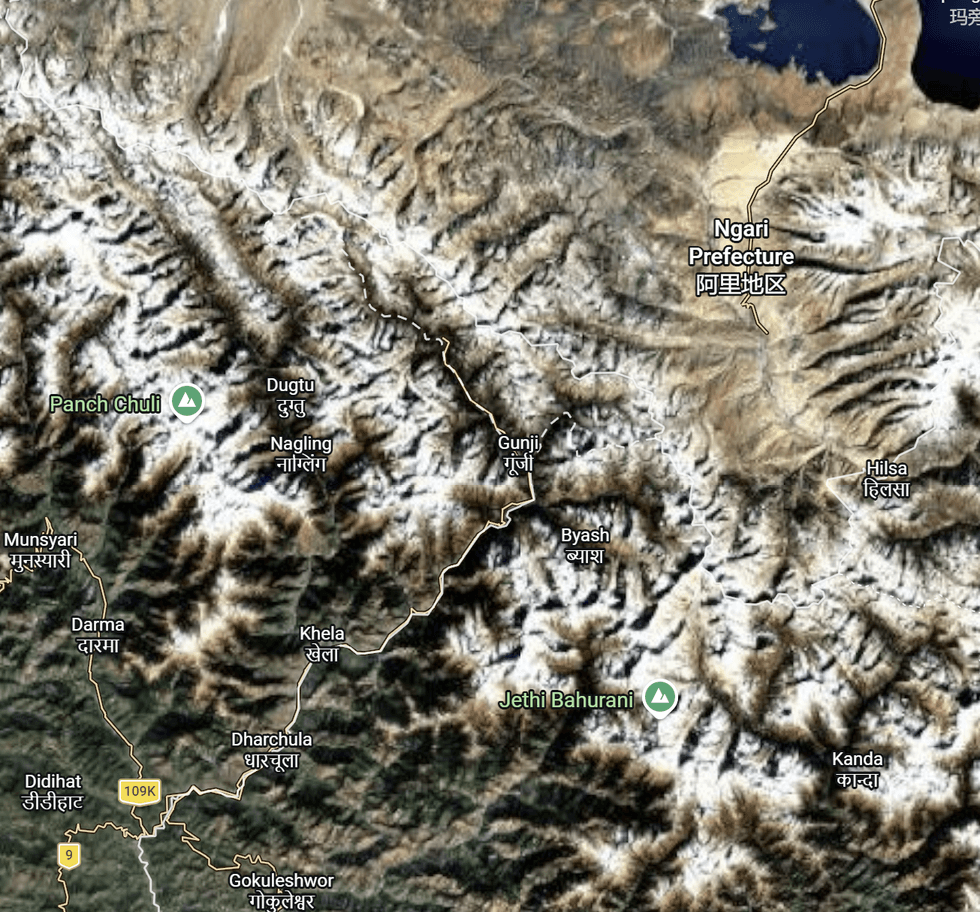
The debated territory is strategically important piece of land between Inida, Nepal and Chinese-controlled Tibet
|The country has argued that India has illegally occupied the 144 square miles since the 1962 Sino-Indian war.
Maps drawn up by the Survey of British India between 1819 and 1879 back Nepal's claim, its Government has claimed.
"The Nepal Government has officially sent a diplomatic note to India regarding what we consider encroachment on Nepali territory, including Lipulekh, and we have already received a response," Mr Shah added.
India has suggested creating a joint panel of historians, surveyors and territorial experts to review the competing claims and find a resolution through dialogue.
LATEST DEVELOPMENTS:
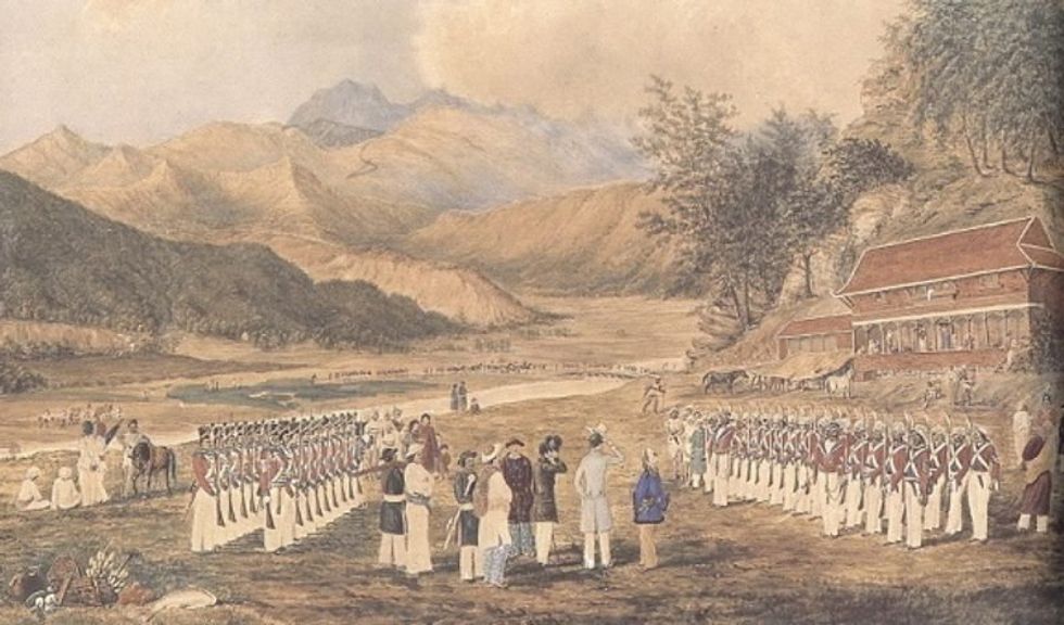
The Treaty of Segauli was signed in 1816
|GURKHA MUSEUM
Last month, Kumar Byanjankar, Mr Shah's chief adviser, met Rob Fenn, the British ambassador to Nepal, to explore whether Britain could help clarify the historical record.
An official in the Prime Minister's office told the Kathmandu Post: "Since the UK was a party to the Treaty of Sugauli, it may possess crucial evidence and maps that could help resolve the dispute with India and China.
"The discussion with the British envoy was an effort to permanently resolve the boundary dispute with India."
Following the meeting, Nepalese officials said Mr Fenn indicated the dispute was a bilateral matter and Britain would not get involved.
Tensions escalated back in 2019 when Nepal objected to an Indian map depicting Kalapani as Indian territory.
Then in May 2020, India then opened a road through Lipulekh Pass to the Kailash Mansarovar pilgrimage route.
Nepal amended its constitution to include a revised national map incorporating the disputed areas, but India dismissed this as an "artificial enlargement" lacking historical support.
Last month, Nepal's foreign ministry again protested the pilgrimage route passing through what it considers Nepalese land.
Spokesman for India's ministry of external affairs Randhir Jaiswal said: "This is not new. The Kailash Mansarovar Yatra has been taking place through this route since 1954.
"If there are boundary issues, we are ready to discuss them. But making a unilateral claim is not the right way."