US weather: Experts ‘keeping close watch’ as ‘disturbance’ gears up to unleash fresh assault

The system threatens to hit the already hurricane-battered state of Florida
Don't Miss
Most Read
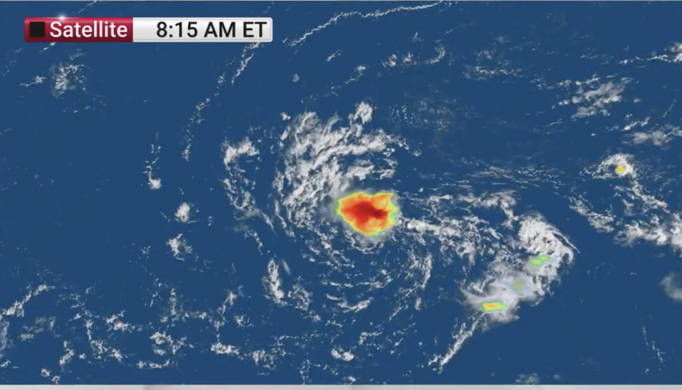
A ‘disturbance’ fidgeting in the Atlantic could be gearing up to unleash the next assault amid warnings for Tropical Storm Nadine.
Just days after Hurricane Milton left a trail of destruction across Florida, ocean waters are once again on the simmer.
Meteorologists are ‘keeping a close watch’ on a strengthening area of low pressure bubbling in the central tropical Atlantic.
A cluster of thunderstorms – the signature of a burgeoning hurricane – has started to form around the system.

Area under watch in Atlantic
|The Weather Channel
Although it may fail to reach storm strength, experts have raised the alarm in the wake of a devastating month of hurricane activity.
Weather Channel meteorologist Robb Ellis said: “There is one wave that we are watching, and over the next week or so it has a medium chance of developing as it continues pushing to the west, and a little closer to the Lesser Antilles.
“By the time it reaches the Caribbean, we could be looking at our next tropical system.
“It is moving into an area that, climatologically, isn’t the most favourable for tropical development, which is a little closer to the US, but it certainly isn’t uncommon for a tropical system to develop as it moves closer to the Antilles.
“And, the next name on the list in the tropical Atlantic is Nadine.”
US LATEST:
Exact location of Atlantic disturbance
|The Weather Channel
The next storm would come during what is shaping up to be a historic period of hurricane activity.
Florida is reeling from one of the most powerful storms the region has seen – Milton– which came hot on the heels of Helene at the start of the month.
The clean-up from both storms is feared to run to more than two hundred billion dollars, with another month to go of storm season.
Jim Dale, US meteorologist for British Weather Services and co-author of ‘Surviving Extreme Weather’, said: “It is still a case of looking over our shoulders, with several weeks left of hurricane season.
“This tropical storm could drift further towards the US, joining with thunderstorm activity in the Caribbean, and we are looking at this over the next five to six days.
“There is a chance that something could come of this one, and if it did, there is the possibility of Nadine turning up.”
 Disturbance growing in Atlantic | The Weather Channel
 Hurricane activity over the past weeks has been boosted by unusually warm waters over the Gulf of Mexico.
Milton and Helene were unusual in forming in the Gulf rather than off the coast of Africa, their usual birthplace.
Although Florida is currently enjoying a hurricane respite, the state is sitting in the firing line of more thundery rain.
A spokesman for the National Weather Service (NOAA) said: “An Easterly flow off the Gulf of Mexico will help produce showers and thunderstorms over parts of the Western Gulf Coast.
“Additionally, tropical moisture over the Florida Keys will keep showers and thunderstorms in the forecast through Wednesday.”
Torrential downpours during last week’s hurricane dumped more than a foot of rain across Florida.
The deluge is thought to have flooded the region with the amount of water it would take to fill 5 million Olympic swimming pools.
Ellis said: “That would be 3.4 trillion gallons of water .”


