


A killer storm sweeping the United States will leave a bitter legacy as eastern states face the peril of a Polar snow squall.
Heavy rain smashing into a freezing northerly plume threatens an Arctic deluge in the run-up to Christmas.
It follows a monster storm which struck at the start of the week toppling trees, closing roads and transport networks and killing four people.
Hundreds of thousands of households across New England, Virginia, Maine and Massachusetts were hit by power outages when the storm struck on Monday.
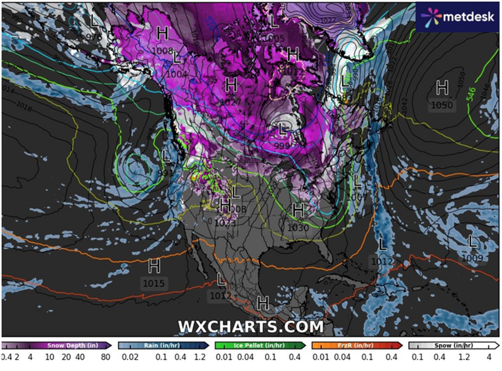
The storm will drag cold air across eastern US states through the coming days unleashing a torrent of snow, experts warn.
|WX Charts
The storm will drag cold air across eastern US states through the coming days unleashing a torrent of snow, experts warn.
Major highways were hit by the first deluge after the weekend which saw gale-force winds whip up a dangerous snow squall.
Further snow is forecast in the run-up to the festive season as rain clashes with cold air over the Texas Panhandle.
Fox Weather meteorologist Michael Estime said: “Rain moves into the panhandle of Texas on Thursday morning, and it'll start to spread across the Central Plains states.
LATEST DEVELOPMENTS:
- US weather: Christmas mega-storm threatens to bring deep snow with ‘tropical storm force winds’
- US snow warning: Thundersnow deluge to blanket America under a FOOT of snow
- US weather forecast: Furious deep low-pressure system swirls in from Pacific to dump a FOOT of snow as 'Pineapple Express' strikes
“As it does so into Thursday evening and Friday, it is going to spell some big-time rain for a lot of folks who could see that area of low pressure.
“We have not only the rain part, but we also have the snow elements to all of this.”
The Weather Channel reported the closure of Interstate 94 on Monday as vehicles were left ‘mangled’ by a spate of ‘snow squalls’.
The worst of the snowstorm should have cleared eastern states by mid-week before southern regions fall into the firing line.
A separate storm system sweeping in from the west will drive further chaotic weather until Christmas weekend.
Jim Dale, US weather correspondent and meteorologist for British Weather Services, said: “There is the potential for snow around mid-week which is going to be the legacy of a significant storm hitting the eastern side of the US.
“This is dragging cold air over the US which means there is a good chance of seeing snow over the Great Lakes, but it should clear before another storm system moves in across the western side of America.”
More than five inches of rain hit New Jersey and Pennsylvania at the start of the week, according to the National Weather Service.
Flood alerts were in force as torrential downpours hit New York, western Connecticut, western Massachusetts, Vermont, New Hampshire and Maine.
Four people were killed during severe weather, including an 89-year-old man in Massachusetts, and a driver in Catskill, New York.
Heavy to moderate rain and the risk of snow will persist through the end of the week, according to the National Weather Service.
A spokesman said: “Locally heavy snow will develop over the highest elevations of the Sierra Nevada Mountains and lighter snow over the highest elevations of the Cascades and parts of Idaho and Nevada.
“The rain will be moderate to heavy at times. Therefore, the WPC has issued a Marginal Risk of excessive rainfall over parts of Northern/ Central California through Wednesday morning.
“The associated heavy rain will create localized areas of flash flooding, affecting areas that experience rapid runoff with heavy rain.”