


Britain’s switchback summer is once again poised to take an about-turn as another windy weekend deluge looms.
Hours after 100mph Floris hammered swathes of the nation, the Atlantic is poised to spit another cyclonic low.
Then, in a further twist, temperatures will rise with parts of the country next week possibly nudging 30C.
**ARE YOU READING THIS ON OUR APP? DOWNLOAD NOW FOR THE BEST GB NEWS EXPERIENCE**
Northern Britain is facing the worst of the rain through the coming days, although experts predict a gentler arrival than Floris.
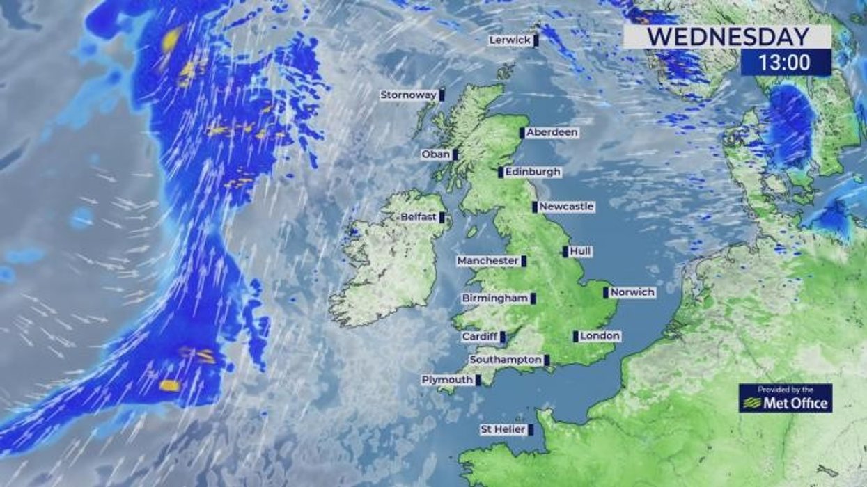
Met Office meteorologist Alex Burkill said: “Another low pressure is going to be coming in, and this one takes a different track from Floris – it is further north and not quite as deep, so the weather is not going to be as disruptive.
“There will be some wet and windy weather around, but it shouldn’t cause any major disruption, but a band of rain will push eastwards on Thursday, and there could be some heavy bursts in it.
“On Friday, we still have the influence of low pressure towards the UK, so there will be some blustery winds to northern parts and some showery rain pushing in.
“But if you do catch any sunshine, and you’re in the shelter from the blustery wind it isn’t going to feel too bad.”
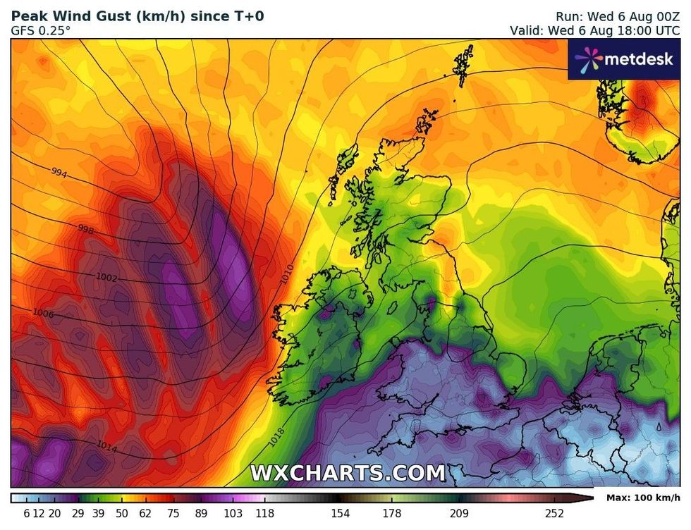
Maximum wind gusts across the UK later today
|WXCHARTS
Unsettled weather will set in later today whipping up 50mph gusts and dumping more than an inch of rain.
Southern regions will stay drier into the weekend with the better chance of higher temperatures.
Met Office deputy chief meteorologist Mike Silverstone said: “While the system later this week won’t carry as many impacts as Storm Floris, a further period of unseasonable wet and windy weather is on the way late on Wednesday and into Thursday for those in northwestern parts of the UK.
“An area of low pressure from the west will bring some strong winds, especially for those in western parts of Scotland. Gusts over 50mph are possible for a time.
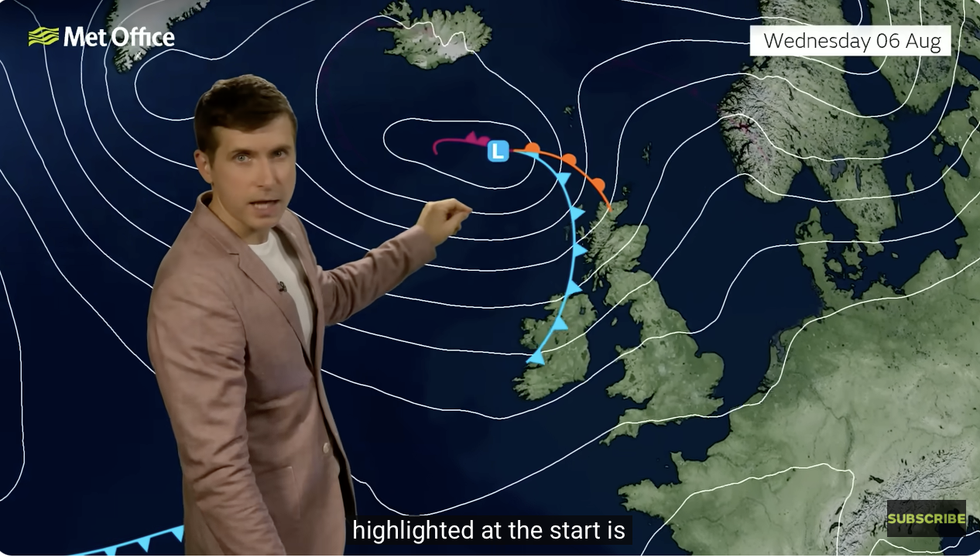
Met Office’s Alex Burkill warns of another low coming in
|MET OFFICE
“Some heavy rain will also accompany the strong winds, with up to 30mm possible.”
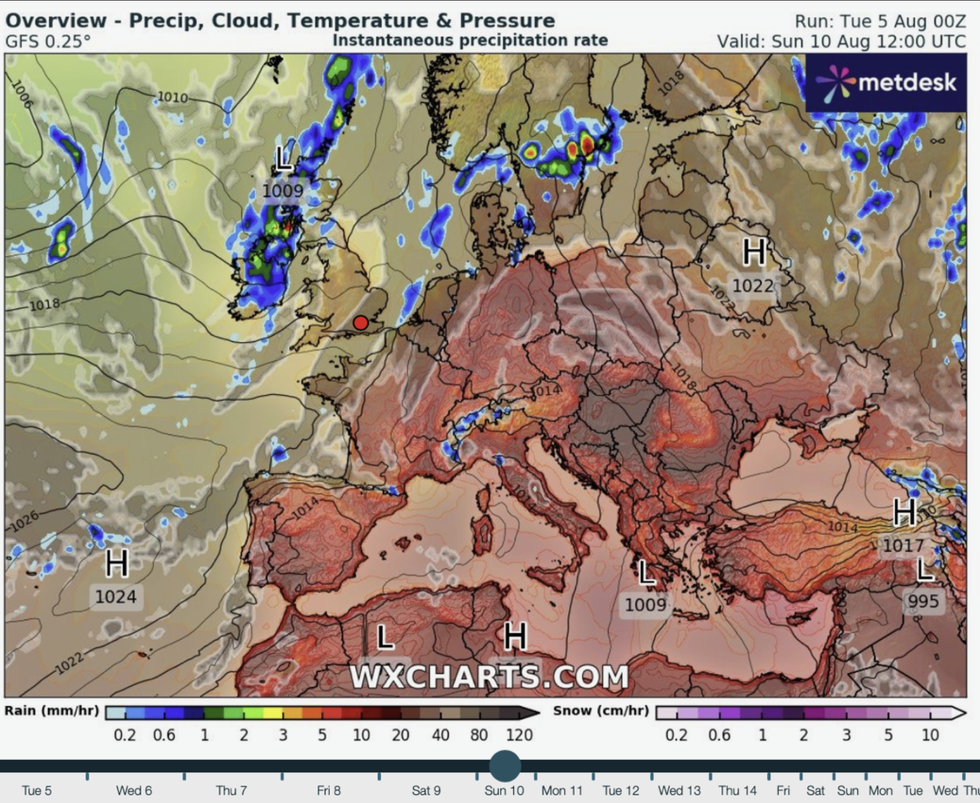
Long-range experts say the stormy summer blast may be a prelude to a roller-coaster autumn.
Warm ocean temperatures around the UK will fuel low-pressure systems on their approach.
Jim Dale, meteorologist for British Weather Services and co-author of ‘Surviving Extreme Weather’, said: “In the longer term, and looking forward into the start of autumn, we are going to have to watch our backs for a major storm, and given the backdrop of climate change, we are in uncertain times.
The North West is most at risk, according to WXCHARTS
|WXCHARTS
“Storms that come out of the blue and do tremendous damage are going to be a risk as we go into September.
“Given the heat that is in the south and the cool air that is coming of the Atlantic, this is going to provide a catalyst for storms.”
Unsettled weather through the next few days will arrive loaded with a thundery sting in the tail.
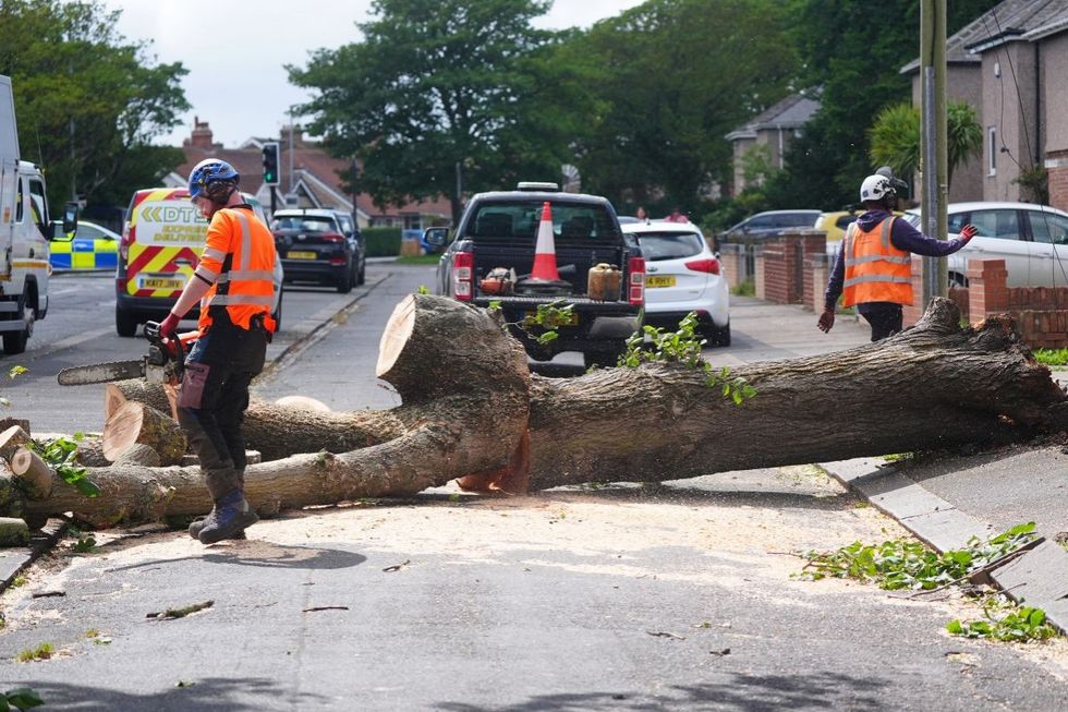
Storm Floris led to trees falling
|PA
Jason Nicholls, AccuWeather lead international forecaster, said: “A front will cause showers and some thunder to spread eastwards across the UK on Wednesday night and into Thursday.
“There will be showers in the north into the weekend, while the south stays drier and with the better chance of sunshine.”