
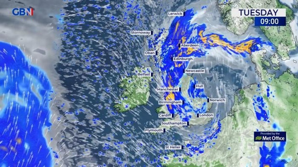


An area of low pressure is set to bring tropical storms to the UK with forecasters warning over "hazardous" conditions.
The Met Office has warned that an area of low pressure is following closely on the heels of Storm Kathleen and could bring stormy conditions to the UK.
The strongest winds are set to be seen on the coast of Wales and North West England with a yellow warning for wind issued stretching from Milford Haven to Fleetwood, Lancashire. The warning is in place for the rest of the day.
A warning of heavy rain has also been issued for parts of southern and eastern Scotland which is in place until 10pm on Wednesday.
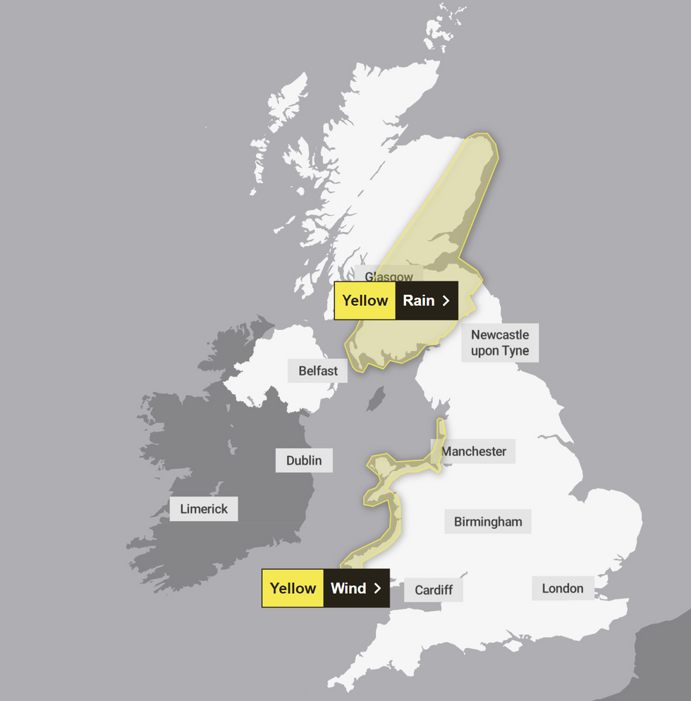
Some of the weather warnings are in place until 10pm tomorrow
|Met Office
Met Office Deputy Chief meteorologist Helen Caughey said: "The forecast contains a brief, quieter interlude thanks to a ridge of high pressure which becomes established across the country later on Tuesday.
"This will bring dry conditions for most areas for a time, but also a chance of some overnight frosts for prone locations.
“However, through Wednesday another band of rain pushes in from the west bringing some heavy and persistent rain, especially for higher ground in the west and north, with warnings already issued for parts of western Scotland.
"This system is accompanied by some strong and gusty winds, especially for coastal locations and across high ground, in the northern half of the country. The best of any drier and brighter conditions are likely across the south and east of the country."
LATEST DEVELOPMENTS
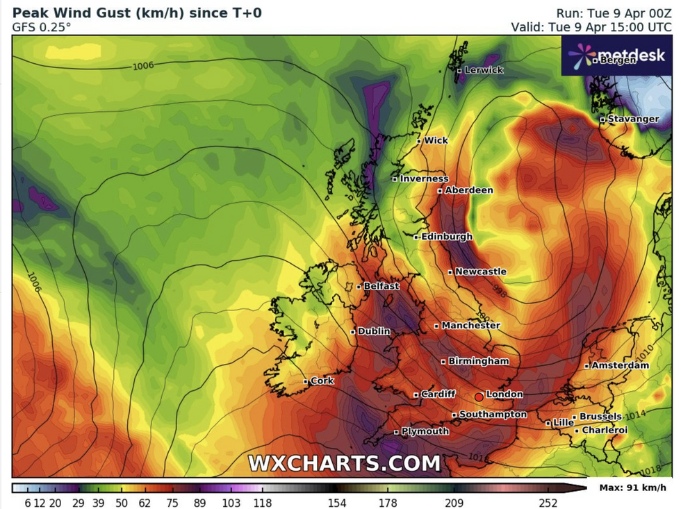
Winds are expected to batter coastal regions
|WXCharts
Gusts are forecast to reach 40-50 mph widely, with 60 or 65 mph gusts expected for exposed coasts of Southwest and west Wales overnight.
Flood duty manager at the Environment Agency Harry Walton said: "Due to a combination of spring tides and strong winds generating storm surge and large waves, minor coastal flooding impacts are probable for parts of England on Monday and Tuesday.
"Environment Agency teams are out on the ground, taking action to reduce the impact of flooding and support those communities affected.
"We urge people to stay safe on the coast, take extreme care on coastal paths and promenades, and we advise people not to drive through flood water as just 30cm of flowing water is enough to move your car."
There are currently 75 flood warnings in place, with 199 flood alerts issued by the Environment Agency.
Looking towards the end of the week, the Met Office is forecasting it to turn drier, albeit rather cloudy, in the south on Thursday and Friday.
However, it is set to remain changeable in the north, with heavy showers forecast for Saturday morning across northern England and Scotland.