


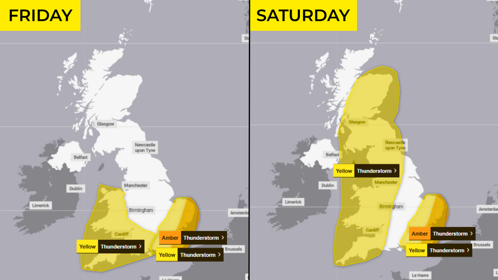
Britons are bracing for two days of thunderstorms, hail and strong winds after the Met Office upgraded its storm warnings from yellow to amber.
From 8pm on Friday evening, an area stretching from the south Kent coast to East Anglia has been handed a nine-hour long amber warning until 5am on Saturday morning.
That comes alongside two yellow thunderstorm warnings - one, across broadly the same area as the amber alert, and another which stretches from Cornwall to Inverness.
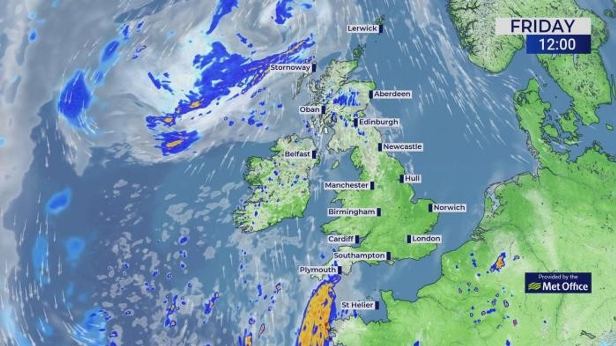
On Friday, a yellow storm warning from the Met Office says that heavy rain and thunderstorms are set to strike across Wales and southwest England from 2pm to midnight.
From midnight, this then grows to cover most of the country until 6pm on Saturday.
Under the Met Office's amber alert, forecasters warn:
- Some communities are likely to become cut off if roads flood;
- Where flooding or lightning strikes occur, delays and some cancellations to train and bus services are likely;
- Spray and sudden flooding can occur, leading to difficult driving conditions and some road closures;
- Power cuts are "likely to occur" and other services to some homes and businesses could be lost;
- Flooding of homes and businesses is likely and could happen quickly, with damage to some buildings from floodwater, lightning strikes, hail or strong winds;
- Fast-flowing or deep floodwater is likely, causing danger to life.
LATEST WEATHER UPDATES FROM GB NEWS:
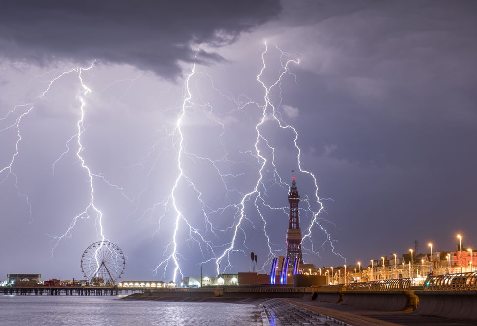
Britons are told to brace for 'damage to buildings' from floodwater, lightning strikes, hail or strong winds
|GETTY
The thunderstorm warnings come after a day of high temperatures across the country.
On both Friday and Saturday, thermometers are expected to shoot up to 29C in parts of London, with 27C climes set for the East Midlands and South East.
The Met Office has indicated that Friday will be a "hot, sunny and humid day" across England and Wales, with an increasing risk of heavy showers and thunderstorms later.
"Hail and gusty winds and localised flooding" is also possible, forecasters added.
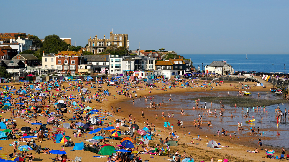
The Met Office has indicated that Friday will be a 'hot, sunny and humid day' across England and Wales
| PAAs night falls, however, Britons are warned of "torrential downpours and thunderstorms", which will continue to move northwards through the evening and into the early hours.
"A warm and humid night for many," forecasters say.
As the weekend comes to a close, showers are expected to ease off - while Monday and Tuesday will see dry conditions with sunny spells.